Download
1 / 31
310 likes | 330 Views
Explore the role of global institutions and communication advances in facilitating cross-border financial transactions. Learn about latitude, density, and longitude to understand geographical concepts.

E N D
The movement of money from one country to another and one currency to another has primarily been facilitated by • the leadership of the United States. • advances in electronic communications. • the World Trade Organization. • transnational corporations. • global agreements brokered by the United Nations.
The movement of money from one country to another and one currency to another has primarily been facilitated by • the leadership of the United States. • advances in electronic communications. • the World Trade Organization. • transnational corporations. • global agreements brokered by the United Nations. Explanation: While all of these factors have played a role, electronic communications have made it possible to move money around the world.
A place’s location relative to other objects or places is called its • situation. • site. • absolute location. • topography. • functional region.
A place’s location relative to other objects or places is called its • situation. • site. • absolute location. • topography. • functional region. Explanation: Situation is the location of a place relative to other objects and places.
Which of the following maps would have the largest scale? • World • Continent • Country • State • City
Which of the following maps would have the largest scale? • World • Continent • Country • State • City Explanation: Large scale maps are used to show smaller areas in greater detail, e.g., city streets and neighborhoods.
An object at 90 degrees north latitude is located • at the North Pole. • on the equator. • at the Tropic of Cancer. • at the Tropic of Capricorn. • closer to Australia than to Europe.
An object at 90 degrees north latitude is located • at the North Pole. • on the equator. • at the Tropic of Cancer. • at the Tropic of Capricorn. • closer to Australia than to Europe. Explanation: Latitude measures distance north and south from the Equator as an angle. It ranges from 0 to 90 degrees.
The frequency an object appears in a given area is its • density. • diffusion. • dispersion. • distribution. • region.
The frequency an object appears in a given area is its • density. • diffusion. • dispersion. • distribution. • region. Explanation: Density and concentration are not synonymous. Density is specified by the number of objects in a given area. Concentration describes the dispersal of those objects.
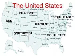
Looking at a world map, choose the most correct location for this pair of latitude and longitude coordinates (expressed in degrees): 0,0. • Central Australia • Northwest Brazil • Southwest of Africa in the Atlantic Ocean • Near the South Pole in Antarctica • London, England
Looking at a world map, choose the most correct location for this pair of latitude and longitude coordinates (expressed in degrees): 0,0. • Central Australia • Northwest Brazil • Southwest of Africa in the Atlantic Ocean • Near the South Pole in Antarctica • London, England Explanation: The coordinates 0,0 mark the point at which the equator intersects the Prime Meridian in the Atlantic Ocean.
Lines of ________ are drawn as east and west circles on the globe and yet they measure distances north and south of the ________. • longitude, Prime Meridian • longitude, equator • latitude, Prime Meridian • latitude, equator • latitude, Date Line
Lines of ________ are drawn as east and west circles on the globe and yet they measure distances north and south of the ________. • longitude, Prime Meridian • longitude, equator • latitude, Prime Meridian • latitude, equator • latitude, Date Line Explanation: Latitude measures distance north and south from the equator as an angle. It ranges from 0 to 90 degrees.
Meridians of longitude on the globe • are the same length north to south. • converge at the poles. • terminate at the poles. • intersect the equator. • All of the above are correct.
Meridians of longitude on the globe • are the same length north to south. • converge at the poles. • terminate at the poles. • intersect the equator. • All of the above are correct. Explanation: Lines of longitude measure distance east and west of the Prime Meridian in angles ranging from 0 to 180.
Imagine that you are aboard a ship on September 21 sailing along the equator. Glancing upward you notice that the Sun is directly overhead. Your watch is set to Greenwich time and reads 6 P.M. What is your longitude? • 90 degrees west of Greenwich • 90 degrees east of Greenwich • 180 degrees west of Greenwich • 180 degrees east of Greenwich • 30 degrees east of Greenwich
Imagine that you are aboard a ship on September 21 sailing along the equator. Glancing upward you notice that the Sun is directly overhead. Your watch is set to Greenwich time and reads 6 P.M. What is your longitude? • 90 degrees west of Greenwich • 90 degrees east of Greenwich • 180 degrees west of Greenwich • 180 degrees east of Greenwich • 30 degrees east of Greenwich Explanation: September 21 is the date of the Autumnal Equinox. The Sun appears directly overhead at noon. The difference in hours between local time (noon) and Greenwich (6 P.M.) is six hours. For every hour, add fifteen degrees of longitude, placing the ship at ninety degrees west of Greenwich
Which of the following is not a formal culture region? • The distribution network for USA Today newspaper • A wheat-growing county in Kansas • A Haitian neighborhood in Miami, Florida • The part of Italy called “Lombardy” • A French-language region in Canada
Which of the following is not a formal culture region? • The distribution network for USA Today newspaper • A wheat-growing county in Kansas • A Haitian neighborhood in Miami, Florida • The part of Italy called “Lombardy” • A French-language region in Canada Explanation: Formal regions are characterized by a degree of homogeneity while functional regions are marked by a node-and-periphery pattern.
What continent does not have an area located in an ‘A’ Climate? • Africa • South America • Australia • Europe • Asia
What continent does not have an area located in an ‘A’ Climate? • Africa • South America • Australia • Europe • Asia Explanation: No portion of Europe is located in the tropics because the continent is too far north.
It is 7:00 P.M. on December 24 at 60 degrees west longitude. What time and day is it at 30 degrees east longitude? • 1:00 P.M. on December 24 • 11:00 P.M. on December 24 • 1:00 A.M. on December 25 • 3:00 A.M. on December 25 • 5:00 A.M. on December 25
It is 7:00 P.M. on December 24 at 60 degrees west longitude. What time and day is it at 30 degrees east longitude? • 1:00 P.M. on December 24 • 11:00 P.M. on December 24 • 1:00 A.M. on December 25 • 3:00 A.M. on December 25 • 5:00 A.M. on December 25 Explanation: 30 degrees east longitude is 6 hours later than 60 degrees west longitude.