Download

1 / 15
630 likes | 1.6k Views
GIS and Crime Mapping. “Any sufficiently advanced technology is indistinguishable from magic.” ~ Arthur C. Clark. Fei Bu and Coriana Fitz. How crime mapping differs from other maps. Crime Map. General Map.

E N D
GISandCrime Mapping “Any sufficiently advanced technology is indistinguishable from magic.” ~ Arthur C. Clark Fei Bu and Coriana Fitz
How crime mapping differs from other maps Crime Map General Map http://www.google.com/search?tbm=isch&hl=en&source=hp&biw=1366&bih=639&q=GIS+layers&gbv=2&oq=GIS+layers&aq=f&aqi=g1&aql=1&gs_sm=e&gs_upl=34164l37113l0l37284l10l9l0l4l4l0l281l780l2.1.2l5l0
Before the Beginning… • Choropleth maps display quantities of things in areas. • divided into polygons, then shaded to show trends • First Chloropleth maps: 1829 Adriano Balbi and André Michel Guerry • Chloropleth map depicting property crimes in France, made by Guerry. Chamard, Sharon. The History of Crime Mapping and Its Use by American Police Departments, Alaska Justice Forum. 2006 http://justice.uaa.alaska.edu/forum/23/3fall2006/a_crimemapping.html André-Michel Guerry, Wikipedia. 2011. http://en.wikipedia.org/wiki/Andr%C3%A9-Michel_Guerry
Pin maps/Point maps Pin map of the United States • Map in which points represent particular geographical locations. • First pin map: Sophonsiba Breckenridge and Edith Abbott • All that with no computers! Chamard, Sharon. The History of Crime Mapping and Its Use by American Police Departments, Alaska Justice Forum. 2006 http://justice.uaa.alaska.edu/forum/23/3fall2006/a_crimemapping.html
No more mess in the office! http://www.google.com/search?hl=en&biw=1366&bih=639&gbv=2&tbm=isch&sa=1&q=messy+office&oq=messy+office&aq=f&aqi=&aql=1&gs_sm=e&gs_upl=2965l4447l0l4572l6l6l0l0l0l0l171l421l4.1l5l0
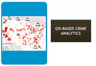
Targeting Crime • Integrating data • Arranging the police forces properly • Easier to research • Decreasing the crime rate effectively http://www.google.com/imgres?q=crime+GIS&hl=en&sa=X&tbm=isch&prmd=ivns&tbnid=-RGnsMePLTy1EM:&imgrefurl
Converging on the Criminal Video Time! From: http://www.13hh.com/video/20595.html
CompStat • Jack Maple was the Deputy Police Commissioner in New York City for Crime Control Strategies. He created CompStat. • CompStat (Computer Statistics) is a dynamic approach to crime reduction, quality of life improvement, and personnel and resource management. • Maple co-authored the book The Crime Fighter and inspired CBS’ TV series The District. Cast of The District, the TV series inspired by Maple’s experience. CompStat, Wikipedia. 2011 http://en.wikipedia.org/wiki/CompStat Jack Maple, Wikipedia, 2011 http://en.wikipedia.org/wiki/Jack_Maple
Economic crime • Analyze and generalize the enormous transaction data • As a reference evidence in court http://www.sbsm.gov.cn/article/mtbd/200901/20090100047266.shtml
Crime mapping used by citizens • Learn more about Community safety • Consider it as a criterion when move to a new community
Increasing use of Crime mapping By 2002, At least 13 percent of the police departments in the U.S. are now using GIS to solve crimes, according to the National Institute of Justice (NIJ).
Negative aspects • The skill it takes to learn GIS is often underestimated. Integrating the mapping into departmental routine requires substantial effort. • It is essential to have working computers and programs to use GIS. If the database gets hacked, a virus infects the computer system, or power outage occurs, the GIS functionality decreases.
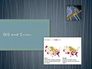
Crime prevention GIS can: • Record and map police activity and crime incidents. • Identify crime hotspots • Understand crime distribution, explore methods, reasons, and trends in criminal activity. • Monitor the impact of crime reduction projects. • Use maps to communicate to the public crime rates in their area. Hey, that’s my donut! That guy needs better crime prevention strategies. Chainey, Spencer, Ratcliffe, Jerry. GIS and Crime Mapping. Wiley, John & Sons, Incorporated. 2005
Summary • There are several additional layers in maps used to fight crime. • Choroplethand Pin maps were used before GIS to find trends in crime. • GIS can be used to track criminals. CompStat is an effective way to monitor crime. It’s used by police departments in most major cities. • GIS can prevent traditional crime and new-type crime. • Citizens uses crime map to learn the community safety. • The difficulty in leaning GIS applications and the potential for computer failure are negative aspects.
Any Questions? Ask Questions! Or I will have to smile and beat you with my bat…