Download
1 / 42
450 likes | 638 Views
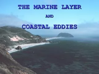
THE MARINE LAYER AND COASTAL EDDIES. THE MARINE LAYER. What is the Marine Layer?. It is a layer over EVERY body of water, no matter how small or large, that has an increased relative humidity (RH). This layer is commonly referred to as a “Marine Layer.”. THE MARINE LAYER.

E N D
THE MARINE LAYER AND COASTAL EDDIES
THE MARINE LAYER What is the Marine Layer? It is a layer over EVERY body of water, no matter how small or large, that has an increased relative humidity (RH). This layer is commonly referred to as a “Marine Layer.”
THE MARINE LAYER Why is there a VISIBLE Marine Layer over the SOCAL OPAREAS most of the year? There is an INVERSION that keeps the lower atmosphere from mixing with the upper atmosphere. Over SOCAL, this inversion is usually at approx. 1,200 FT. This inversion is produced by the EASTPAC High. The Southwestern USA and adjacent waters are in the SOUTHEASTERN quadrant of the EASTPAC High. This is the quadrant where MAX SUBSIDENCE occurs under high pressures.
THE MARINE LAYER Things to consider: 1. The location and strength of the EASTPAC High. If the high builds, ridges over or moves toward SOCAL, then the subsidence will increase and the inversion will lower (i.e. 1,200 FT down to 900 FT), this will cause the bases of the low clouds to also lower. 2. Just the opposite, if the EASTPAC High weakens, a short wave approaches or the high shifts to the west, subsidence will decrease and the height of the inversion will rise and the low cloud bases will also rise.
KNUC 25MAR04 12Z SKEW-T. Here we have a well established inversion near the surface. The air below the inversion is NOT mixing with the atmosphere above the it. Notice that the LCL is above the inversion, the current SKY CON: BKN200. NO low clouds, WHY? The air can not be lifted to the LCL for the low clouds to form. It is very important to understand this concept!
THE MARINE LAYER So another consideration needs to be made, where is the LCL located in the atmosphere. 3. If the LCL is above the inversion, do not expect low clouds/fog to FORM. It is possible for low clouds/fog to be advected in under the inversion but they will not form there. NOTE: There is an exception! Early morning fog can form over areas where up-welling is occurring. This type of fog is usually patchy, dense and begins to lift and dissipate quickly after sun rise. Pay attention to coastal SSTs, if the SST is cooler than the FCSTED temps, fog may form. (Warm over Cold)
THE MARINE LAYER 4. If the LCL is below the inversion, there is a greater chance that low clouds/fog will form. The distance BTWN the LCL and the inversion will help determined the thickness of the cloud layer/fog. IF the layer is FCSTED to be > 2,000 FT thick, expect DZ. The thicker the layer, the longer and more wide spread the DZ will be. NOTE: At sun rise, begin subtracting 100 FT from the cloud layer each hour, over water (150 FT = coastal, 200 FT = inland), do this until the layer is less than 2,000 FT think and that is about when the DZ should end. IF the SST is colder than the air or if a layer above the low clouds, this rule will not work well.
THE MARINE LAYER 5. If the EASTPAC High is strong enough, the inversion can become surface based. If this occurs, FCST for DENSE FOG with little to no chance of burn-off or lifting (again, depending on the location of the LCL). When it comes to FCST-ing low clouds and fog with an inversion in the lower atmosphere, it is extremely important to pay close attention to the location of the LCL. This can not be over emphasized.
KNTD 17MAR04 12Z SKEW-T. For the last 48 HRS the EASTPAC High had been ridging over SOCAL driving the inversion down to the SFC. BHR is to get underway at 0600L. Notice that the LCL is at the SFC, VERY BAD!
12Z 16MAR04 24 HR PROG, VT: 12Z 17MAR04. Under these conditions SFC wind is FCSTED to be light and variable (L/V).
SOCAL BUOY REPORTS, DTG: 12Z 17MAR04. As FCSTED, only L/V wind.
GOES 12 VIS Image DTG: 1500Z 17MAR04 The 15Z observation from the pier: VV003 1/2 FG VRB03KT 14/14 A3006. Lowest observed VSBY that morning, 1/16 NM, the bow of the ship was disappearing into the fog. Even though the lay was not very thick (approx. 400-500 FT), with no wind to mix the atmosphere the fog persisted ALL DAY.
Temp spread = 10°C/18°F KNTD 18MAR04 00Z SKEW-T. Based on this SKEW-T, should you FCST low clouds or fog? WHY/WHY NOT? NO! Even though the entire OPAREA was covered by low clouds and fog and the base of the inversion is on the SFC, KNTD was clear in the low levels. This sounding is at 1600L (max heating) and KNTD is on the coast just north of LA.
KNUC 30MAR04 12Z SKEW-T. What would you FCST based on this SKEW-T? It appears that above the inversion at approx. 915 MB significant drying occurs. We’ll used this as the cloud tops (915 MB Level). Here is what I would FCST: LCL ≈ 975 MB and Cloud Tops ≈ 915 MB. Without knowing the actual heights of these levels, the 925 MB level is normally assumed to be approx. 3,000 FT. So, subtract 925 MB from the average Sea Level Pressure 1013 MB = 88 MB. Then divide 3,000 FT by 88 MB and you get 34 FT per 1 MB in the lower atmosphere (only use this below 850 MB). So then: 975-915 = 60 x 34 = 2,040 FT FCST Conditions: OVC009 with DZ Why 900 FT? Easy, again LCL ≈ 975 MB indicated Surface Pressure below is approx. 1000 MB. 1000-975 = 25 x 34 = 850 FT (reportable value = 900 FT) 975 MB Level 915 MB Level REMARKS: Other forecasted conditions need to be taken into consideration, but this method will get you give you a solid base to work from. Or said plainly, your not guessing!
WHAT ARE COASTAL EDDIES Eddies are small scale, meso-scale, cyclonic circulations, that tend to form over the SOCAL OPAREAS south of PT Conception in the SOCAL Bight Region. When formed, they significantly alter the local weather conditions over the SOCAL Coastal Regions and the OPAREAS. The term “Catalina Eddy” is commonly miss used by the local media and untrained FDOs to describe the development and/or presence of an eddy or eddies. There are specific considerations and criteria that need to be met in order to name a eddy a “Catalina Eddy.”
POINT CONCEPTION SANTA CRUZ SANTA CATALINA SANTA ROSA SAN CLEMENTE (KNUC) SAN NICOLAS (KNSI) SOCAL BIGHT REGION These locations are commonly referred to in WX Discussions from the NWS and other reports when dealing with eddies.
FORMING A COASTAL EDDY There are several mechanisms that form eddies over the SOCAL OPAREAS and along the coast of California. Any one of these mechanisms can generate an eddy. In combination they can generate the well known “Catalina Eddy.” 1. CLIMO: The EASPTAC High generates a north to northwest wind flow along the Central and Southern Coast of California during most of the year. This flow is generate by the gradient BTWN the high and the Thermal Trough over Southwestern US. As this flow passes along the uneven coast lines, return flows are generated which aid in the development of eddies.
PERSISTENCE of the wind flow past a point will cause a return flow, this is one of the “starting” mechanisms in the formation of an eddy. The time is takes for an eddy to begin is dependent on the wind speed/direction. Understand, this is NOT increasing wind flow, just persistent wind flow! Increasing wind flow will develop this conditions more rapidly. DAY 1 DAY 2 DAY 3 15-20 KTS 15-20 KTS 15-20 KTS
SOCAL BIGHT REGION SO, a persistent wind flow past PT Conception would cause this type of effect. Again, this effect is directly dependent on the wind speed/direction.
Coastal weather stations may show little indication that an eddy has set-up. WHY? Coastal topography is the main reason, satellite images are the BEST TOOL to locate/ID eddies.
FORMING A COASTAL EDDY In order to increase this flow past PT Conception the following synoptic scale situations need to occur, these situations can occur in combination to dramatically increase the flow: a. The EASTPAC High builds, ridges or moves eastward. b. The Thermal Trough deepens. c. A front or upper level trough passes over the OPAREAS. Winds will tend to increase both because of the increasing gradients and enhancement by the topography.
FORMING A COASTAL EDDY 2. Another mechanism that aids in the development of coastal eddies is the Thermal Trough that forms over the Northern Mexico through Desert Southwest and up over the Central Valleys. The Thermal Trough is nothing more than a SERIES of Thermal Low Pressures. In order to accurately FCST where a coastal eddy will set-up along the coast, FCSTRS need to understand the relationship BTWN the winds over the SOCAL OPAREAS and the Thermal Trough. Remember, wind ALWAYS flows from high pressure towards low pressure. IRT the Thermal Trough, towards the LOWEST PRESSURE!
For a well developed eddy to form, the lowest pressure in the Thermal Trough needs to be located in this general area. This allows for the wind to turn into the Bight Region, aiding the other mechanisms to be set-up/continue. L 1002 L 1000 L 1002
If the lowest pressure in the Thermal Trough is over the Central Valleys, then the winds turn quickly as they come past PT Conception and the eddy develops over/just north of Santa Rosa Island. In this location the eddy has little effect over the rest of the OPAREAS. L 1000 L 1002 L 1002
If the lowest pressure in the Thermal Trough is over the Imperial Valley or even further south over North Mexico, the winds turn slowly and numerous weak eddies can develop over the OPAREAS. These eddies generally form over the Northern OPAREAS and drift southward. How fast they drift will depend on the speed of the flow past PT Conception. L 1002 L 1002 L 1000
FORMING A COASTAL EDDY 3. The final mechanism that aids in the development of coastal eddies is the approach of a front or upper level trough. In the approach of a front or trough a southerly flow is generated over the SOCAL OPAREAS. This flow is turned cyclonically in the lower atmosphere by the topography of SOCAL Coastal MT Ranges.
Area where an eddy will most likely form. GOES 12 (WEST) IR IMAGE DTG: 1115Z 05 APR 04 As a weak mid-level trough (700 MB) moves over the SOCAL OPAREAS, topography turns the southerly flow ahead of it cyclonically. This southerly flow, advects warmer, moist air northward. The trough causes the inversion to lift, thickening the Marine Layer and increasing the chance of DZ. NOTE: The cause of the southerly flow is the trough. As it moves over the OPAREAS, the eddy will move. If the trough moves quickly, then the eddy will be short lived.
Notice that low clouds are being advected well inland. KNKX: OVC025 7 DZ 20006KT 15/14 A2991 RMK VSBY LWR NE-SE. NOTE: Behind the trough the Marine Layer is being dried out by off shore flow.
SOCAL BIGHT REGION It is important to understand that the topography of the Bight Region will turn ANY low level, southerly wind flow cyclonically!
METOC IMPACTS 1. Air quality will improve as the inversion rises and pollutants mix through a greater depth of the atmosphere. 2. If the layer reaches > 2,000 FT thickness, expect DZ. If a trough passes over expect continued thickening and possible SHRA. A significant system needs to pass over to get TSRA. TS activity is not associated with eddies! 3. Coastal temps will be several degrees cooler than the day before, cloud cover reduces the amount of SFC heating. 4. When the “Catalina Eddy” is at its strongest, the thickness of the low clouds can become 6,000 FT and be advected into the inland valleys and reach as far as Palmdale (KPMD).
FORMING A CATALINA EDDY So now we have 3 mechanisms which develop eddies over the SOCAL OPAREAS. When all of these conditions come together, we get our highest probability for a true Catalina Eddy to form. • Persistent wind past PT Conception (N-NNW 20-30 KTS) • The lowest pressure in the Thermal Trough over the High Desert. • Southerly wind flow coming into the SOCAL OPAREAS (for any reason).
When these conditions come together, an eddy will form over/near Catalina Island. These eddies are very persistent, lasting for days! L 1002 L 1000 20-30 KTS L 1002
CATALINA EDDIES CLIMO: The Catalina Eddy is most likely to form during spring, summer or fall when the EASTPAC High is well formed. Winter cases are less frequent and are usually associated with the approach of a low pressure system or slow moving upper level trough. Usually these types of eddies do not meet all the specifications. NWS: Catalina Eddy formation is accompanied by a southerly shift in coastal winds, a rapid increase in the depth of the marine layer, and a thickening of the coastal stratus.
CONSIDERATIONS 1. A streamline analysis of the boundary layer winds over the SOCAL OPAREAS, available ship reports and buoy data, provide an satisfactory tool for determining the possible existence of an eddy. 2. A widely used parameter in recognizing the possible existence of an eddy is a sustained wind of S-SSW 5-10 KTS at NASNI, especially during the period from sunrise to noon when the wind normally shifts to the W-NW due to the onset of the sea breeze. Also persistent low clouds along coastal areas, usual burn-off is 0900-1100L. 3. Eddies can be detected early on satellite imagery by looking carefully for cyclonic turning of the stratus band immediately off the southern California shore. DO NOT always rely on satellite imagery for identifying the presence of an eddy, a weak eddy may not effect the cloud layer over it.
CONSIDERATIONS (cont.) Variations in the eddy pattern are created by some of the following influences: 1. Strength of the pressure gradient BTWN the EASTPAC High and the Thermal Trough. 2. Land/sea breeze influence: a. Nighttime cooling over land reduces the tendency for air to flow in across the coastline. Upon meeting the opposition of the land breeze, the wind is forced to shift northward along the coast creating a S-SE wind flow. b. During the day, the SW flow generated by an eddy will enhance the sea breeze. This will tend to increase the average wind speeds over the Coastal Regions (average 8-12 KTS).
EFFECTS OF A CATELINA EDDY • Winds: • PT Conception = N-NNW 20-30 KTS (generally) • San Nicholas Island (KNSI) = NW 15-30 KTS • NASNI (KNZY), Imperial Beach (KNRS) and Los Angeles (KLAX): Night-Early AM = SE • Afternoon, S-SW = SE • (Speeds will very depending on the strength and • location of the eddy) 2. Stratus Layer. Due to the size, intensity and duration variations, the effects on the stratus layer are predictable only in general terms. The most significant effect of the Catalina Eddy appears to be a deepening of the coastal marine layer with a corresponding rise in the base of the inversion and in the height, thickness, inland extent and duration of the stratus (ceilings will often rise as much as 1,000 to 1,500 FT).
EFFECTS OF A CATELINA EDDY NOTE: After a period time (5-6 days), a Catalina Eddy may lift the inversion so much that the marine layer lacks sufficient moisture to produce clouds, and the sky at along the coast will become almost clear. This situation does not mean the eddy has dissipated. IF enough moisture is advected into the marine layer, the stratus will reform or if the eddy weakens and the inversion begins to lower then a cloud layer be reform. Normally during the summer months the pressure at KNSI and KNUC is approx. 1-1½ millibars HIGHER than the coastal stations (WHY?). During a Catalina Eddy, these stations report LOWER pressure than the coastal stations.
Now look at the increase in cloud cover over this area. This would tend to indicate some type of on shore flow, from the southwest. Notice the decrease in low cloud cover in this area. This would tend to indicate some type of off shore flow, from the north. Do you see any indication of an eddy in this satellite image? GOES 12 (WEST) IR IMAGE DTG: 1600Z 05 APR 04
GOES 12 (WEST) VIS IMAGE DTG: 1600Z 05 APR 04
FROM NPMOC-SD FCSTRS HANDBOOK: WHAT IS WRONG WITH THIS EXAMPLE OF A COASTAL EDDY? The Streamline Anal indicates the wind field being effected all the way to Yuma, AR and over the Desert Southwest. This is more reflective of some type of Migratory Low and not a Coastal Eddy. Not even a Catalina Eddy will effect the wind in this way due to the Coastal MTS Ranges of SOCAL.