Download
1 / 28
280 likes | 434 Views
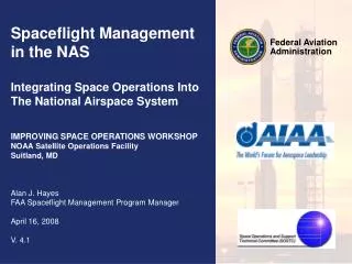
Federal Aviation Administration. Spaceflight Management in the NAS Integrating Space Operations Into The National Airspace System IMPROVING SPACE OPERATIONS WORKSHOP NOAA Satellite Operations Facility Suitland, MD Alan J. Hayes FAA Spaceflight Management Program Manager April 16, 2008

E N D
Federal Aviation Administration Spaceflight Management in the NAS Integrating Space Operations Into The National Airspace System IMPROVING SPACE OPERATIONS WORKSHOP NOAA Satellite Operations Facility Suitland, MD Alan J. Hayes FAA Spaceflight Management Program Manager April 16, 2008 V. 4.1
Overview • Introduction to the FAA • Background/Problem Statement • Current FAA Risk Mitigation Strategy • Space and Air Traffic Management System (SATMS) Concept • Space Shuttle Hazard Area to Aircraft Computation (SHAAC) Tool • SpaceTrax and the Spaceflight Integration Tool • Virtual Spaceflight Center KXAS • Current & Future Spaceflight Management Architectures • Conclusions • Questions
The FAA is responsible for the safety of civil aviation. The Federal Aviation Act of 1958 created the agency under the name Federal Aviation Agency. We adopted our present name in 1967 when we became a part of the Department of Transportation. Our major roles include: Regulating civil aviation to promote safety Encouraging and developing civil aeronautics, including new aviation technology Developing and operating a system of air traffic control and navigation for both civil and military aircraft Researching and developing the National Airspace System and civil aeronautics Developing and carrying out programs to control aircraft noise and other environmental effects of civil aviation Regulating U.S. commercial space transportation Introduction to the FAA
The Office of Commercial Space Transportation (AST) was established in 1984 as the Office of Commercial Space Transportation (OCST) in the Office of the Secretary of Transportation within the Department of Transportation. AST was transferred to the FAA in November 1995. The Office of Commercial Space Transportation: Regulates the commercial space transportation industry, to ensure compliance with international obligations of the United States and to protect the public health and safety, safety of property, and national security and foreign policy interests of the United States; Encourages, facilitates, and promotes commercial space launches and reentries by the private sector; Recommends appropriate changes in Federal statutes, treaties, regulations, policies, plans, and procedures; and Facilitates the strengthening and expansion of the United States space transportation infrastructure. AST issues FAA licenses for commercial launches of orbital rockets and suborbital rockets. The Office of Commercial Space Transportation (AST)
The primary service of the Air Traffic Organization is to move air traffic safely and efficiently. Air Traffic Organization (ATO) System Operations Service Unit provides overall national guidance for air traffic procedures and airspace issues, traffic flow management for the National Airspace System (NAS), requirements for weather observation and reporting standards, and the focal point for interface with Department of Defense (DoD) and Department of Homeland Security (DHS) regarding air transportation security issues. Offices with Spaceflight responsibilities include: Air Traffic Control System Command Center (ATCSCC) Airspace & Aeronautical Information Management (AAIM) Spaceflight Management Program Safety Security Air Traffic Organization (ATO) System Operations Services
Background • The FAA expects unprecedented demands on the National Airspace System and the nation’s Air Traffic Control system over the next 10 years: • Doubling of air traffic operations • Increase in space operations • R & D: Blue Origin, Armadillo Aerospace • Space Tourism: Virgin Galactic, Rocketplane, etc. • Prizes: X Prize Cup, America’s Space Prize, NASA Centennial Challenges • NASA: Space Shuttle, Orion • NASA Commercial Orbital Transportation Services: SpaceX
Background (continued) The NAS was not designed to handle high-speed spacecraft. Different tools, processes, and procedures will be necessary to minimize the impact of space operations in the NAS. FL4000 Class E Airspace FL600
DFW N Debris Footprint Background – The Columbia Accident Prior to the Columbia accident, FAA Air Traffic procedures for supporting Space Shuttle operations did not take into account the potential debris hazard to aircraft during a Shuttle reentry
Problem Statement The FAA needs to safely accommodate spacecraft transitioning to and from space through the National Airspace System (NAS). To accomplish this, space and air traffic operations will need to be seamlessly integrated under the current and future FAA Air Traffic infrastructure.
Current FAA Risk Mitigation Strategy • Notices to Airmen (NOTAMs) • Temporary Flight Restrictions (TFRs) • Special Use Airspace (SUA) • Restricted Areas • Warning Areas • Central Altitude Reservation Function (CARF) • Altitude Reservation (ALTRV) • Command Center Advisories (CCA) • Traffic Situation Display • Manual Entry of Lat/Long prior to and during Shuttle Landing to create Flow Evaluation Areas (FEAs)
Current FAA Risk Mitigation Strategy (continued) • Impacts • Existing Special Use Airspace (SUA) is sized for the largest vehicles that may use them, with fixed boundaries • Typically activated for extended periods of time • Spaceflight Operations are handled as an exception to normal NAS operations (i.e. no Flight Plans, ATO flight tracking is handled manually, etc.) • Require extensive advanced coordination with various Air Traffic entities • Can be difficult to accommodate launch/landing delays and scrubs • Goals • Reduce the amount of airspace that is restricted for each launch/landing and the amount of time that the restriction needs to be in effect • Schedule the restriction so as to accommodate conventional air traffic while still achieving the safety and space mission objectives • Accommodate launch/landing delays, scrubs, and incidents
The FAA has developed a Concept of Operations (CONOPS) for a future Space and Air Traffic Management System (SATMS). This concept: • Represents a framework for seamlessly integrating space vehicles on their way to and from space with more traditional air traffic operations • Calls for assured separation between space and air traffic • Will require new space and air traffic management tools and enhanced communications, navigation, and surveillance services • The SATMS Toolkit is currently under development by the FAA. It consists of: • The legacy Space Shuttle Hazard Area to Aircraft Computation (SHAAC) • The SpaceTrax trajectory tool, and • The Spaceflight-wide Interactive Flight Tool (SWIFT) The SATMS Concept & Toolkit
The Space Shuttle Hazard Area to Aircraft Computation (SHAAC) tool was developed by AST to identify hazard areas of potential debris produced by the Space Shuttle should a breakup occur during re-entry. Designed to reduce FAA dependence on NASA and increase FAA capabilities by replicating functionality of the existing NASA tool. SHAAC Capabilities Utilizing complex algorithms and modeling techniques, SHAAC: Utilizing trajectory data from NASA, to identify potentially affected airspace in advance of a Shuttle reentry to increase air traffic control situational awareness In the event of an accident, determines the extent of the effected airspace Serves as a Proof-of-Concept for SpaceTrax and the Spaceflight-wide Interactive Flight Tool (SWIFT) The SHAAC tool was first used at the Air Traffic Control System Command Center (ATCSCC) in FY08 to support Shuttle Flight STS-120. Space Shuttle Hazard Area to Aircraft Computation (SHAAC) Tool
Space Shuttle Hazard Area to Aircraft Computation (SHAAC) Tool (continued) Output & Display Features Generates file of latitude/longitude coordinates of hazard area corners in same format as data previously provided by NASA. • Graphical depictions of hazard areas plotted on maps with political and airspace boundaries • Latitude/longitude coordinates of hazard areas manually entered into the Traffic Situational Display • PC-based (Thick Client) application
SpaceTrax and SWIFT Tools • SpaceTrax and SWIFT are being developed by the FAA (ATO-R) to assist air traffic controllers in managing airspace and the risk to aircraft from space operations, by providing improved situational awareness. • Capabilities of Both Tools: • Track spacecraft movement within the NAS • Create and file ICAO Flight Plans for spaceflight operations • Should an incident occur: • Identifies potentially affected airspace • Identifies affected airways, sectors, and airports. • Generate NOTAMs and Command Center Advisories
SpaceTrax • Utilizes Trajectory Files from NASA and Output Files from SHAAC/Others, SpaceTrax will: • Display the planned trajectory (Launch/Landing) as received from NASA • Identify Entry Points (Time, Altitude, and Velocity) into Controlled Airspace, ARTCC, and Political Boundaries for plan and actual data • Displaygraphical depictions and reports of hazard areas plotted on maps with political and airspace boundaries • Provide a 2D and 3D display capability • Generate Latitude/Longitude, Altitude, and Speed data for entry into an ICAO Flight Plan • Automatically Generate Reports currently being prepared manually • Process real-time data and provides Latitude/Longitude information every 30 seconds (adjustable) for manual entry into the TSD • PC-based (Thick Client) Application
SWIFT • Planning Mode • Identify the airspace restriction requirements, potential impacts to other NAS users, and options to mitigate those impacts • Allow decision makers to make informed risk reduction decisions • Graphical depictions of hazard areas plotted on maps with political and airspace boundaries. • Generate Reports • Web-Based (Thin Client) Application
Input Real-Time Data from space carrier conducting spaceflight operations following an FAA-defined Interface Requirements Document (IRD) Compute rectangular hazard areas that bound the locations of potential debris and outputs their latitude/longitude coordinates and space vehicle real-time location directly to TFM-M for display on the Traffic Situational Display (TSD) File ICAO Flight Plans with HCS/ERAM/ETMS Generates TFR NOTAMs and Command Center Advisories Utilizes Web Services for Data Transfer SWIM and NextGen Compliant SWIFT (continued) • Real-time Mode • Display the space vehicle’s trajectory and estimates of the potentially hazardous airspace against current air traffic data • In the event of an accident, provide information to Air Traffic Controllers identifying potential hazardous airspace due to falling debris
SATMS Toolkit Implementation Decommissioned @ End of Shuttle Program Initial Operating Capability (IOC) FY2008 Space Shuttle Hazard Area to Aircraft Computation (SHAAC) Tool { Phase 1 (PC-based) Decommissioned FY2012 SpaceTrax Tool Versions 1.x – 2.x O&M IOC FY2008 { Spaceflight-wide Interactive Flight Tool (SWIFT) Versions 1.x – 4.x O&M* Phase 2 (Server-based) IOC FY2009 FY2008 FY2009 FY2010 FY2011 FY2012 FY2013 FY2014 FY2015+ * Period TBD
To support SpaceTrax and the Spaceflight-wide Interactive Flight Tool (SWIFT), a virtual Spaceflight Center is being created that will: Issue all Spaceflight-related Flight Plans. All Spaceflight Operations will have a flight plan automatically created for them Issue Modifications to existing Spaceflight-related Flight Plans Send Position Reports to ETMS/TFM-M Issue Spaceflight-related NOTAM messages Issue Command Center Advisories Send and Receive Service B Messages Provide Spaceflight-related information to FAA and Commercial Users. Virtual Spaceflight “Center” - KXAS
Current Spaceflight Management Architecture DSR NASA Real-Time Trajectory Data Key: Manual Automatic NASA Web Site NASA Planned Trajectory Files ATCSCC Draft NOTAM Messages ARTCCs Latitude, Longitude, Altitude, & Speed SHAAC (Debris Field Reports & Files) For TSD Adaptations Altitude Requests Data for Draft NOTAM Messages Draft NOTAM Messages CARF NOTAM Entry (NES) Advisories AISR TSD / WSD Display Flight Plans NASA Planned Trajectory Files ATCSCC Advisory Flight Plans & Aircraft Position Reports Published NOTAM Messages NOTAMs FNS ETMS TFM-M HCS/ ERAM
SATMS Phase 1 Architecture DSR NASA Real-Time Trajectory Data SpaceTrax (at ATCSCC) Virtual “Spaceflight” Center KXAS NOTAM Report (SpaceTrax) NASA Planned Trajectory Files ATCSCC Draft NOTAM Messages Debris Fields ARTCCs SHAAC (Debris Field Reports & Files) Plan & Actual Flight Display (SpaceTrax) Flight Plan Report (SpaceTrax) Spacecraft Location Report (SpaceTrax) Data for Draft NOTAM Messages Altitude Requests Altitude Requests Flight Plan Messages For TSD Adaptations Draft NOTAM Messages CARF NOTAM Entry (NES) Advisories AISR TSD / WSD Display Flight Plans NASA Planned Trajectory Files ATCSCC Advisory Flight Plans & Aircraft Position Reports Published NOTAM Messages NOTAMs FNS ETMS TFM-M HCS/ ERAM
SATMS Phase 2/3 Architecture DSR Real-Time Trajectory Data SpaceTrax & SWIFT (at ATCSCC) Virtual “Spaceflight” Center KXAS Plan & Actual Flight Display (SpaceTrax) Planned Trajectory Files ATCSCC Draft NOTAM Messages ARTCCs Command Center Advisories (CCA), Flight Movement Messages, and TSD Adaptations (Phase 3) Altitude Requests (Phase 3) Flight Plan Messages (Phase 3) Draft NOTAM Messages CARF NOTAM Entry (NES) AISR TSD / WSD Display Flight Plans ATCSCC Advisory Flight Plans & Aircraft Position Reports Published NOTAM Messages NOTAMs FNS ETMS TFM-M HCS/ ERAM
SATMS Toolkit will be implemented over the next 3-5 years: Year 1 (FY2008) SpaceTrax 1.0 SWIFT Proof-of-Concept Year 2 (FY2009) SWIFT 1.0 SpaceTrax 2.0 Real-Time Data Interface 1.0 TFM-M Interface Prototype Year 3 (FY2010) SWIFT 2.0 SpaceTrax 3.0 Real-Time Data Interface 2.0 TFM-M Interface 1.0 Year 4+ (FY2011 and later) Satellite Orbit/Re-entry Tracking Continuing updates to the Toolkit FY08 – FY12 Implementation
Conclusions • Space operations will continue to increase, as will the challenges of accommodating operations safely in the NAS. • Experience gained in support of Shuttle reentries has helped to identify and refine SpaceTrax and SWIFT requirements and implementation strategies. • The toolset and associated Air Traffic procedures will enhance situational awareness for Controllers and help them identify airspace restrictions, while providing mitigation options for potential impacts.
Alan Hayes, FAA Program Manager Telephone: (202) 493-1406 Email: Alan.Hayes@faa.gov Thank You! For More Information Please Contact: