Download
1 / 21
210 likes | 532 Views
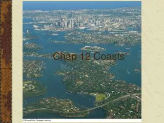
Chapter 12 Coasts, Beaches, and Estuaries. 12.1 Major Zones. Coastal area: land edge that borders the sea Width varies Geography Climate Vegetation Social customs and culture Legal definition

E N D
12.1 Major Zones • Coastal area: land edge that borders the sea • Width varies • Geography • Climate • Vegetation • Social customs and culture • Legal definition • Shore: outer limit of wave action on the bottom to the limit of the waves’ direct influence on land • Beach: accumulation of sand or gravel that occupies part of the shore
12.2 Types of Coasts • Primary coasts • Effect of ice ages • Effect of sediment carried by rivers • Effect of wind • Effect of volcanic activity • Effect of tectonic activity • Secondary coasts • Erosion due to wave activity • Barrier islands • Stabilization due to plant growth • Coral atolls and reef coasts • Mangrove swamps and salt marshes
12.3 Anatomy of a Beach • Backshore • Berm and berm crest • Foreshore • High and low water shorelines • Wave-cut scarp • Low-tide terrace • Beach face • Offshore • Troughs • Bars and barrier islands
12.4 Beach Dynamics • Natural processes • Waves • Summer: gentler waves move sand shoreward • Winter: large storm waves remove sand to offshore bars • Onshore and longshore transport • Swash zone • Drift sector • Spring time river flooding • Great storms • Landslides
12.4 Beach Dynamics, continued • Coastal circulation • Sediment transport in surf zone • Rip currents • Coastal circulation cell • Natural sand transport • Energy input by waves
12.5 Beach Types • Shape and Structure • Spits • Combo • Hook • Eroded beach • Lag deposit • Armored beach • Beach material • Source determines composition and size • Land sources • Offshore sources • Color of sand: • White sand: derived from coral • Black sand: derived from basaltic lava • Green sand: derived from specific minerals (olivine or glauconite) • Pink sand: derived from shell material
12.6 Modifying Beaches • Coastal structures • Effect of dams on river sediment supply • Effect of breakwaters, jetties, and groins on longshore sediment transport • Effect of rising sea level • Effect of seawalls on wave erosion • The Santa Barbara story • The history of Ediz Hook
Boxed Reading: NationalMarine Sanctuaries • Managed by the National Oceanic and Atmospheric Administration (NOAA) • Restricted multiple use • Commercial fishing • Shipping traffic • Recreation • Local populations’ opposition to NOAA regulations • Education
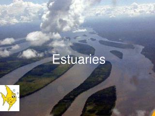
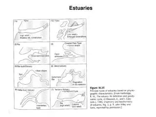
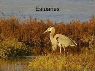
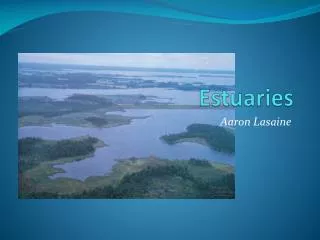
12.7 Estuaries • Types of estuaries • Processes that govern vertical mixing and stratification: • Strength of oscillatory tidal currents • Rate of freshwater addition • Bottom roughness • Average depth • Types of estuaries: • Salt wedge, well-mixed, partially mixed, and fjord-type estuaries • Circulation patterns • Seaward at the top • Landward at depth • Salt and water budgets • Temperate-zone estuaries • Fresh water input by rivers dominates over evaporation and precipitation
12.8 High Evaporation Rates • Located in low precipitation zones, near 30°N and 30°S • Negligible freshwater input by rivers • Evaporation dominates • Inverse estuaries • Circulation patterns • Landward at top • Seaward at depth
Boxed Reading: Rising Sea Level • Rates of sea level rise: • 20 cm over past century • 2.8 mm per year at present (satellite based estimate) • 31-110 cm by year 2100 • Increasing rate of rise • Global phenomenon • Associated problems are location dependent • Causes of sea level rise • Variations in the amounts stored in land ice • Thermal expansion of sea water • Rise and fall of coasts • Effect of El Niño • Seasonal variations in sea level
12.9 Flushing Time • Carrying capacity of wastes • Flushing time for fresh water • Flushing by tidal action • Effect of mixing • Effect of coastal upwelling and downwelling
12.10 Practical Considerations: Case Histories • The development of San Francisco Bay • Effect of mining and overfishing on fisheries • Effect of water diversion for irrigation on deltas and marshlands • Effect of intensive agriculture and industrial wastes on water quality • Effects of treated freshwater discharge from urban areas on salt marshes and habitat for birds and animals • Conservation and development
12.10 Practical Considerations: Case Histories, continued • The situation in Chesapeake Bay • Overfishing and declining catches of oysters and fish • Partially treated and untreated sewage the cause of typhoid outbreaks • Effects of increased inputs of nutrients and low oxygen levels on water quality • Effects of commercial fertilizer on toxic organisms • Research and regulations • Natural impacts due to tropical storms, variations in rainfall and temperature, and ice formation during severe winters
Summary • Primary coasts: formed by nonmarine processes • Secondary coasts: modified by marine processes • Dynamic equilibrium of beaches • Supply, removal, and longshore transport of sediments • Interference by dams, breakwaters, groins, and jetties • Estuary flushing time • Capacity for dissipating wastes • Tidal action • Mixing and partial recycling
Vocab for Concept Map • Shore- area from lowest tide to the waves highest tide • Beach- accumulation of sediment (sand/gravel) • Geomorphology- study of the land forms and the processes that have shaped land through time • Eustatic change- climate change resulting in sea level change, creating different coasts lines • Primary coasts- coastline primary shaped by terrestrial processes rather than marine • Secondary coast- coastline primary shaped by marine forces or marine organisms • Fjords- narrow, deep, steep-walled inlet formed by the submergence of a mountainous coast or by the enterence of the ocean into a deeply excavated glacial trough after the melting of the glacier. A deep, small surface-area estuary with moderately high river input and little tidal mixing.
Sill- collection of debris from glacier that formed a lip, creating a shallow entrance, where the sea meets the land • Moraine- sediments left by a glacier when it starts to retreat it leaves a mound of rubble along the boarder of its greatest expansion. • Drowned river valley or ria coast- • Delta- sediment build up coming from river into sea that sits atop the continental shelf. Ex Chesapeake bay • Alluvial plain- deposits that sit at the ends of deltas and deep sea trenches, sediment accumulation. Ex Mississippi river delta • Dune coast- wind modified depositional coast, ex western sahara in Africa • Lava coast- lava flows extending to the sea form black sand beaches, ex Hawaiian islands • Cratered coasts- craters formed by volcanic explosions became concave bays when they lost their rims on the seaward side, ex Hanauma Bay Hawaii • Fault bay- Tectonic activity results in faulting and the faulting reaches the sea and fills in with water creating a bay, ex san Francisco and tomales bays in pacific ocean
Fault coasts- • Sea stacks- small rock islands and tall slender pinnacles of resistant rock are formed as water erodes less resistant rock, ex common on Oregon, California and Washington’s coastlines • Bars- Eroded materials that move seaward by the waves and currents to areas just off the coast creating a bar of sand parallel to the coast line • Barrier islands- when greater amounts of material are added to offshore area bars can turn into barrier islands, when they break the surface, ex Galveston Island off Texas coast • Sand spits and hooks- connected bars to the shore at one end, they can grow shift position, wash away, ex Sequim bay Washington • Reef coasts- coasts built by corals/marine organisms, corals grow in shallow waters surrounding a landmass, and the small animals gradually build a fringing reef, which is attached directly to the landmass, ex Iwo Jima, Japan • Salt marsh- temperate climates, low lying protected coasts with area of sand and mud are often thickly covered with grasses, ex mangrove forests in Florida • Backshore- dry region of beach • Foreshore- low tide area extending out to low tide terrace • Offshore- low tide terrace to the limit of the wave action on the seafloor • Berms- formed by wave deposited material and have flat tops and sloping sides or rise in elevation away from water, on backshore area. • Scarp- abrupt change in the beach slope that is caused by cutting action of waves at normal high tide • Beach face- upper portion of foreshore that has a steeper slope
Troughs- bars that run parallel to the beach on the seaward side of the low-tide terrace, in offshore region • Dynamic equilibrium- when a sand beach supplies new sand equaling the loss of sand from the beach. Beaches continually change! • Onshore current- landward current • Longshore current- current in surf zone • Longshore transport- along coast when sediment moves parallel to the shore and surf zone • Swash- up rush of water that moves sand grains diagonally up and along beach • Cusps- evenly spaced crescent shaped depressions in sand • Drift sector- path traveled by beach sediments as the longshore current transports them from their source to their area of deposition • Accreting- areas at the depositional end of the drift sector that grow • Coastal circulation cell- linked drift sectors stretching along coast • Tombolo- when spit builds up to connect to an island or rock to the shore • Lag deposit- beach littered with large blocks, pebbles and boulders • Armored beach- lag deposit that continues to accumulate to protect beach from erosion and wave action • Breakwaters and jetties- built to protect harbors and coastal area from erosion, breakwaters are built parallel to the coast line, where jetties extend from shore to protect coast • Groin- rock or timber structures, are placed perpendicular to the beach to trap sand carried in the longshore transport • Estuary- where the ocean and freshwater meet at the coastal zone • Salt wedge estuary- within mouth of a river flowing directly into the salt water, seawater is held back by the large fresh water flow coming from rivers mouth, net seaward surface flow is almost entirely fast moving river water • Well mixed estuary- strong tidal mixing and low river flow, creating a slow net seaward flow of water at all depths
Partially mixed estuary- strong net seaward surface flow of fresh water and a strong inflow of seawater at depth • Fjord type estuary- deep, small surface area estuaries with moderately high river input and little tidal mixing • Net circulation- net circulation of an estuary (or seaward) at the top and in (or landward) at the bottom • Inverse estuaries- reversed normal circulation patters of normal bays, evaporation of water leads to no net dilution of seawater • Flushing time- mean volume of an estuary and length of time required for the estuary to exchange its waters