Download
1 / 20
300 likes | 2.06k Views
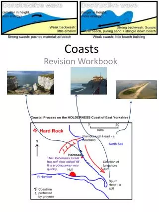
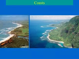
Oceanography An Invitation to Marine Science, 7th Tom Garrison. Chapter 12 Coasts. Chapter 12 Study Plan. Coasts Are Shaped by Marine and Terrestrial Processes Erosional Processes Dominate Some Coasts Beaches Dominate Depositional Coasts

E N D
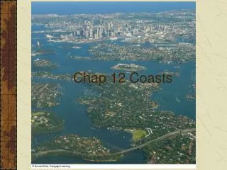
Oceanography An Invitation to Marine Science, 7th Tom Garrison Chapter 12 Coasts
Chapter 12 Study Plan • Coasts Are Shaped by Marine and Terrestrial Processes • Erosional Processes Dominate Some Coasts • Beaches Dominate Depositional Coasts • Larger-Scale Features Accumulate on Depositional Coasts • Biological Activity Forms and Modifies Coasts • Fresh Water Meets the Ocean in Estuaries • The Characteristics of U.S. Coasts • Humans Interfere in Coastal Processes
Chapter 12 Main Concepts • The location of a coast depends primarily on global tectonic activity and the ocean’s water volume. • The shape of a coast is a product of many processes: uplift and subsidence, the wearing-down of land by erosion, and the redistribution of material by sediment transport and deposition. • Coasts are classified as erosional coasts (on which erosion dominates) or depositional coasts (on which deposition dominates). • Beaches change shape and volume as a function of wave energy and the balance of sediment input and removal. • Human interference with coastal processes has generally accelerated the erosion of coasts near inhabited areas.
Coasts Are Shaped by Marine and Terrestrial Processes Sea levels past and future. (a) Sea level rose rapidly at the end of the last ice age as glaciers and ice caps melted and water returned to the ocean. The rate of rise has slowed over the past 4,000 years and is now believed to be between 1.0 and 2.4 millimeters per year. (b) Projections of sea level through the year 2100. Seven research groups (represented here by colored lines) have estimated future sea level based on historical observations and climate models. Even the most conservative of these predictions estimates a 20-centimeter (8-inch) rise.
(top-left) The southeastern coast of the U.S. looked much different 18,000 years ago, during the last ice age. Because of lower sea level, the position of the gently sloping coast has been as much as 200 km (125 miles) seaward from the present shoreline, leaving much of the continental shelf exposed. (bottom-left) In the distant future, if the ocean were to expand and the polar ice caps were to melt because of global warming, sea level could rise perhaps 60 meters (200 feet), driving the coast inland as much as 250 kilometers (160 miles) Coasts Are Shaped by Marine and Terrestrial Processes
Features of an erosional coast at low tide. Wave erosion of a sea cliff produces a shelf-like wave-cut platform visible at low tide. Erosional Coasts Often Have Complex Features
Shorelines Can Be Straightened by Selective Erosion Wave energy converges on headlands and diverges in the adjoining bays. The accumulation of sediment derived from the headland in the tranquil bays eventually smoothes the contours of the shore. • Marine erosion is usually most rapid on high-energy coasts, areas frequently battered by large waves. • Low-energy coasts are only infrequently attacked by large waves.
Beaches Often Have a Distinct Profile A beach is a zone of loose particles that covers a shore. What are the features of a beach? • Berm • Berm crest • Backshore • Foreshore • Beach scarp • Longshore trough • Longshore bars
Waves Transport Sediment on Beaches A longshore current moves sediment along the shoreline between the surf zone and the upper limit of wave action.
Sand Input and Outflow Are Balanced in Coastal Cells Coastal sediment transport cells. (a) The general features of coastal cells. Sand is introduced by rivers, transported southward by the longshore drift, and trapped within the nearshore heads of submarine canyons. (B) Example of a sand budget. If sediment gains and losses are approximately equal, the nearshore system is in equilibrium. If losses exceed gains, as shown here, the beaches within the cell will shrink and possibly disappear. Sections of coast in which sand input and sand output are balanced are referred to as coastal cells.
Large-Scale Features Accumulate on Depositional Coasts (above) A composite diagram of the large-scale features of an imaginary depositional coast. Not all these features would be found in such close proximity on a real coast. • A sand spit forms where the longshore current slows as it clears a headland and approaches a quiet bay. • A bay mouth bar forms when a sand spit closes off a bay by attaching to a headland adjacent to the bay. • Depositional coasts can also develop narrow, exposed sandbars that are parallel to but separated from land - known as barrier islands. • A long, shallow body of seawater isolated from the ocean is known as a lagoon.
Coasts Are Formed And Modified By Biological Activity The development of an atoll. (a) A fringing reef forms around an island in the tropics. (b) The island sinks as the oceanic plate on which it rides moves away from a spreading center. In this case, the island does not sink at a rate faster than coral organisms can build upward forming a barrier reef. (c) The island eventually disappears beneath the surface, but the coral remains at the surface as an atoll.
Estuaries Are Classified by Their Origins An estuary is a body of water in which fresh river water mixes with ocean water. Estuaries can be classified by their origin: • Drowned river mouths • Fjords • Bar-built • Tectonic (a) Drowned river mouths: the mouths of the James, York, and Susquehanna rivers; Chesapeake Bay; Sydney Harbour, Australia. (b) Fjords: New Zealand’s Milford South; the Strait of Juan de Fuca in Washington state. (c) Bar-built: Albernarle and Pamlico sounds in North Carolina (d) Tectonic: San Francisco Bay; Tomales Bay
Estuary Characteristics Are Influenced by Water Density and Flow Types of estuaries in vertical cross sections. The salinity values show the amount of mixing between fresh water and seawater in the various types. (a) Salt wedge estuary. (b) Well-mixed estuary. (c) Partially mixed estuary. (d) Fjord estuary.
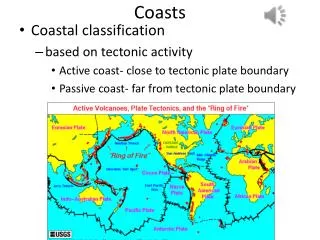
The Characteristics of U.S. Coasts • The Pacific Coast - An actively rising margin where indications of recent tectonic activity can be observed. • The Atlantic Coast - A passive margin on the trailing position of the North American plate. • The Gulf Coast - Smaller wave size and a smaller tidal range characterize the Gulf Coast.
Humans Have Interfered in Coastal Processes What are some ways that humans try to influence coastal processes? • Groins • Seawalls • Importing sand (left) A few of the many types of measures taken to slow and prevent beach erosion. In many cases these methods help serve as a reminder that shorelines and beaches are constantly changing, and are not under human control.
(a) Groin Groins are structures that extend from the beach into the water. They help counter erosion by trapping sand from the current. Groins accumulate sand on their updrift side, but erosion is worse on the downdrift side, which is deprived of sand. Current (b) Seawall Seawalls protect property temporarily, but they also increase beach erosion by deflecting wave energy onto the sand in front of and beside them. High waves can wash over seawalls and destroy them and property. (c) Importing sand Importing sand to a beach is considered the best response to erosion. The new sand often is dredged from offshore, can cost tens of millions of dollars, and can disturb aquatic biodiversity. Because it is often finer than beach sand, dredged sand erodes more quickly. Stepped Art Fig. 12-35, p. 341
Humans Have Interfered in Coastal Processes A map showing shore erosion by region. One example of shore erosion is the lighthouse on Cape Hatteras, which was moved during 1998 and 1999 to protect it from destruction. It was threatened by rising sea levels and a changing shoreline.
Chapter 12 in Perspective In this chapter you learned that the location of a coast depends primarily on global tectonic activity and the ocean’s water volume, while the shape of a coast is a product of many processes: uplift and subsidence, the wearing-down of land by erosion, and the redistribution of material by sediment transport and deposition. Coasts are classified as erosional coasts (on which erosion dominates) or depositional coasts (on which deposition dominates). Natural rock bridges, tall stacks, and sea caves are found on erosional coasts. Depositional coasts often support beaches, accumulations of loose particles. Generally, the finer the particles on the beach, the flatter its slope. Beaches change shape and volume as a function of wave energy and the balance of sediment input and removal. Coral reefs and estuaries are among the most complex and biologically productive coasts. Human interference with coastal processes has generally accelerated the erosion of coasts near inhabited areas. In the next chapter you will learn that the study of oceanography includes a marvelous variety of living things. The next chapter’s discussion of the general nature and characteristics of marine life will launch us into the biological part of our journey.