Download
1 / 8
80 likes | 262 Views
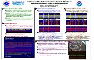
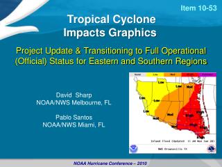
The Proposed NHC/WFO Collaborative Watch/Warning Process - Ad Hoc Group Recommendations Toward Establishing Pathfinder Options. Pablo Santos, Shannon White, David Sharp, Jamie Rhome, Andy Devanas. Background.

E N D
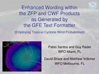
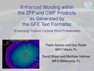
The Proposed NHC/WFO Collaborative Watch/Warning Process - Ad Hoc Group Recommendations Toward Establishing Pathfinder Options Pablo Santos, Shannon White, David Sharp, Jamie Rhome, Andy Devanas
Background 1.) VTEC was voted to be removed from the HLS during the 2008 NOAA Hurricane Conference. The following Ad Hoc Group recommendations are based on the presumption that this is still the common desire. This is also the supported position of this Ad Hoc Group. 2.) Addressing the proposal for a new tropical cyclone storm surge watch/warning product from the technical perspective (prototyping). To include new VTEC codes, or variations of existing codes. It is not within the adopted purview of this Ad Hoc Group to offer a value judgment whether or not storm surge watches/warnings should be provided, only to offer a technical (and prototype) pathway to how they it be provided.
Background 3.) Advancing the discussion toward the development of a NHC/WFO Collaborative Watch/Warning Process. Progress on this issue has not moved beyond the discussion phase. From the technical perspective, opportunity exists for exploring pathways for creative prototyping. In short, the following recommendations seek to act upon decisions that have already been made while opening the door for more meaningful community dialog in a manner consistent with the general principles put forth in the Proposed Tropical Cyclone Watch/Warning Collaboration and Storm Surge Warning Product Development Plan draft documents dated 22 July 2010 and 06 October 2010, respectively, as compiled by Tim Schott.
Background Vendors have long requested one ETN per storm rather than having different event codes and ETN for coastal, inland, and marine segments. A placeholder for baselining the latest HLS is in OB9.3, which has a national deployment of March 15, 2011. This means we have a venue to implement the short range proposal that follows.
Proposed Changes for 2011 • Make HU and TR hazards the only ones used, regardless of zone. That is, get rid of TI and HI. Procedurally, nothing changes on NHC side. • Have all zones carry the same ETN, which is driven by the ALxx2011 storm number given in the TCP • So, ETN for first storm of the season will be 1001 for all offices in all zones • This would benefit even issuance of marine watches and warnings that are not preceded by a coastal watch or warning. • HLS segmentation will still be partly determined by VTEC, but the permutations are greatly reduced, thus allowing greater flexibility • Same caveats for choosing breakouts will apply as in previous 2 seasons due to wind and surge wording logic. • NWR tone alerting is streamlined from reduction in segments/hazards • Also, tone alerting of watches would be at office discretion, instead of mandatory per 10-1710 update, further reducing tones
Longer Term ProposalsBuilding on Short Range Changes Remove VTEC from the HLS All WFOs would issue a CWA-specific TCV (TCVxxx) which contains the VTEC for their CWA/MAoR Investigate a means to create a national (master) TCV that would be the composite of all of the TCVxxx's from each office Possibly created from the NDFD. NHC GFE not large enough to accommodate this. Updated hourly (at least) This scheme can accommodate a new storm surge watch/warning rather easily. But we still need to address the extra tropical cyclone surge hazard. Consider current CFW product with its unique Event Code. Using the same Event code with two different products not currently allowed but may be possible with the future Integrated Hazard Tool.
Longer Term ProposalsAlternatively, a variation from the previous slide Develop software at NHC/CPHC to draw polygon that would represent an area under a TR.W/A or HU.W/A. Preliminary TCV (TCP) would follow for collaboration purposes with WFOs. Workload constraints need to be considered. When TCP is received, proposed areas under watch/warning at WFO are plotted. The WFO refines those in collaboration with NHC and publishes the final grids to the NDFD. TCVXXX from WFOs follow. A centrally produced product that either uses the NDFD or the TCVXXX is finally issued with all VTEC codes in it and updated hourly as offices and NHC change the status of their watches and warnings.
WHO DOES ALL OF THIS: A TECHINICAL GROUP WITH PROTOTYPING LIKE MINDED PEOPLE WITH FOLKS FROM NHC, WFO, REGIONS, DEVELOPERS, AND CPHC. THIS GROUP WOULD WORK IN TANDEM WITH SS AND WATCH WARNING COLLABORATION TEAMS.Questions?


![[PDF DOWNLOAD] Grow Up, David! David Shannon](https://cdn5.slideserve.com/10147493/download-and-read-online-dwonload-ebook-pdf-ebook-dt.jpg)

![[DOWNLOAD]⚡️PDF✔️ It's Christmas, David! (David Books [Shannon])](https://cdn7.slideserve.com/13183778/it-s-christmas-david-david-books-shannon-dt.jpg)