Download
1 / 16
160 likes | 180 Views
Explore the current and future needs of the Terrestrial Ecology, Biodiversity, and Applied Sciences communities for suborbital observations. Discuss the evolution of NASA's Suborbital Science program, UAV technology, partnerships with small businesses, and unique measurements possible with aircraft missions.

E N D
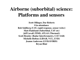
Airborne (suborbital) science: Platforms and sensors Scott Ollinger, Dar Roberts 8 in attendance Rob Sohlberg (UAV, rapid response, sensor webs)) Matt Fladeland (Suborbital, UAV etc) Jeff Luvall (TIMS, ATLAS (Thermal)) Scott Hensley (Radar Interferometry, UAV SAR) Michelle Hofton (LIDAR, VCL, LVIS) Jeanne Anderson (LVIS/AVIRIS) Bryan Blair
Discussion Questions • What are the Terrestrial Ecology, Biodiversity, and Applied Sciences Community’s current and future needs for suborbital observations? • Recognizing that the NASA Suborbital Science program is evolving and that repeated attempts to secure new funds for new airborne sensors have failed, how should our community respond/adjust/adapt? • What are the TE, Biodiv, and ASP needs for unpiloted aerial vehicles (UAVs)? How should we take advantage of current investments in UAV technology?
Additional Questions • What is the mechanism for downsizing sensors to fit on a UAV? • What other non-NASA programs exist that have a current or future need for aircraft remote sensing? • How could NASA or the user community go about making the link between these agencies? • What is the potential for partnerships with small businesses? • What unique measurements can be made that do not compete with private assets? • To what extent are aircraft missions useful beyond their service as a test bed for planned spaceborne missions? • How will the suborbital program be impacted by and react to the decadal survey? • Is there an optimal suborbital platform?
Discussion Questions • What are the Terrestrial Ecology, Biodiversity, and Applied Sciences Community’s current and future needs for suborbital observations? • Alternative question: How does the suborbital platform program contribute to TE, Biodiv and ASP?
What might an Ecologist want to know? • What is there (PFT, Species)? • TE, Biodiversity, invasions, phytoplankton/algae • How much is there (plant cover)? • TE, Biodiversity and invasions • What is its physiological status? • Vegetation health, chemistry, carbon exchange, LUE, NPP, etc. • What is its structure, biophysical properties? • Height, biomass, LAI, roughness, albedo, subcanopy • How is it changing? • Land-cover change, forest degradation, aforestation, invasion • How do these properties vary with spatial, spectral and temporal scale? • What are the geological/soil properties? • What are the atmospheric properties? • What is its temperature and emissivity? • For water, what is its depth, sediment concentration, current, waveheight
Ecological Contributions of Airborne Platforms (Part I) • Fine to moderate spatial resolution • For some applications, resolutions ~ 3 m or less are needed • Fine spectral resolution (AVIRIS) • Improves PFT or species discrimination, provides a suite of physiologically meaningful measures, improves biophysical retrievals, water vapor and trace gases, chemical diversity (biodiversity) • Timing (critical) • Provides improved cloud avoidance, flexibility to support field campaigns, meet timing requirements (ie, coastal tides) • Provides non-sun synchronous acquisitions • Can explore variability in viewing vs solar geometry (scan angle, BRDF)\ • Trajectory control, relative overlap between flight lines etc. • Contributes timely data (ie, southern California fire storm). • Sohlberg, needed timely, postfire imagery to assess burn severity and potential post-fire recovery needed for rehabilitation • Hazards (earthquakes, floods, fires) – need timely, immediate data acquisition following disturbance • Persistence (dwelling over one spot for an extended period of time (fire monitoring, evapotranspiration, carbon release)
Ecological Contributions of Airborne Platforms (Part II) • Unique sensors • Small footprint LIDAR, LVIS, FLIR, Fluorescence (FLEX), polarimetric (P band), no single pass interferometer, multispectral, high spatial resolution thermal (ATLAS, MASTER, Autonomous Modular Sensor (AMS)), eddy covariance • Advantages of P band, does not saturate up to 200 tons/ha • Data continuity at an appropriate spatial scale • Long term sampling (ie, long term resampling of a site with the same or similar sensors) • Multisensor integration • An imaging spectrometer can be used to simulate other instruments • Critical for scaling between ground and space • Synergistic use of sensors (combination of two or more sensors): Need good validation from an airborne program • Sensor Test bed • Provides a platform for testing out sensor concepts, technology components and measurement strategies • Provides a platform for testing software (on board processing) and sensor webs • Data Quality (can be improved between flight seasons) • Quality of calibration, ability to improve sensors over time • Many commercial sources do not provide science quality data (ie, vexcel) • Sensor evolution • Sensors can be improved over multiple flight seasons • Cost – Aircraft missions can be cost effective when satellite missions are not possible • Development cycle – Can be compressed significantly with an airborne system
Limitations and Advantages of Spaceborne Sensors for Ecology
Question 2: Part 1 • Recognizing that the NASA Suborbital Science program is evolving and that repeated attempts to secure new funds for new airborne sensors have failed, how should our community respond/adjust/adapt? • There should be consideration of other programs, such as NSF/NEON (Scott Ollinger) • NSF calls for sensor development (MREFC): NEON 400-500 million dollars • NSF 6 million central NEON office (call, 2 years ago, Bruce Hayden: NEON Inc). • 7 out of 8 groups considered aircraft remote sensing as a core set of requirements for a NEON network (Imaging Spectrometry and LIDAR). • Concern: Advice given in design consortium did not acknowledge potential contribution of NASA, no representatives from NASA (NEON project implementation committee). • Action Item: NEON constantly asking for feedback – where ever possible people should get the message across that a partnership between NASA and NEON would be highly beneficial • www.neoninc.org • Other programs • SBIR, Naval Postgraduate School, EPA, NOAA, DOE • Recommendation: What kinds of sensors could be developed through an SBIR • University/Institutional efforts • ie, Carnegie waveform small foot print LIDAR, Imaging Spectrometry • NCOM (University of Florida) • University sensors (ie, UNebraska CASI) • Sensor integration support (UC Santa Cruz: Airborne Science and Technology Laboratory: Jeff Myers contact)
Question 2: Part 2 • Recognizing that the NASA Suborbital Science program is evolving and that repeated attempts to secure new funds for new airborne sensors have failed, how should our community respond/adjust/adapt? • We should know how many non-NASA sensors (ie, University etc) exist? • We should have a table of existing sensors • Perhaps the Instrument Incubator Program could be used • NASA has invested considerable funds in UAV SAR – how might this approach/platform be adapted for use with a different sensor package or support a different science objective (ie, canopy height). • Outreach/education – why do management, congress, scientists etc. not perceive the value of the airborne program? • Data should be made more accessible to the user community • Mission reporting should be improved and access should be improved • Is there a document that outlines the unique contributions of a suborbital platform? • TARGET JOURNAL: BIOSCIENCES, FRONTIERS in ECOLOGY • NASA should be encouraged to have specific calls for suborbital science • Could NASA enhance existing system?
Question 3: Part IWeb sites: http://uav.wff.nasa.gov/http://suborbital.nasa.gov/platforms/platforms.html • What are the TE, Biodiv, and ASP needs for unpiloted aerial vehicles (UAVs)? How should we take advantage of current investments in UAV technology? • When is a UAV appropriate (the cost of UAVs is really high, so you need a good justification) • Justification: Tasks that are Dull, Dirty or Dangerous • Long duration, high altitude, autonomy (ie, guided by sensor input to tell it where the optimal flight lines are through a sensor web), too dangerous (fire, or very low altitude such as eddy covariance over tree tops) • What UAVs are available? (see http://uav.wff.nasa.gov/for a more complete list, that is still out of date) • http://nirops.fs.fed.us/UASdemo/ (see photogallery at bottom: ~ 20 lbs) • Ikhana (predator) • Aerosonde (leased from AAI) • Sierra (AMES) • Altair (Lease arrangement with General Atomics) • Proteus (normally piloted): leased from Scaled Composites • What does NASA have now? • Sierra (still under construction at NASA Ames) • Predator B (ikhana): Delivery in Fall 06 • Global Hawks (Dryden): 2008 sometime
Question 3: Part IIWeb sites: http://uav.wff.nasa.gov/http://suborbital.nasa.gov/platforms/platforms.html • What are the TE, Biodiv, and ASP needs for unpiloted aerial vehicles (UAVs)? How should we take advantage of current investments in UAV technology? • UAV Attributes • What is the cost? • Altair: Currently cost prohibitive (hugely expensive compared to manned assets) • Ikhana: Actual cost unknown, likely to be costly but when assessed by flight hour might match manned assets • Global Hawk: unkbnown costs • What are the flight attributes? (ie, speed, elevation, stability) • Altair: up to 36 hours continuous flight, altitude 52,000 feet, up to 1000 lbs (depends on sensor pod limitations) • What is the payload? • Altair 1000 lbs, same as Ikhana • Global Hawk: 3000 lbs • Can your sensor be adapted to work with a UAV? • NASA is currently heavily invested in UAVs. How might this capability be used? • UAVs are not the answer to all problems (Scott) • How much do you care about your sensor? • Which smaller UAVs exist • See http://uav.wff.nasa.gov • See http://nirops.fs.fed.us/UASdemo/ • Past workshops: see http://suborbital.nasa.gov/technology/partnership.html
Additional Questions • What is the mechanism for downsizing sensors to fit on a UAV? • What other non-NASA programs exist that have a current or future need for aircraft remote sensing? • How could NASA or the user community go about making the link between these agencies? • What is the potential for partnerships with small businesses? • What unique measurements can be made that do not compete with private assets? • To what extent are aircraft missions useful beyond their service as a test bed for planned spaceborne missions? • How will the suborbital program be impacted by and react to the decadal survey? • What are the mission concepts that could take advantage of the unique attributes of UAVs? • What are the flight restrictions for UAVs? • Need a COA (certificate of authorization) • Is there an optimal suborbital platform? • No
Additional Questions • What are the mission concepts that could take advantage of the unique attributes of UAVs? • Long duration flights either required for diurnal studies or long range acquisition (ie, southern Ocean) • CO2 sniffer for validation of OCO and towers (remote areas): Small package (NOAA, modified LICOR 7550: IRGA) • Night time fluxes • Coastal blooms (need for continuous measurements) • Forest fire emissions and dynamics (spread, intensity) • Fires, dwelling (time series), perimeters • Circumnavigation of ice sheets (antarctic) • Real-time data acquisition at fine spatial resolution • UAV often has a high band width satellite link that can be taken advantage of. This is also more cost effective than a satellite for onboard processing • How much might we gain from this type of real-time potential? • Example, plant fluorescence • Potential of continental scale mapping made possible by long duration capabilities of UAV using an active sensor (ie, LIDAR power various with square of distance, so this translates to a lower power need for a laser) • Ideal platform for testing out microsat constellation
Action Items • Journal Article on Ecological Advantages of airborne platforms? • Target Bioscience, Frontiers in Ecology, Remote Sensing of Environment • Participants • Jeff Luvall (thermal), Matt Fladeland (UAV, past flight requests, historical program), Scott Ollinger (imaging spectrometry), Dar Roberts (imaging spectrometry), Michelle Hofton (LIDAR) • Map of US showing where aircraft sensors have been flown, existing archives
Key bullets: Day 1 • We identified a number of benefits of aircraft remote sensing that cannot be replaced by satellites • Summarize this list (or for example) • Outreach • Knowledge of benefits of suborbital science program is poor in important components of the scientific community • We need a paper that summarizes the ecological strengths of an airborne program • Working with non-NASA programs that have needs for aircraft remote sensing (NEON) or taking advantage of existing non-NASA, public resource • UAVs • To date there is no evidence that they are likely to be an effective replacement of current aircraft, but could enhance or complement these programs (cost prohibitive) • There are unique ecological questions that probably can only be addressed using an UAV (long duration requirements, dangerous acquisitions) • Excellent UAV information exists