Download
1 / 34
340 likes | 492 Views
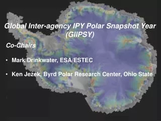
Global Inter-agency IPY Polar Snapshot Year (GIIPSY). Co-Chairs Mark Drinkwater, ESA/ESTEC Ken Jezek, Byrd Polar Research Center, Ohio State Presented by Pablo Clemente-Colón, NIC, at the 8 th IICWG Meeting, 24 October 2007,Frascati, Italy. Global Inter-agency IPY Polar Snapshot Year

E N D
Global Inter-agency IPY Polar Snapshot Year (GIIPSY) Co-Chairs • Mark Drinkwater, ESA/ESTEC • Ken Jezek, Byrd Polar Research Center, Ohio State Presented by Pablo Clemente-Colón, NIC, at the 8th IICWG Meeting, 24 October 2007,Frascati, Italy
Global Inter-agency IPY Polar Snapshot Year (GIIPSY) GIIPSY aims to facilitate: • Use of current and soon to be launched earth observing satellites to develop broad spectral, medium and high resolution snapshots of the polar regions. • Use of the snapshots as gauges for assessing the impacts of past and future high latitude environmental changes. • Establishment of technical and programmatic infrastructure for sustaining international observations beyond IPY.
Implementing GIIPSY through the IPY SPACE TASK GROUP (STG) • STG SUMMARY: • First meeting of STG 1 took place in WMO Headquarters from 17-19 Jan, 2007 • Participation of the following Space Agencies: • CMA, CNES, CSA, DLR, ESA, Eumetsat, NASA, Roshydromet, • Additional representation from WCRP-CliC, GIIPSY, IPY-Joint Committee
Key Outcomes from STG 1 • STG made substantive progress on developing the concept of an effective space component of the observing system for the polar regions during IPY. This would deliver a series of “firsts”, including: • For the first time, pole to coast multi-frequency InSAR measurements of ice-sheet surface velocity. • For the first time, repeat fine-resolution SAR mapping of the entire Southern Ocean sea-ice cover for sea ice motion. • For the first time, one complete high resolution visible and thermal IR (Vis/IR) snapshot of circumpolar permafrost. • For the first time, pan-Arctic high and moderate resolution Vis/IR snapshots of freshwater (lake and river) freeze-up and break-up. • The Space Agencies introduced the concept of IPY data portfolios as an organizing principle. Each Agency will determine what data will be made available to IPY scientists as part of its portfolio. The intention is to provide open and easy access to these portfolios for scientific use. The content of the portfolios will evolve through the STG coordination of planning, acquisition, downlink and processing during IPY and beyond, as a legacy.
Key Objectives for STG-2 • In view of the high importance and priority of achieving the scientific “firsts” it is highly desirable if interested groups continue to urge Space Agencies to do their utmost in developing and adopting a coordinated approach for the implementation to these activities for the remaining period of IPY. • One of the key issues is how to secure the legacy of a long-term observing system. This legacy shall include high-level products resulting from the science of IPY, e.g. high spatial resolution digital terrain maps of the polar regions. One approach that may be considered for long term security of the IPY legacy is to establish a link to GEO.
STG Successes • CSA Arctic Science Archive Processing Project (ASAP) • CSA Modified Antarctic Mapping Mission (MiniMAMM) • DLR TerraSAR-X Support of IPY • ESA AO • ESA Data Portal and Metadata Tagging for IPY • Dedicated IPY Acquisition Planning
ESA Planned ASAR Image ModeSwath 2 HH-pol October 16
CSA Modified Antarctic Mapping Mission (MiniMAMM) November 2007
CSAArctic Science Archive Processing Project (ASAP) • National consultation (Nov-06) • Three phases under which more than 7 500 Radarsat-1 archive data will be processed: Phase 1 (50%): Blanket coverage in Fine 1 of the Canadian polar region and the Arctic Archipelago (2000-2001) Phase 2 (25%): Seasonal polar snapshots between 2003 and now Phase 3 (25%): Processing of images under specific areas of interests identified and agreed upon as supersites by the research communities • Web Portal for images and products dissemination
CSA ASAP CoveragesFrozen Baseline – F1 Phase 1 - Baseline Fine Mode. Northern Canadian complete coverage (3098 scenes)
CSA ASAP CoveragesMin and Max Sea Ice Extent Phase 2 - - Arctic Basin ScanSAR Sea-Ice Snapshots (364 scenes)
1. Coastal Beaufort, Mackenzie Delta 2. Churchill, Hudson Bay west 3. Ellesmere, Kane Basin 4. Devon, Ellesmere south 5. Nouveau Quebec, Hudson Bay east 6. Baffin south 7. Torngats, Labrador coastal north 8. Great Slave 9. Great Bear 10. NWT 11. Mackenzie Delta fine 12. Axel Heidberg 12 3 4 11 1 9 10 6 8 7 2 5 CSA ASAP Canadian Supersites
CSA ASAP Coverages forCanadian Supersites Phase 3 - Arctic Super-sites (4038 scenes)
Partnerships for IPY Data Access • CSA/NASA/UAF • Working together to make RADARSAT-1 data available as specific legacy data sets • The project is well underway • JAXA/NOAA/NASA/UAF/ESA • Working with JAXA and the European counterpart to AADN to make ALOS data available in the IPY context • The project is defined, but not implemented • ADN meeting next week
IPY RADARSAT-1 Legacy Datasets “The Goal for the IPY Legacy datasets is to present RADARSAT-1 data to a new generation of researchers interested in studying Polar regions.”
2007 Arctic Sea Ice Extent Record Minimum Captured by CSA RADARSAT-1 The Alaska Satellite Facility (ASF) downlinks and mosaics Canadian Space Agency (CSA) RADARSAT-1 images of the western Arctic Ocean every three days. These synthetic aperture radar (SAR) images are acquired both day and night regardless of weather conditions. The data are used for research and operational monitoring of changes in sea ice cover. The animation to the right shows changing sea ice conditions from mid-July to mid-September and documents the evolution of a record minimum extent in 2007. The transparent blue mask indicates the sea ice edge as determined by analysts at the National Ice Center (NIC).
2007 Arctic Sea Ice Extent Record Minimum Captured by NIC Charts The National Ice Center produces weekly and bi-weekly Arctic charts that also captured the evolution of the 2007 sea ice extent record minimum.. The animation of bi-weekly NIC charts to the right shows changing sea ice conditions from March 12 to September 24 2007.
Old CSA ASAP Phase 2? Circumpolar ScanSAR Seasonal Coverage Spring 2004 March 2007 September 2007 Winter 2004
How do you get these data? • End User License Agreement (EULA) – user must agree to terms and conditions. • Registration required – data will be password protected. Once users complete the EULA and registration, access to IPY data will be granted by USO. – users will log in through the URSA home page to get to the IPY data.
Coverage areas • Greenland – Sept. 2000 – Jan. 2001 • Antarctica – Sept. – Oct. 1997 • Kamchatka – Dec. 1999 – Jan. 2000 • Sea Ice – Sept. – Mar. 2003 - 2006 • Toolik Station - Oct. 2004 – Dec. 2006 • Other suggested sites?
GIIPSY Continuing Challenges • Increasing the number of Space Agencies participating in the STG – we encourage global involvement (Italy, India, others?) • Securing commitments of key data sets such as L-band SAR and high resolution optical repeat observations of the arctic ice pack.
GIIPSY Information • Information on GIIPSY is available at: http://bprc.osu.edu/rsl/GIIPSY/ • The site includes minutes of the STG meeting and the two STG teleconferences.
GIIPSY Legacy Objectives • A. Sea level rise, and hemispheric climate (Glaciers, ice caps, ice sheets): 1) For the first time, one summer, one winter SAR snapshot of the polar ice sheets, glaciers and ice caps. Near simultaneous imagery at L, C, and X band, polarimetric quad pole for documenting ice surface physical parameters. 2) For the first time, pole-to-coast multi-frequency InSAR measurements of ice surface velocity.3) For the first time, repeated X-band InSAR topography for detecting local changes in ice sheet elevation associated with motion of subglacial water. 4) For the first time, one summer, one winter, high resolution visible/near IR/ TIR snapshot of the entirety of the polar ice sheets, glaciers and small ice caps followed with bimonthly coverage of select glaciers for snow-zone mapping 5) Continued measurements of ice surface elevation from radar and laser altimeters (spaceborne and airborne) for volume change 6) Continued, daily visible and infrared medium-resolution imaging of the entirety of the polar ice sheets, glaciers and ice caps and to be compiled into monthly maps. 7) Continued, daily medium-to-coarse resolution active and passive microwave images of the polar ice sheets, ice fields and ice caps for melt extent 8) Continued measurements of the gravity field for mass balance.
IPY Legacy Objectives • B. Ocean circulation and polar air-sea interactions (Sea ice): 1) For the first time, L-band SAR mapping of the Arctic ocean and marginal seas sea ice cover for leads and ridges. 2) For the first time, repeat fine resolution SAR mapping of the entire Southern ocean sea ice cover for ice motion 3) For the first time, SAR and optical fine resolution mappings of the entire Arctic ocean 4) Continued 3-day medium resolution SAR mapping of sea ice covered waters for motion, and melt pond coverage 5) Continued passive microwave observations of sea ice concentration and extent 6) Continued laser and radar altimeter measurements of ice thickness and sea surface topography 7) Measurements of IPY Polar Geoid • C. Regional climate, precipitation and hydrology (Terrestrial snow cover): 1) Daily medium resolution visible/near IR/TIR observations of all snow covered terrain 2) Daily passive microwave observations of snow covered terrain for determination of snow water equivalent
IPY Legacy Objectives E. Aquatic ecosystems, transportation and hazards (Lake and river ice) 1) For the first time, pan-arctic high and medium resolution microwave snapshots of fresh water- break/freeze-up 2) For the first time, pan-arctic high and medium resolution visible, near IR and TIR snapshots of fresh water- break/freeze-up 3) Seasonal, low-frequency (6-10 GHz) passive microwave observations of lake ice thickness D. Changing permafrost and Arctic climate (Permafrost)1) For the first time, one complete high resolution snapshot of all polar permafrost terrain at L, C and X band. 2) For the first time, one complete, high resolution visible and thermal IR snapshot of all polar permafrost terrain 3) Continued medium and coarse active and passive microwave observations of all polar permafrost