Download
1 / 25
250 likes | 309 Views
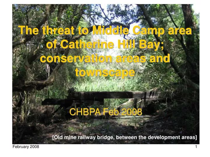
The threat to Middle Camp area of Catherine Hill Bay; conservation areas and townscape. CHBPA Feb 2008. [Old mine railway bridge, between the development areas]. The reality of C&A’s Plan.

E N D
The threat to Middle Camp area of Catherine Hill Bay; conservation areas and townscape CHBPA Feb 2008 [Old mine railway bridge, between the development areas]
The reality of C&A’s Plan • “The company is pleased to be able to contribute to the establishment and realisation of the long sought after conservation corridor...the Wallarah Peninsula.” (Concept Plan 1.2 Project Objectives, p.8) • IN FACT, the company intends to use Part 3A to take its land which is mostly already zoned for conservation and is part of a national park, and cut it north-south and east-west with new housing; six times the number of houses that are in the adjacent heritage mining village.
Where this will happen Tall regrowth on land of the old E-pit area: C&A’s Area B
C&A’s Area C behind the village; the first bush to go under housing
...and at night? The plan omits the ecological and visual impacts of the new housing’s night lights
C&A’s Area C; where the heritage festival backdrop would change
C&A’s Area C; where the heritage festival backdrop would change
Ecological assessment (EA) • The EA repeats many times that the offsets are more than ‘ traditional’ offsets, and that they preserve the Wallarah Peninsula conservation areas. • However it never values the offsets, nor considers the change in shape of the national park as a threat. • The Area B development will change the shape of the park and cut the corridor by more than half, from about 900m wide to under 300m wide and maybe less.
The language of the EA distracts from the real story The EA has repeated key phrases as if they were established fact, when they are mere assertions; eg in pages 5-104, more than 50 times the phrase “[existing flora/fauna] will be retained/conserved /protected/ reserved/ secured in the conservation lands” is used, as if that protection is a given, which ignores issues that mean protection cannot be guaranteed.
Contiguity of Wallarah National Park/Munmorah SRA as it is now Pacific Highway Pacific Highway Park Park Park Park Coastline Flowers Dve Flowers Dve Park Park Park
Park Park Park Contiguity of Wallarah NP/Munmorah SRA as it is now; roads and corridor Pacific Highway About 900m Flowers Dve
Reduction in contiguity of Wallarah National Park by this development Pacific Highway Park Park [Nords Wharf Plan] Flowers Dve Park Park
Roads also impact on contiguity of Wallarah NP/Munmorah SRA Pacific Highway Park Park Flowers Dve Park
The road effects on the remaining corridor are not quantified in the EA • “It is important to consider the contribution of roads to the increasing fragmentation of habitats, particularly for species that may react negatively to roads as physical, behavioural or sociological barriers. The associated possibility of genetic isolation of animal populations is also important.” (Ecological Effects of Roads, Parks Victoria 2004, p 25) • “The road effect zone is defined by the distance to which each different ecological road impact extends outward (Forman 1999). These distances differ for each impact, ranging from a few metres to over a kilometre... the road” • The road effects zone averages 600 m in width (Ecological Effects of Roads, Parks Victoria 2004, p 47.
Other impact zones • Additional to the road effect is the impact of humans, weeds and pets on the corridor (see below) • C&As concept plan does not address this possible complete closing-off of the Wallarah NP corridor by its development. • Repeated assertion: eg EA Part 5.2.1 page 88 “As the majority of the habitat will be conserved it is considered unlikely that any impact will be significant.” which completely obscures the issue of the geometric shape of the habitats, and the road and development impact haloes.
Impact of pets and feral animals is not addressed in EA • Pets are recognised as a serious problem in parks, eg NPWS Press release, 19/7/05: “The NPWS has invested considerable effort over the years into raising the conservation message regarding the inappropriateness of having dogs in national parks, however it is likely that some neighbours are unaware that their pets are roaming [into Ku-ring-gai Chase NP] at night.” • Dogs and cats pose a threat to the conservation areas which is not addressed in the EA even though feral cats are a Key Threatening Process and the number of pets from 300 dwellings will be considerable. (Laing, 2007, Submission against MP 06-0330). The OFFSET VALUE ascribed in the Plan to the conservation areas may be significantly destroyed within a few years.
EA omits impacts of Roads, residents, pets, weeds on shape and contiguity of conservation areas Pacific Highway Park Park About 200 m left Flowers Dve Park Park
So what about the offset values?? • Concept plan does not value the conservation lands as they are now, nor does it give estimates of the reduction in value due to the impact of its development. • This leaves the panel and minister in the dark about whether the offset lands will actually be of benefit to the state. The proposal is seriously deficient in this fundamental issue and should be rejected. • The area’s current conservation zonings guarantee benefit to the state and should be maintained.
Heritage aspects – a unique community, recognised in the concept plan as already protected by controls Ribbon development
Heritage aspects – a unique community, recognised in the concept plan as already protected by heritage controls Historically significant ribbon development
Heritage aspects – a unique whole community, swamped by new housing under this plan Heritage ribbon village squashed by overdevelopment
Heritage Impact Assessment • Lake Macquarie LEP, Hunter REP and National Trust heritage listing for village and specifics, but blandly dismissed in the HIA with “heritage values will be respected and conserved” • National Trust is quoted: “A company town ...valuable as ...strong townscape character ... should respect this and historic evidence it presents...” (p53, Heritage IA) • The HIA simply says the view catchment of the Conservation Area needs to be carefully considered, while it finds no issue in the completely overpowering development inconsistent with the company town ribbon layout so valuable as our heritage.
HIA makes bald assertions • HIA cumulative impacts statement (p108) acknowledges this development (and the Rose one to the south) will result in a change to the local area through an increase in the built areas. • Then it restricts itself to mainly considering the view impact , neglecting the complete transformation of a company town to a conglomeration of large blobs of new houses surrounding the original ribbon of miners’ houses and heritage items noted in the report, particularly the E pit area. • Baldly asserts with no reference to evidence that this will be largely offset by the (unspecified) positive heritage outcomes.
The DG’s requirements have not been met. Reject the plan! • In the EA significant issues of impact on adjacent parks and of the true offset values have not been addressed • In the HIA significant aspects of overall impact on the village have not been addressed • These are sufficient to reject this plan. [Wetlands below the development]