OCEANIA
210 likes | 373 Views
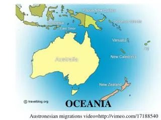
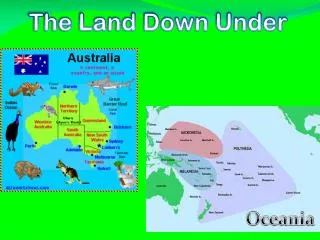
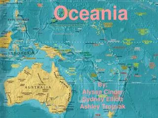
OCEANIA. Physical notes. Australia. smaller than the U.S. Smallest continent Only continent with one country. Great Dividing Range. Eastern Coast MTN Range E HIGHLANDS (less than 5k feet) Central Lowlands West= pasture land. Outback. Covers 2/3 of the land

OCEANIA
E N D
Presentation Transcript
OCEANIA Physical notes
smaller than the U.S. • Smallest continent • Only continent with one country
Great Dividing Range • Eastern Coast MTN Range • E HIGHLANDS (less than 5k feet) • Central Lowlands • West=pasture land.
Outback • Covers 2/3 of the land • Mostly waste land with some nomadic herding
Great Barrier Reef • NE coast of Australia • Coral reef = large MARINE habitat.
General info. A clip • +++ rainfall along EASTERN COAST • Vegetation • Rainforest – Northern coastline • Woodlands/Forests SE coast (wattles) • Natural Resources • Only 10% of the land is arable • Wheat, cattle, sheep, minerals (iron ore, gold, silver, gems)
Create a triple Venn Diagram to compare/contrast the Outback, the Great Dividing Range, and the Great Barrier Reef. What are the similarities and differences?
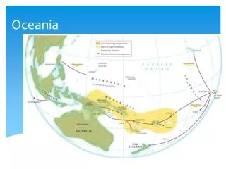
East of Australia, across Tasman Sea • Main Islands • North Island • Narrow, hilly – active volcanoes, geysers, hot springs • South Island • Longer, mountainous (Southern Alps)
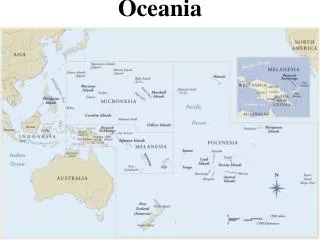
Melanesia • “Black Islands” • NE of Australia
Micronesia • “Small Islands” • South of Japanese Islands
Polynesia • “Many Islands” • Midway Island to New Zealand
3 types of Islands • 1. High Islands • Volcanic, Ring of Fire • 2. Low Islands • little soil, few resources • 3. Continental Islands • largest islands, rich mineral resources.
Climate • Tropical-Warm consistently • Typhoons • Counterclockwise/Pacific Ocean
“The Frozen Continent” • Only place on earth with no permanent settlement (city/town/village) • Dry • Avg. rainfall/year is 3”
UNDER THE ICE • CENTER • Transantarctic MTS (DIVIDE East & West) • EAST • PLATEAU/MTS/ VALLEYS • WEST • ISLANDS COVERED BY ICE
Average temp. - 70° (lowest temp. ever is - 128°F • Resources – minerals, sea resources (krill)