Download
1 / 12
120 likes | 254 Views
Database Issues. Barry Biediger Utah Automated Geographic Reference Center (AGRC) October 28, 2004. Overview. Some GIS basics How the database can be accessed Submitting data. What is GIS?. GIS = Geographic Information System.

E N D
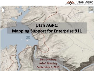
Database Issues Barry Biediger Utah Automated Geographic Reference Center (AGRC) October 28, 2004
Overview • Some GIS basics • How the database can be accessed • Submitting data
What is GIS? GIS = Geographic Information System • System for management, analysis, modeling, and visualization of geospatial data. • Integrates diverse data and models in a map-based context. facilities transport topography geology wells
What is AT or NEAR Location X? Location X GIS FacilitatesData Integration Wetlands Geology • Location can be used as the central organizing principle for data from multiple databases-Questions can be asked of the data in 2 ways:1)What is at location X?2)At what locations does somecondition exist? Utilities Streets Population Property Boundaries Pipelines Streams Counties Point Sources Slope or Aspect Aerial Imagery
How a GIS Database Works • Items in a traditional database are linked to a geographic representation of their real world location in the form of: • - points • - lines • - polygons • - grid cells Vector Data Raster Data
What is AT or NEAR Location X? Accessing the Database agrc.utah.gov servers Shapefiles/GDBs File based download Oracle/SDE Spatial Data Direct database connection with ArcGIS Tabular Data Oracle client, Access, Excel Internet Map Server
ArcIMS Prototype Site Some basic exploratory analysis tools are included on the ArcIMS site. • The user needs only a moderately fast internet connection. http://utstdp-ims.state.ut.us/website/co2wc
Connecting Directly to the SDE Database Those users with ArcGIS 9.0 can connect directly to the database and work with the data layers directly(read only) Contact Barry Biediger bbiediger@utah.gov for the connection parameters and details.
File Download If there is enough need, an ftp site can be set up where users can download the GIS data layers in Geodatabase or Shapefile formats. Alternatively, AGRC can send data layers to users as they request them.
Submitting data to the database • Any common GIS format can be submitted • Shapefiles • Geodatabases • Coverages • Any other format readable by ArcGIS • Flat files (e.g. Excel spreadsheets) with coordinates for point features.
Metadata (Data Describing Data) • Metadata is crucial for the credibility and understandability of the data. • At a minimum, these items need to be provided to AGRC when submitting data: • Description • Source • Scale • Definition of attributes • Projection information is absolutely necessary.
Questions, Comments • AGRC Contacts: Dennis Goreham, 801-538-3163 dgoreham@utah.gov Barry Biediger, 801-537-9078 bbiediger@utah.gov • AGRC website: • http://agrc.utah.gov