Hourly Updated NOAA NWP Models
440 likes | 600 Views
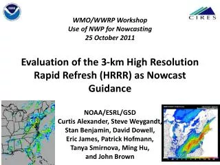
WMO/WWRP Workshop Use of NWP for Nowcasting 25 October 2011 Evaluation of the 3-km High Resolution Rapid Refresh (HRRR) as Nowcast Guidance NOAA /ESRL/ GSD Curtis Alexander, Steve Weygandt, Stan Benjamin, David Dowell, Eric James, Patrick Hofmann, Tanya Smirnova , Ming Hu, and John Brown.

Hourly Updated NOAA NWP Models
E N D
Presentation Transcript
WMO/WWRPWorkshopUse of NWP for Nowcasting25 October 2011Evaluation of the 3-km High Resolution Rapid Refresh (HRRR) as Nowcast GuidanceNOAA/ESRL/GSDCurtis Alexander, Steve Weygandt, Stan Benjamin, David Dowell, Eric James, Patrick Hofmann, Tanya Smirnova, Ming Hu, and John Brown
Hourly Updated NOAA NWP Models Rapid Refresh (RR) replaces RUC at NCEP in 2011 WRF, GSI with RUC features 13km Rapid Refresh (mesoscale) 13km RUC (mesoscale) 3km HRRR (storm-scale) RUC – current oper Model, new 18h fcst every hour High-Resolution Rapid Refresh Experimental 3km nest inside RR, new 15-h fcst every hour
Spring 2011 Hourly HRRR Initialization from RR 15-h fcst 15-h fcst Hourly HRRR Interp to 3 km grid Lateral Boundary Conditions Interp to 3 km grid 18-h fcst 18-h fcst Use 1-h old LBC to reduce latency Initial Condition Fields 18-h fcst Use most recent IC (post-DFI) to get latest radar info 1-hr fcst DDFI DDFI 1-hr fcst 1-hr fcst Back- ground Fields Analysis Fields Reduced Latency: ~2h for 2011 Hourly RR 3DVAR 3DVAR Obs Obs Time (UTC) 11 z 12 z 13 z
HRRR Milestones • Inception over northeastern US Sept 2007 • Integration into CoSPA: Aviation Users Spring 2008 • Domain expansion to eastern US Mar 2009 • HCPF time-lagged ensemble inception May 2009 • HRRR WRF-ARW updated to v3.1.1 Oct 2009 • Domain expansion to CONUS Oct 2009 • HRRR WRF-ARW updated to v3.2 Apr 2010 • Forecast period extended to 15 hrs Apr 2010 • Real-time multi-scale reflect. verification June 2010 • Parallel (shadow) retrospective system Sept 2010 • Attained ~95% reliability Jun 2010 • Reduced latency to ~2 hrs Dec 2010
HRRR (and RR) Future Milestones • Conversion of all output to GRIB2 format Apr 2011 • Transition from RUC to RR parent model Apr 2011 • DOE-funded HRRR FTP site for energy industry May 2011 • Update to WRF-ARW v3.3.1 Nov 2011 • Rapid Refresh operational at NCEP Dec 2011 • Reflectivity data assimilation at 3 km scale 2012 • Incorporate SatCast products at 3 km scale 2012 • Assimilate Radial Velocity at 3 km scale 2012 • HRRR demo @ESRL improves 2012-2014 • Ensemble Rapid Refresh (NARRE) at NCEP 2014 • HRRR operational at NCEP 2015? • Ensemble HRRR (HRRRE) at NCEP 2016?
Some HRRR users and applications Aviation Aviation Weather Center (AWC): 2-D grids Federal Aviation Administration (FAA) Command Center National Center for Atmospheric Research (NCAR): 2-D, 3-D, 15-min grids Operational evaluation in CoSPA Storm Prediction Center (SPC): 2-D grids Operational severe weather forecasting and evaluation National Severe Storms Laboratory (NSSL): 2-D, 3-D and 15-min grids Mesoscale analysis, Short-term precipitation forecasts National Centers for Environmental Prediction (NCEP): 15-min grids Real Time Mesoscale Analysis (RTMA) Bonneville Power Administration (BPA): 3-D grids Real-time forecasts of turbine-level wind and solar irradiance Colorado State University (CSU/CIRA): 2-D grids Verification of solar irradiance forecasts at SURFRAD sites Numerous private sector companies Air Resources Laboratory (ARL): Tiled 3-D HRRR grids Dispersion forecasts, Local wind forecasts in complex terrain National Weather Service (NWS): 2-D and 3-D grids Operational weather forecasting United States Air Force (USAF): 2-D grids Operational weather forecasting Severe Weather Renewable Energy Forecasting
ESRL/GSD NCEP Model Configurations RUC Dev RUC Backup RUC Oper RR Primary RR Dev2 RR EMC RR Dev HRRR Dev HRRR Primary CoSPA
Blending Radar Nowcasts and HRRR Forecasts for Aviation CoSPA: Collaborative effort: ESRL/GSD, NCAR/RAL, MIT/LL Provide 0-8 hr thunderstorm intensity and echo top guidance to aviation community HRRR 15 UTC 08 July 2011 6 hr forecast valid 21 UTC CoSPA 17 UTC 08 July 2011 4 hr forecast valid 21 UTC Observation Valid 21 UTC 08 July 2011 VIL Blend with CIWS Echo Top
Blending Radar Nowcasts and HRRR Forecasts for Aviation CoSPA: Collaborative effort: ESRL/GSD, NCAR/RAL, MIT/LL Provide 0-8 hr thunderstorm intensity and echo top guidance to aviation community HRRR 15 UTC 08 July 2011 6 hr forecast valid 21 UTC CoSPA 17 UTC 08 July 2011 4 hr forecast valid 21 UTC Verification Valid 21 UTC 08 July 2011 VIL Blend with CIWS CSI 0.20 Bias 1.30 Eastern US 30 dBZ threshold 40 km grid Echo Top
HRRR Verification < 500 ftceiling, 6-hr forecasts TSS (3 day averages) HRRR RR HRRR-RR HRRR RUC HRRR-RUC HRRR better RUC/RR better HRRR consistently beats the RUC (cold season) HRRR consistently beats the RR (warm season)
HRRR Verification < 0.5 mi visibility, 6-hr forecasts TSS (7 day averages) HRRR RUC HRRR-RUC HRRR RR HRRR-RR HRRR better RUC/RR better HRRR consistently beats the RUC (cold season) HRRR consistently beats the RR (warm season)
HRRR Verification 10 m wind, 6-hr forecasts RMS (3 day averages) HRRR RUC HRRR-RUC HRRR RR HRRR-RR RUC/RR better HRRR better HRRR consistently beats the RUC (cold season) HRRR nearly equal to RR (warm season)
HRRR Verification Upper-Air Wind, 6-hr forecasts RMS HRRR RR HRRR-RR HRRR RUC HRRR-RUC HRRR better RR better HRRR better RUC better HRRR and RUC nearly equal (cold season) RRconsistently beats the HRRR (warm season)
HRRR Verification Precipitation, 24-hr (2x12) forecasts 15 April – 25 October 2011 CSI 13 km BIAS 13 km HRRR RR RUC Optimal | | | | | | | | 0.01 0.10 0.25 0.50 1.00 1.50 2.00 3.00 in | | | | | | | | 0.01 0.10 0.25 0.50 1.00 1.50 2.00 3.00 in Threshold Threshold HRRR consistently beats the RR/RUC (warm season)
HRRR Verification Reflectivity, All Forecasts 25 dBZ CSI 40 km HRRR RR HRRR-RR HRRR RUC HRRR-RUC HRRR better RUC/RR better HRRR consistently beats the RUC At 4+ hrs (cold season) HRRR consistently beats the RR (warm season)
HRRR Verification Reflectivity, All Forecasts 35 dBZ CSI HRRR RR HRRR-RR HRRR RUC HRRR-RUC HRRR better RUC/RR better HRRR consistently beats the RUC (cold season) HRRR consistently beats the RR (warm season)
HRRR – wintertime forecast applications Excellent skill for low ceiling / visibility LIFR IFR MVFR |--------VFR-------------
HRRR – wintertime forecast applications Excellent skill for low ceiling / visibility MVFR MVFR LIFR LIFR VFR VFR IFR IFR LIFR IFR MVFR |--------VFR-------------
HRRR – wintertime forecast applications Very good skill for small-scale details in strongly forced convection and precipitation HRRR 8h fcst. NSSL reflectivity 08z Jan. 17, 2010
HRRR – wintertime forecast applications Good skill for small-scale terrain-related details 60 F 60 F Surface obs 08z Jan. 17, 2010
HRRR Reflectivity Verification Eastern US, Reflectivity > 25 dBZ 11-20 August 2011 BIAS 03 km CSI 40 km RUC->HRRR Radar RR->HRRR Radar RR->HRRR No Radar RUC->HRRR No Radar Optimal RR->HRRR Radar RR->HRRR No Radar RUC->HRRR Radar RUC->HRRR No Radar Reflectivity DA in RR/RUC increases HRRR forecast skill HRRR bias depends strongly on parent model
00z 12 August 2011 Obs 00 hr HRRR forecasts RR – Radar data RR – No radar data
Obs 01z 12 August 2011 Obs 01 hr HRRR forecasts RR – Radar data RR – No radar data
Reflectivity 00z 12 August 2011 00 hr forecasts RR – Radar data RR – No radar data Convergence Cross-Section
Reflectivity 01z 12 August 2011 01 hr forecasts RR – Radar data RR – No radar data Convergence Cross-Section
Many case All init times “neighborhood”verification of 6-h forecasts from 3-km HRRR verification:10 June – 26 Sept 2010 80-km 25 dBZ 6-h fcst 40-km 20-km 3-km valid (GMT) valid (EDT) 00 02 04 06 08 10 12 14 16 18 20 22 8p 10p 12 2a 4a 6a 8a 10a 12 2p 4p 6p
“neighborhood”verification of 6-h forecasts from 3-km HRRR verification:10 June – 26 Sept 2010 80-km 25 dBZ 6-h fcst Convective Initiation period 40-km Initiation 20-km 3-km valid (GMT) valid (EDT) 00 02 04 06 08 10 12 14 16 18 20 22 8p 10p 12 2a 4a 6a 8a 10a 12 2p 4p 6p
Convective Decay period “neighborhood”verification of 6-h forecasts from 3-km HRRR verification:10 June – 26 Sept 2010 80-km 25 dBZ 6-h fcst Convective Initiation period 40-km Initiation Decay 20-km 3-km valid (GMT) valid (EDT) 00 02 04 06 08 10 12 14 16 18 20 22 8p 10p 12 2a 4a 6a 8a 10a 12 2p 4p 6p
Convective Decay period “neighborhood”verification of 6-h forecasts from 3-km HRRR verification:10 June – 26 Sept 2010 80-km 25 dBZ 6-h fcst Convective Initiation period 40-km Initiation Decay Transition 20-km 3-km valid (GMT) valid (EDT) 00 02 04 06 08 10 12 14 16 18 20 22 8p 10p 12 2a 4a 6a 8a 10a 12 2p 4p 6p
Time-lagged ensemble Model Init Time Example: 15z + 2, 4, 6 hour HCPF 18z 17z 16z 15z 14z 13z 12z 11z Model runs used 13z+4 12z+5 11z+6 13z+6 12z+7 11z+8 13z+8 12z+9 11z+10 model has 2h latency HCPF 2 4 6 11z 12z 13z 14z 15z 16z 17z 18z 19z 20z 21z 22z 23z Forecast Valid Time (UTC)
Spatio-temporal scale of probabilities? Probability of convection at fixed point in space/time is very small even during summer afternoons in the southeastern US Horizontal Scale Time Window Probability > 40 dBZ O(1 km ) O(1 min) O(<< 1%) O(10 km) O(10 min) O(1 %) O(100 km) O(100 min) O(30%)
Spatio-temporal scale of probabilities? Observed convection near Atlanta, GA 22 UTC 26 October 2010 3 hr forecast valid 21 UTC 26 October 4 hr forecast valid 22 UTC 26 October Same model run at different valid times
Spatio-temporal scale of probabilities? Observed convection near Atlanta, GA 22 UTC 26 October 2010 3-4 hr forecast valid 21-22 UTC 4-5 hr forecast valid 22-23 UTC Use a 2 hr time window
Spatio-temporal scale of probabilities? Observed convection near Atlanta, GA 22 UTC 26 October 2010 3-4 hr forecast valid 21-22 UTC 4-5 hr forecast valid 22-23 UTC Then apply spatial filter: 90 km radius shown here
Reliability vs Resolution/Sharpness Logistic regression using various observation time windows for calibration Parameter choices: 3 members (2 hr lag youngest member) Fixed 2 hr time window Fixed 60 km spatial filter 1.0 m/s updraft velocity detection threshold P(convection) = [1 + exp(-z)]-1 z = B0 + B1x1 + B2x2 + B3x3 where Bi are the regressed weights and xi are the predictors (HRRR member forecasts) Obtain reliability while preserving resolution Probabilities constrained between 0 and 1
The HRRR and HCPF Confidence Probabilities and Deterministic Valid 23z 16 July 2010
The HRRR and HCPF Confidence Probabilities and Deterministic Valid 23z 16 July 2010
Tornado Outbreak KS/OK 10 May 2010 Updraft helicity from four consecutive HRRR runs 13-16 UTC (color coded by run) Tornado Reports Up to valid time (red dots) HRRR Severe Weather Forecasts
Tornado Outbreak KS/OK 10 May 2010 Updraft helicity probability Four consecutive HRRR runs (13-16 UTC) Time-bracket of 2-hrs 45 km search radius HRRR Severe Weather Forecasts
Summary • HRRR now initialized by the RR as of 14 April 2011 • Parallel (shadow) HRRR-dev will demo 2012 candidate changes in • real-time and/or retrospective runs: • - WRF v3.3.1 • - MYNN PBL scheme • - Shallow convective param • - Satcast product • - Soil moisture nudging • - 3-km radar radial • velocity assimilation • - 3-km radar reflectivity • assimilation • - Refined 13-km Radar-DFI • HCPF development • Research Regular HRRR • at NESSC as duplicate source } Targeting improved convective initiation forecasts } Targeting improved convective maintenance forecasts } Targeting confidence of convective forecasts } Targeting improved reliability of HRRR
HRRR Precipitation Forecast TONIGHT 13UTC 25 October 2011 Run 14 hrFcst Valid 03 UTC (9 p.m.) 15 hrFcst Valid 04 UTC (10 p.m.) Snow in Boulder Rain in Boulder How much? See Steve Weygandt’s Talk @ 3:30 p.m.
