Download
1 / 9
120 likes | 221 Views
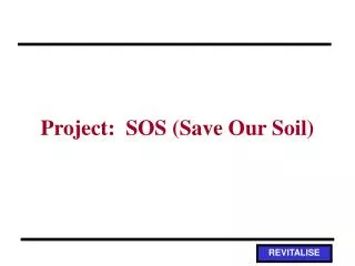
Project: SOS (Save Our Soil). Activity Overview. Guiding Question: When it rains, where does the water go? Where does the soil go? Procedure Use scientific visualization to assist in evaluating a plot of farmland Use results of visualization to communicate results to the farmer

E N D
Activity Overview • Guiding Question: • When it rains, where does the water go? Where does the soil go? • Procedure • Use scientific visualization to assist in evaluating a plot of farmland • Use results of visualization to communicate results to the farmer • Use results of visualization to communicate results to local homeowners association
Case Study Scenario • Farmer Mark's field is a small (10 acre) plot of land located in southwestern Durham County in North Carolina. Typically the field has been used for tobacco, but is currently being used for a variety of straight-to-market crops, such as corn, tomatoes, and pumpkins. The field is bordered by residential areas, most notably by a new elementary school directly to the south. There is considerable concern about stormwater runoff with the increase in construction directly surrounding the field.The goal of this project is to prepare a study for use in presentation to the local neighborhood association about the stormwater runoff issue, as well as to the local city and county government. The farmer is also concerned about loss of soil due to erosion, and would like some help in determining which crop(s) might best alleviate this problem.
Farmer Mark’s Field • Field to left of pond, a trapezoidal-shaped plot of land, surrounded by residential areas and elementary school
Prepare visualization • Collect field data • Visualize field data • Use field data results in stormwater runnoff/soil erosion model • Question: which crop(s) can best prevent stormwater runoff and soil loss? • Use results of model visualization to communicate results
Collect field data • Use topographic map with overlay to: • Determine parameters of the field • Determine approximate elevations (in feet) for each of the 50 points
Visualize field data • Enter data into spreadsheet (Excel) • Visualize data using 3D surface plot • Rotate surface plot to achieve best view • Calculate slope
Use WEPP model • Water Erosion Prediction Program • Use model to investigate stormwater runoff, soil erosion, and agricultural options