WRPLOT View & “Some” Wind Rose Uses
WRPLOT View & “Some” Wind Rose Uses. Glenn Gehring, Technology Specialist III Tribal Air Monitoring Support Center glenn.gehring@nau.edu 541-612-0899. http://www.weblakes.com/download/freeware.html. No Headers except LAKES FORMAT in cell A1. Save as tab delimited text file.


WRPLOT View & “Some” Wind Rose Uses
E N D
Presentation Transcript
WRPLOT View & “Some” Wind Rose Uses Glenn Gehring, Technology Specialist III Tribal Air Monitoring Support Center glenn.gehring@nau.edu 541-612-0899
No Headers except LAKES FORMAT in cell A1. Save as tab delimited text file Work your data so it only has the wind data from your desired concentrations in the correct format. Make a Lakes Format text file. Then import to WRPLOT View
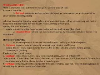
NOx Pollution Rose Wind data from approximately the highest 10% recorded NOx concentrations at the CTUIR monitoring project in Hermiston were imported into WRPLOT View generating this pollution rose. Of these highest 10%, concentrations ranged from 25 to 130 ppb with 14 hours at 100 ppb or higher and 146 hours at 50 ppb or higher. The mean was 40.3 ppb for these concentrations. Notice the southerly winds. What“stuff” is inthat direction that emits NOx? Note: winds don’t typically go in straight lines for long distances – they curve around pressure systems and surface features. Wind roses aren’t typically useful to identify transport sources, but are very useful to identify problem sources near the monitor.
Wal-Mart Distribution Center
There are vast open areas south of Hermiston, but there are also agricultural sources south of the airport. Note: Ammonia is used as a fertilizer and can impact NOx analyzers under certain circumstances. I looked at these data to see if the high concentrations centered around dates farmers typically fertilize. They didn’t. There are many methods used to help identify problem sources. Wind roses are only part of the whole process.
NCAR Meteorological Observations Database Slide source: Update on 8-Hour Ozone Early Action Compact Modeling for Oklahoma presentation, presented at: Oklahoma Ozone Modeling/SIP Protocol Meeting, October 2, 2003, by ENVIRON International Corporation (red circle is mine)
Daily Max 8-Hour Ozone August 16, 1999 Slide source: Update on 8-Hour Ozone Early ActionCompact Modeling for Oklahoma presentation, presented at: Oklahoma Ozone Modeling/SIP Protocol Meeting, October 2, 2003, by ENVIRON International Corporation (red circle is mine)
Daily Max 8-Hour Ozone August 17, 1999 Slide source: Update on 8-Hour Ozone Early Action Compact Modeling for Oklahoma presentation, presented at: Oklahoma Ozone Modeling/SIP Protocol Meeting, October 2, 2003, by ENVIRON International Corporation (red circle is mine)
Daily Max 8-Hour Ozone August 19, 1999 Slide source: Update on 8-Hour Ozone Early Action Compact Modeling for Oklahoma presentation, presented at: Oklahoma Ozone Modeling/SIP Protocol Meeting, October 2, 2003, by ENVIRON International Corporation (red circle is mine)
NOx & VOC Sources, Ozone Precursors Emission Source Symbols are Proportional, Larger Dots Emit More These two met sites are near the Arkansas River. Is this river effect? Prevailing Winds (Annual Average)
Ft. Smith & Stilwell, Winds and Sources Is this river effect? If so, and it is used in the model does it skew the model output?
Ozone season wind rose Most Relevant Winds for Ozone Tulsa Ozone Season Wind Rose, Lines Indicate the Direction the Wind Came FROM, and Colors Indicate Wind Speed (1984-1992, March 1 to October 31, from 8 AM to 6 PM) N E W Enter 5-years of wind data then specify days (ozone season months) and time if you want to see daytime winds during the ozone season S
The hardest part is getting data into the proper format to input it into WRPLOT View. Good spreadsheet and database skills help as there are many shortcut methods that make it easier, but it is still a task. Even so, sometimes it is well worth the effort if you are interested in better understanding your air quality issues. And, in my honest opinion, understanding your air shed is a critical step in improving air quality. Please feel free to contact me if you want assistance.