Download
1 / 18
180 likes | 302 Views
This overview highlights significant advancements in convective-scale numerical weather prediction and data assimilation at the Center for Analysis and Prediction of Storms (CAPS) at the University of Oklahoma. Notable projects include real-time high-resolution ensemble forecasts for hazardous weather and improved simulations of tornadoes and heavy precipitation events. The use of advanced supercomputers and innovative assimilation techniques has led to enhanced forecasting accuracy, including hurricane track and intensity predictions, and localized storm-scale predictability for effective decision-making.

E N D
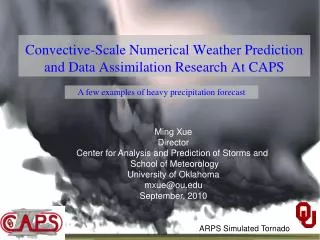
Convective-Scale Numerical Weather Prediction and Data Assimilation Research At CAPS A few examples of heavy precipitation forecast Ming Xue Director Center for Analysis and Prediction of Storms and School of Meteorology University of Oklahoma mxue@ou.edu September, 2010 ARPS Simulated Tornado
Future of NWP – also what’s happening in research and experimental realtime forecast mode at CAPS Global models running at < 10 km grid spacing, Continental-scale regional models and their ensembles running at ~1 km grid spacing, resolving individual thunderstorms and localized phenomena, and providing probabilistic information for decision making and response. Localized nested ensemble prediction systems running at < 1 km grid spacing, for tornado, turbulence, city-scale forecasts. Typhoon/hurricane track and intensity forecasts are much improved at convection-resolving resolutions Observations from radar, satellite and in-situ platforms are effectively assimilated into NWP models Need Peta-flop+ supercomputers!
Storm-Scale Convection-Allowing Ensemble and Convection-Resolving Deterministic Forecasting • CAPS/OU has been carrying out a project since 2007 to develop, conduct and evaluate realtime high-resolution ensemble and deterministic forecastsfor convective-scale hazardous weather. Forecasts were directly fed to the NOAA HWT (Hazardous Weather Testbed) and evaluated in realtime by forecasters and researchers in an organized effort. • Goals: To determine the optimal design, configurations, and post-processing of storm-scale ensemble prediction, and to provide the products for evaluation by forecasters and researchers, and test storm-scale data assimilation methods. • Spring 2010: 26-member 4-km ensemble and one 1-km forecastsfor full CONUS domain. 30-hourly daily forecasts over 7 weeks. Assimilation of data from 120+ radars. Multi-model (WSR-ARW, WRF-NMM and ARPS), multi-physics, perturbed IC and LBC (from SREF).
June 14, 2010 OKC Flooding 13h 13Z Probability-matched ensemble mean hourly accumulated precipitation (mm) Max=151mm Max=71% Raw probability ofhourly precipitation >0.5 inch 14h 14Z Max=125mm Max=71% 15h 15Z Max=141mm Max=64%
1 km WRF-ARW forecasts of composite reflectivity 13h 13Z Observed radar mosaic reflectivity 14h 14Z 15h 15Z
12–18Z accumulated precipitation: 18h(June 14, 2010 – OKC Flood Day) SSEF Prob match SSEF mean QPE SREF mean SREF Prob match NAM HWT images
18–0Z accumulated precipitation: 24h(June 14, 2010 – OKC Flood Day) SSEF Prob match SSEF mean QPE SREF mean SREF Prob match NAM HWT images
ETS for 3-hourly Precip. ≥ 0.5 in 2009 (26-day) 2008 (32-day) With radar With radar no radar no radar 12 km NAM 12 km NAM Probability-matched score generally better than any ensemble member 2 km score no-better than the best 4-km ensemble member – may be due to physics 1-km score better than any 4-km member and than the 4 km PM score. Radar data clearly improves precipitation forecasts, up to 12 hours. High-resolution forecasts clearly consistently better than 12 km NAM.
Comparisons of reflectivity GSS (ETS) scores of SSEF, HRRR and NAM for Spring 2010 CAPS SSEF Ensemble PM Mean CAPS SSEF 1 km Model CAPS SSEF ARW-CN(control w/o radar assimilation) CAPS SSEF ARW-C0(control w/o radar assimilation) HRRR NAM Corollary Lesson: To provide a “fair” comparison Between CAPS and HRRR, the 01Z and 13Z runs for HRRRshould be used
Comparison of CAPS 4 km Cn/C0 2008 Forecasts with McGill 2-km MAPLE Nowcasting System and Canadian 15-km GEM Model 4km with radar MAPLE 4km with radar 4km no radar CSI for 0.2 mm/h Correlation for reflectivity Courtesy of Madalina Surcel of McGill U. (Surcel et al. 2009 Radar Conf.)
High-Resolution Numerical Simulations of Typhoon Morakot (2009)
ARPS 2.5 km Forecast of Composite Reflectivity for Morokat with GFS IC + Radar 3h 6h 12h 24h ARPS obs
Hourly Accumulated Precipitation 6 h fcst 12 h fcst 24 h fcst Radar Precipitation Estimate observation
Total Accumulated Precipitation 6 h fcst 12 h fcst 24 h fcst 1630mm Radar Precipitation Estimate 1530mm
CAPS Realtime Convection-Allowing-Resolution Hurricane Forecasts • In fall 2010, CAPS is producing experimental single-large-domain 4-km hurricane forecasts over Atlantic • 48 hour forecasts twice daily (00 and 12 TC) • Two sets of WRF-ARW forecasts, using GFS and global EnKF analyses and corresponding LBCs. Global EnKF and forecasts produced by Jeff Whitaker of ESRL. • Goals: Assessing convection-resolving model in predicting TC genesis, track, intensity and structure. • Experiment ongoing and systematic evaluation to be performed.
42 hour forecast valid at 2 pm today Dx =4 km 1800x900x50 grid