Download
1 / 15
150 likes | 205 Views
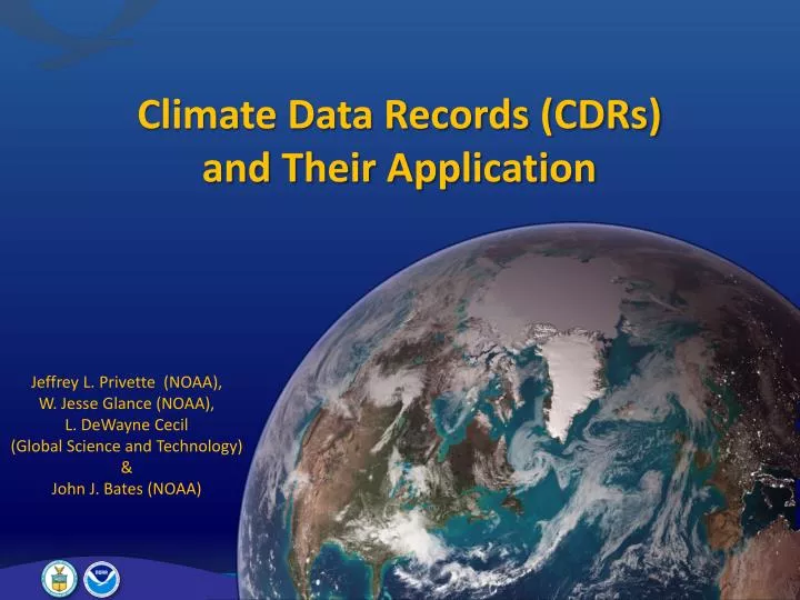
Climate Data Records (CDRs) and Their Application. Jeffrey L. Privette (NOAA), W. Jesse Glance (NOAA), L . DeWayne Cecil (Global Science and Technology) & John J. Bates (NOAA). The Academy View.

E N D
Climate Data Records (CDRs)and Their Application Jeffrey L. Privette (NOAA), W. Jesse Glance (NOAA), L. DeWayne Cecil (Global Science and Technology) & John J. Bates (NOAA)
The Academy View The National Research Council (NRC, 2004) defines a CDR as a time series of measurements of sufficient length, consistency, and continuity to determine climate variability and change.
A CDR Provides Consistency& Continuity Homogenization reduces artifacts imparted by observing systems, facilitating meaningful comparisons in space and time Operational weather and hazard productsare produced rapidly to potentially save life and property New satellite launched Vegetation Greenness Index Climate Data Records (CDRs)provide long term product consistency through rigorous reprocessing with advanced algorithms, ancillary data and evolved instrument understanding. Time (year)
CDRs Can Support Decision MakersHypothetical problems for climate data and information • Climate Information Responding to User Needs (CIRUN) Roundtable Q&A* • Can we get consistent data series on average and extreme events (e.g., that disrupt business operations) so that current trends in climate can be established? [Want] to inter-comparison locations (state, city) and changes … through time. • Energy Utilities • What is the closest historical analog (duration, extent, severity) to the this year’s hot spell? • Local Governments and Planners • Are city and county water sources (wells, reservoirs) stable given climate change? • International Shipping • Can transport companies get a competitive advantage by investing now in ships for routes through the Northwest Passage? • Agribusiness • How could a company adjust its portfolio of producers, transporters and foreign investment due to climate? • Not hypothetical – received from constituent. • See: http://www.climateneeds.umd.edu
The Academy View The National Research Council (NRC, 2004) defines a CDR as a time series of measurements of sufficient length, consistency, and continuity to determine climate variability and change.
The Academy and the Private Sector Either/Or ? Both? Same? The National Research Council (NRC, 2004) defines a CDR as a time series of measurements of sufficient length, consistency, and continuity to determine climate variability and change. The CDR Program provides proven satellite-derived climate data and information records – including data sets, source codes and documentation – to allow decision-makers, policy-makers and scientists throughout society to make informed decisions and analyses involving future weather and climate.
Different User Needs RequireDifferent Processing Time Lags • Research Support(Epoch reprocessing of complete period of record, Complete, State-of-the-art) Quality (accuracy, completeness, etc.) • Operational Weather(Quick, Robust, Data as-available, Algorithm as-is, Sensor-unique) Minutes Days Weeks Years Decades Time past observation (logarithmic scale)
Different User Needs RequireDifferent Processing Time Lags • Research Support(Epoch reprocessing of complete period of record, Complete, State-of-the-art) • Decision Support • (Routine, Complete, Timely, Climate processing, Consistent in time/space/resolution over period-of-record) Quality (accuracy, completeness, etc.) • Operational Weather(Quick, Robust, Data as-available, Algorithm as-is, Sensor-unique) Minutes Days Weeks Years Decades Time past observation (logarithmic scale)
Different User Needs RequireDifferent Processing Time Lags • Research Support(Epoch reprocessing of complete period of record, Complete, State-of-the-art) • Decision Support • (Routine, Complete, Timely, Climate processing, Consistent in time/space/resolution over period-of-record) Quality (accuracy, completeness, etc.) • Operational Weather(Quick, Robust, Data as-available, Algorithm as-is, Sensor-unique) Minutes Days Weeks Years Decades Time past observation (logarithmic scale)
Sustained Climate Information Flow Emerging International Architecture Satellite & In Situ Observations Near Real Time Long-term Information Preservation Observing system performance Monitoring and automated corrections Archives Satellite data Re-calibration Inter-calibration Reprocessing Inter-calibration Essential Climate Variables [Thematic Climate Data (TCDRs)] Fundamental Climate Data Records (FCDRs) Environmental Data Records Interim Climate Data Records (ICDRs) Sustained Coordinated Processing Data conversion User Services Climate Information Records SCOPE-CM Major model-based Reanalysis Short scale physical phenomena monitoring Operational Climate Monitoring supporting Climate Services Longer term climate variability & climate change analysis Adaptation + mitigation planning (decision making) Sustained Applications Climate Data Records 10
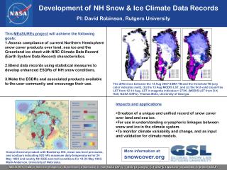
2012 drought depicted by Vegetation Index CDR (July 17) • CDRs Supporting Farming and Agribusiness • Example: historical context • 5 km resolution,“wall-to-wall” (globally) • Historical record from 1981- to current • Collatoral products • Surface Reflectance • Leaf Area Index (LAI) • FPAR (photosynthetically active radiation) Primary U.S. corn and soybean region
Temporal Scale of Agricultural Stakeholder Interests Days Months Years <1 10 20 1 3 6 9 1 3 5 10 50 100< Farmer Consumer Crop Breeder Reservoir Construction Aid Agency Emissions Policymaker Regulatory Agency Commodities Trader Biofuel or Processing Plant Construction Elected Official (Re-)Insurance Companies Development Aid Disaster Relief
CDRs Supporting Insurance/ReinsuranceExample: Hurricane Trends Transition fromgovernment to industry Government provisionof data Decision support information Hurricane intensity trends (Kossinet al. 2007)
CDR Access for Decision Makers User Model Of Data Access Traditional Large Volume Data Access Current method of data access and delivery Preferred method of same Going from “drinking from the fire hose” to “sipping a cup of tea” Reduce the data volume, filter what remains, and mix with relevant ecological data to produce a desired product.
Summary • CDR Program supports private sector applications • Interim Climate Data Records offer many advantagesover operational weather products • More complete in time and space • Consistency over multi-satellite period of record • Enables searches for historical analogs • “climate quality algorithms” • Better ancillary inputs • Better sensor functioning knowledge • For more information visit WWW.NCDC.NOAA.GOV/CDR