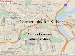
Cartography
Cartography. Map Making. What is the art of making maps called? Cartography – the art of making maps. What is a Map ?. A map is a drawing or a picture of the earths surface, showing how things are related to each other by distance, direction and size. Lagrange Middle School.


Cartography
E N D
Presentation Transcript
Map Making What is the art of making maps called? Cartography – the art of making maps
What is a Map ? • A map is a drawing or a picture of the earths surface, showing how things are related to each other by distance, direction and size.
Uses of MapsWhat do we use Maps for? • Maps are used for: • Navigation : To find places • Direction to travel • Determine distance • Determine Size • Visually display data
Different types of maps • Types of Maps • Topographic map – • Shows elevation of the land • Shows 3 dimensional ups and downs on 2 dimensional surface • Population density – How many people live in an area (crowdedness). Road maps, School Maps, Weather Maps, Etc…
What is on a proper map? • What is on a Proper Map? • Title – • Tells what map you are looking at. • Key / Legend Shows representations of objects on the map. • Scale – • Shows distance on a map.
What is on a proper map? • Compass – • gives direction (N,S,E,W) WE not EW to get out of the woods. • Landmarks/features – • objects such as mountains, buildings, parking lots ect. • Roads with names – • roads are labeled to clarify which roads you are looking at • Latitude and longitude • For navigation
Latitude and Longitude • How do we tell which is which?
What is Latitude? • Latitude is the Measure of distance north and south of the equator. (Laddertude, Flatitude) • What is its range? • Latitude range = 0° – 90° N or S • What are lines of equal latitude? • Parallels are lines of the same latitude running East and West on a map Parallel to the Equator What is 0 Degrees Latitude? • Equator - 0° latitude • Halfway between North and South pole
Other notable Latitudes North Pole: 90° N Arctic Circle: 66.5° N Tropic of Cancer: 23.5° N Equator: 0° Latitude Tropic of Capricorn: 23.5° S Antarctic Circle: 66.5° S South Pole: 90° S All #’s relate to 23.5 Earths Tilt
Longitude • Longitude is the measure of distance east and west of the prime meridian Longitude Range? • Longitude Range 0° - 180° E or W Can only go half way around a circle • Lines of equal Longitude? • Meridian - Lines of equal Longitude. Run between North and South Pole Zero Degrees Longitude • Prime Meridian – 0° longitude Runs through Greenwich, England • What is the name for 180° The International Date Line is 180 Deg. Longitude
Why did we start using Lat / Long? • We started using Latitude / Longitude For ship navigation Poor navigation = Bad Day
Our Latitude / Longitude • Latitude / Longitude for Lagrangeville, NY? • Lat / Long for Lagrangeville, NY • 41 Deg. North / 74 Deg. West
To Review • Latitude first, mustalways include N or S • Longitude second, must always include E or W • Start at equator and go N or S the number of degree • Start at the Prime meridian and go E or W the number of degrees • The intersection of the two lines is your location
Find these Coordinates • 40° N 3° W • Madrid, Spain • 36° N 112° W • Grand Canyon National Park • 0°N 36° E • Nairobi, Kenya • 33° S 70° E • Santiago, Chile • 28° N 81° W • Disney World - Orlando, Florida
Why do we have Time Zones? • Time zones - Longitudinal belt in which all areas have the same local time • Why do we have time zones? • Since the Earth rotates, not all places are in daylight at the same time. To accommodate for this, different places are set to different times
Greenwich Mean Time (GMT) • Where is the starting point for time zones? The 0 point for time is 0° Longitude or the prime meridian (Greenwich Mean Time (GMT). • How far apart is each time zone? • Every time zone is 15 Deg. Apart. • 360° / 24 hours = 15° / hour What happens to time when we move to the West? • Every 15 deg. you move West we subtract 1 hr (Lazy Californians) What happens when we move to the East? • Every 15 degrees to the East we add 1 hour (Busy NYC)
International Date Line • Can we go back multiple days in time? • To stop us from going to far back or forward in time, the International Date line resets the day. What happens when we cross it? • Crossing to the west we add one day. • Crossing it to the east we subtract one day • It is the opposite of time zones! Why is the line not straight with the 180 deg meridian? • The line does not run perfectly North and South, it bends around islands in its path
Time Zones in the United States • US time zones: • Eastern Standard Time • Central Standard Time • Mountain Standard Time • Pacific Standard Time • Alaska and Hawaii
Mapping the Earth • What is the best representation of the Earth? • The best representation of the Earth is a Globe. • What happens when we try to make a map the Earth? When the round surface of the Earth is projected on a flat surface changes occur that distort the size and shape of land and oceans
Mercator Projection • Mercator Maps show correct shape of coastline • Distorts the size of land and water areas far from the equator • Greenland is made much larger then it really is.
Equal Area Projection • Equal Area Maps shows area correctly Distorts the shapes
Map lab Conclusion (G) 1.) What is a map? 2.) What is the study of maps known as? 3.) Name and explain 3 kinds of maps people would use? 4.) What are 8 important features on a map (define) 5.) What changed from your first map to your final map? (Meaning did you add or change anything.) 6.) Explain 2 types of maps that try to fix the problem of distortion.
H.I. Lab (G) / Secret Code Lab (R) • Conclusion: • Define Latitude ? • Define parallels ? (in terms of latitude) • What is the zero point for Latitude ? • Define Longitude ? • Define Meridian ? (in terms of Longitude) • What is the zero point for Longitude ? • What are time zones, Why do we have them and how many degrees are between them? • What is the International Date Line, where is it andwhy do we have it ?