Download
1 / 40
400 likes | 521 Views
This session presents case studies on low flows and flood patterns in the Amazon Basin, the world's largest drainage basin encompassing approximately 6 million km² across seven countries. The studies utilize rainfall and discharge data from various stations like ANA (Brazil), SENAMHI (Bolivia), and INAMHI (Ecuador). Employing the Regional Vector Method and correlation analyses, it explores annual pluviometric indexes, discharge trends, and seasonal variability, providing insights into the hydrological dynamics affecting the region's freshwater discharge and climate variability.

E N D
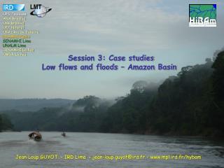
UPS Toulouse ANA Brasília UnB Brasília UFF Niteroí UFRJ Rio de Janeiro INAMHI Quito SENAMHI Lima UNALM Lima SENAMHI La Paz UMSA La Paz Session 3: Case studiesLow flows and floods – Amazon Basin Jean Loup GUYOT – IRD Lima – jean-loup.guyot@ird.fr - www.mpl.ird.fr/hybam
Amazon Drainage Basin • the largest basin of the world (Area : 6 000 000 km²) • ≈ 5% of continental areas • ≈ 20% of fresh water discharge • 7 countries • Mean discharge : 200 000 m³.s-1
Rainfall stations from : ANA (Brazil), SENAMHI (Bolivia and Peru), INAMHI (Ecuador) IDEAM (Colombia
Regional Vector Method - RVM This methodology consists in assuming that for the same climatic zone under the same rainfall regime, the annual pluviometric totals are pseudo proportional, with a little random variation every year due to rain distribution in the zone. To calculate this “Vector” station, the RVM applies the concept of extended average rainfall to the work period, which is an estimation of the average possible value that would have been obtained through continuous observations during the study period. Based on the above mentioned, the Least Squares Method is applied to find the Regional Annual Pluviometric Regional Indexes Zi and the extended average rainfall Pj. This may be calculated by minimizing the sum of the formula (1), where i is the year index, j is the station index, N is the number of years, and M is the number of stations. Pij is the annual rainfall in the station j,the year i; Pj is the extended average rainfall to the period of N years; and finally, Zi is the regional pluviometric index of the year i. The series of the chronological indexes Zi is called “Regional Annual Pluviometric Indexes Vector”. Hiez (1977) & Brunet-Moret (1979)
25 vectors (homogenous areas) : 16 in the Andean Countries, 9 in Brazil n = 1446 (756) 1964/2003 Espinoza et al. (submitted).
05N 75W 70W 65W 60W 55W 50W 80W 00 05S 300mm 10S 3 000 15S 6 000 20S Km Mean annual rainfall
75W 70W 65W 60W 55W 50W 80W 05N Branco 00 Negro Amazonas Marañón Madeira Xingu 05S Tapajós Juruá Ucayali Purus 10S 15S 0.1 0.5 20S 1.0 Seasonal Variability Coefficient (sVC)
75W 70W 65W 60W 55W 50W 80W 05N 00 05S 10S 0.05 15S 0.25 20S 0.50 Interannual Variability Coefficient (iVC)
75W 70W 65W 60W 55W 50W 80W 05N 00 05S 0.1 10S 1.0 15S 2.0 3.0 20S Interannual VC / Seasonal VC
Mean annual rainfall trend (Óbidos) - 0.32 % / year Espinoza et al. (submitted).
Mean annual rainfall trend (Tamshiyacu) - 0.83 % / year TAMSHIYACU Espinoza et al. (2006).
n = 43 1943/1999 Callède et al. (2004).
No trend n = 163 1940/2003 Callède et al. (submitted).
Tamshiyacu Óbidos Gauging stations from : ANA (Brazil), SENAMHI (Bolivia), INAMHI (Ecuador), HYBAM (Bolivia, Peru and Ecuador)
Venezuela Colombia CAR Ecuador SER OBI ACA MAN SAI TAM ITA ALT FVA G-L Brasil PVE Peru Bolivia Km
Trend analysis The trend analysis is made based on the calculation of the correlation coefficients, which are applied for evaluating the series trend. The correlation coefficients applied are: Pearson coefficient, which is parametric and measures the lineal correlation among variables, Spearman is non-parametric based on the range, and Kendall, also non-parametric based on the range and probability of the data occurrence order.
Annual Discharge Data (Óbidos gauging station, Brazil) 2006 Max Mean (no trend) Min 2005 Nine events with runoff higher than 250 000 m3/s occurred between 1970 and 2005, while four have been observed since the beginning of the century,
Annual Discharge Data (Tamshiyacu gauging station, Peru) -0.81% / year Espinoza et al. (2006). IAHS Publ. 308, 424-429.
CAR SER ACA OBI MAN SAI ITA TAM ALT FVA G-L PVE Mean annual discharge trend
CAR SER ACA OBI MAN SAI ITA TAM ALT FVA G-L PVE Max annual discharge trend
CAR SER ACA OBI MAN SAI ITA TAM ALT FVA G-L PVE Min annual discharge trend
One long observed time serie : Negro River at Manaus (1903 - today) Due to backwater effects, Negro River water levels are controlled by the Amazon river near the confluence, like all majors tributaries of the Amazon basin. Meade et al. (1991). Environ. Geol. Water Sci. 18(2), 105-114.
Richey et al. (1989). Science. 246, 101-103. -> No trend, links with ENSO events Milly et al. (2002). Nature, 415: 524-517. -> increasing floods
One long reconstructed time serie : Amazon River at Óbidos (1903 - today)
2 observed periods without nivel correction. The rating curve for the recent Period can not be used for the whole period. -> be careful with published discharge data (UNESCO)
Max, Mean and Min annual discharges : Amazon River at Óbidos (1903 - 1999) Callède et al. (2004).
Breaks analysis The breaks and changes in the series are evaluated through different methods, using Kronostat software: the Buishand method, of Bayesian nature, based on changes of the series average. The Pettitt method is a non-parametric test based on changes in the average and the range of the series. Lee and Heghinian test are also used, which is other Bayesian method that uses the average as an indicator of change. Finally, Hubert segmentation is applied based on the significant difference of the average and the standard deviation among periods; for the search of multiple changes in the series. Callède et al. (2004).
Runoff coefficient : Amazon River at Óbidos (1903 - 2003) Callède et al. (submitted).
Conclusion • Main results for the 1902 – 1999 period at Obidos are : • increasing trends for annual mean discharge and annual flood discharge, • no tendency for low flows, and • a significant break for the maximum and mean time series in 1969-1970. • Using the HYBAM dataset for the whole Amazon basin, a first study has been • realized for 30 years (1975-2005). Mean annual rainfall over the Óbidos drainage • basin presents a decreasing trend of 0.32%/year, while mean annual discharge is stable. • This difference between rainfall estimation and discharge can be the consequence of: • • rainfall under estimation, mainly in the equatorial region (north Peru, Colombia) • were rainfall data is rare, • • impact of the deforestation : with the same rainfall, there is more runoff, etc… • • and/or change in the rainfall regime, with higher intensity, i.e. more runoff. • For the same period (1975-2005), annual flood discharges are increasing, while • annual low flows are decreasing, traducing an increasing amplitude of discharge at • the Óbidos station. • The study of these tendencies in the different sub basins should allow us • to understand better the impact of the climatic variability in the Amazon basin. • => More data is required, • => We have to help the Andean countries in this way
Suspended Sediment Yield : Amazon River at Óbidos (1995 - today) Guyot et al. (in press). IAHS