Download
1 / 27
270 likes | 394 Views
This session dives into the significance of shipwrecks and marine exploration. Discover how studying wrecks informs us about our past, oceanic conditions, and human errors in navigation. Explore ancient navigation techniques of the Polynesians, the role of modern technology in ocean exploration, and the evolution of submersibles. Learn about critical methodologies like sonar mapping and the use of ROVs for underwater exploration. The agenda also outlines tests and projects related to world geography through engaging and informative activities.

E N D
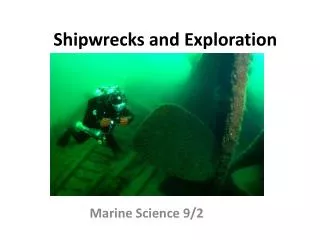
Shipwrecks and Exploration Marine Science 9/2
Agenda • Tests not graded yet..coming soon! • World Geography Project Due Tomorrow?
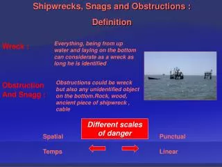
Why do we study shipwrecks? • Tells us about our past and ocean conditions (currents, weather) • Historical and Cultural Significance • Teaches us about human error
Importance of Shipwrecks • Today, many goods are still transported by ships • Shipwrecks from the past become biologically rich communities • 20% of shipwrecks in the history have occurred in very deep waters
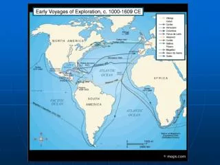
Exploring the Oceans Throughout Time • Polynesians: extensive travel; 10,000 islands and 26 million square kilometers • Shells and sticks to create grid maps • 900 BC to 300 AD: • Fiji- Hawaii- Easter Island
Most Primitive Forms of Navigation • Use of celestial bodies: stars, sun, moon • Chinese mariner’s compass • Travels to Europe in 10th century • First compasses somewhat unreliable
The Facts • Less than five percent of the ocean has been explored (Source: NOAA)
Common Methods Used for Exploring the World’s Ocean • Satellites: • sea surface temperature (SST) and color • algal blooms • water circulation • Shipboard Observations and Sensors • Examples: CTDs (conductivity, temperature, depth) • Diving
Modern Technology for Exploring the Oceans • Underwater Drones: “Gliders” • Can travel through harsh conditions
Other Methods of Exploration • Submersibles • Explore the abyssal depths • Helped find our hydrothermal vents • Just as a space shuttle is built to withstand the near total vacuum of outer space, these are built to withstand the crushing pressure of the deep ocean.
Other Submersibles: ROVs • Remotely-operated vehicles • Many used to pick up artifacts from shipwrecks • Also used to study the living creatures and chemistry of the ocean • Maneuverable arms: force reflective • HD Video
So what does a ROV do? • Sonar: sound pulses bounce off sea floor to produce pictures of seafloor • Magnetometers: measure magnetic field (strength and direction) • Cameras • Water Sampling: clarity, temperature, density, speed of sound, light penetration
Sonar: Mapping the Seafloor http://oceanservice.noaa.gov/facts/sonar.html
Deepest Explorations: Timeline • First challenger expedition: 1872-1876 • First time discovering Marianas Trench • Recorded a sounding of over 8,184 meters deep • See primitive technology
Deepest Explorations: Timeline • Trieste: 1960 • first manned vessel to have reached the bottom of the Challenger Deep (36,000 feet) • Marianas Trench near Guam https://www.youtube.com/watch?v=HY4JDmKNKWA
Deepest Explorations: Timeline • Alvin: a deep submergence vehicle (DSV) • First of its kind; more maneuverable than Trieste • Built in 1960s • 8,000 feet (started at only 35 feet)
More Recently (2012): The Challenger • Challenger: James Cameron; explored the Marianas Trench • This is now a Marine Protected Area (MPA) • Marianas Trench Marine National Monument; established 2009 • Size of Wyoming • Part of the Pacific Ring of Fire
The Challenger • http://www.deepseachallenge.com • 26 feet long; like a race car and a torpedo as described by Cameron • Along with the Trieste, the only vehicle to have carried humans into the greatest depths of the ocean
Finish Geography Projects • New Vocab: start working on in class. • Due Friday (Sept. 5th)
Activity: Venn Diagram of DSVs • Groups of Three: • One person: Trieste • Second person: Alvin • Third: Challenger • Complete worksheet individually • As a group, create Venn Diagram