SEARCH AND RESCUE
350 likes | 884 Views
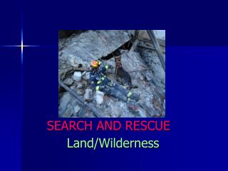
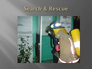
SEARCH AND RESCUE. Land/Wilderness. Ben Morse SPECIAL OPERATIONS DIVISION CHIEF SAVANNAH FIRE & EMERGENCY SERVICES GEORGIA SEARCH & RESCUE TEAM COORDINATOR. Search and Rescue Land/Wilderness. Methodology Terminology Search Techniques Two Types of Searches Land/Wilderness

SEARCH AND RESCUE
E N D
Presentation Transcript
SEARCH AND RESCUE Land/Wilderness
Ben MorseSPECIAL OPERATIONS DIVISION CHIEF SAVANNAH FIRE & EMERGENCY SERVICES GEORGIA SEARCH & RESCUE TEAM COORDINATOR
Search and RescueLand/Wilderness • Methodology • Terminology • Search Techniques • Two Types of Searches • Land/Wilderness • Urban Searches • Geo-referencing
Search and RescueTerminology • Search Areas • Assigned by Incident Command • Map • Search Grids • Labeled • Map issued to each Team • Point Last Seen (PLS) • Point on map where victim was last seen • by a witness • Positive ID! • Trailhead, hunting camp, office space, work area, etc… • Place to focus search around • Age, experience, physical fitness, how long ago sighted • clues to how large search area will be
Search and RescueTerminology • Last Known Position (LKP) • During a search clues will turn up • When they are solid enough to be reasonably certain that the search victim left it • Since LKP more recent than PLS • New starting point for search • General direction of travel • Approximate speed of travel
Search and RescueTerminology • Probability of Detection (POD) • Likelihood of finding search subject in: • Given search area • With technique used • Different search techniques yield different POD’s • Coin reported in Sand Box • Each search technique has a “probability of detection” • More thorough: higher POD/longer it takes to search same area • Managing a Search is a balance of POD and Search Time
Search and RescueLand/Wilderness Search • Equipment • Maps • Handheld GPS • Compass • Suitable clothing • Weather / Environment • Communications with aircraft • Food, water, first aid, etc…. • ATV’s
Search and RescueLand/Wilderness Search • Search Techniques • Bastard Search • Look in obvious places/assume victim not lost • What the searchers call the person after crawling through woods, etc… then finding him eating popcorn and watching baseball • Example: boy goes hunting and doesn’t return by dark • Searchers called out • Boy returns home in wee hours • In reality, hunting story was fabricated to get out of chores and spend day with Sally
Search and RescueLand/Wilderness Search • When suspected – assign a team to do a hasty search of likely places the person would go • Considerations • Intelligence • Latest info of plans of person • Where they were going • Who are the friends • Recently made friends • Speed • Use radios & vehicles so planners can rule out areas • Talk to the couple in the tent next door • Was there an argument earlier in the day • Leave a note on the car, etc…
Search and RescueLand/Wilderness Search • Containment Search • When search team arrives they have a PLS of victim • Determine max area based on PLS • How fast person walking • How long since last seen • Wind up with a circle with PLS at the center • Direction unknown • Make containment the top priority • It limits your search area • Anyone can do it • Straight roads – two or three searchers • Even two sides of area helps • Must be vigilant – 100% that no one gets by them • Run rehab for those in deeper searches/report in by radio regularly
Search and RescueLand/Wilderness Search • Hasty Search • 10 to 12 highly trained searchers dropped in to virgin area • Goal: move quickly, look for clues or lost person • Purpose: Bring a rapid end to the search • Almost slow jog, check areas person may be injured or resting • Not directed – team has free reign • Slow down for point search; pass open areas very rapidly • Speed requires trained rescuers who know to look for clues • Footprints, broken branches • POD based on skill of rescuers and search area
Search and RescueLand/Wilderness Search • Grid Search • Typical line of searchers walking through woods • Searchers in straight line moving slowly and deliberately • Maintain spacing with searchers on sides • Do not take the path of least resistance (thorn bush) • Seldom find victim, but typically find clues • Sometimes used to give people something to do in very large searches • Spacing – pack of cigarettes
Search and RescueLand/Wilderness Search • Choke Point Search • Use based on lost persons skills, and the terrain • Large river with few bridges • Typically not very useful where lost person is trying to evade searchers • Can be handled by less experienced/physically fit teams
Search and RescueLand/Wilderness Search • Track Trap Search • Natural or man-made “traps” that capture evidence of a lost persons passing • Footprints in sand • Clothing caught in thorn bushes • Where frequent lost persons are reported,(National Parks) SAR teams build track traps out of sand on major trails • Track traps are raked smooth, then checked frequently • Tracks are compared to those of the lost person
Geo-referencing • Do we need to have all Searchers using the same system, • Air • Ground Teams • Incident Command • Others… • Should they all at least understand the playbook?
Geo-referencing • Latitude / Longitude • United States National Grid • Global Area Referencing System
Lat/Long Lat / Long • Keeping it simple~ for Catastrophic Incident SAR, the commonly described “Latitude and Longitude”describes what a SAR responder will use on a standard chart/map and what is displayed in a GPS receiver. Lat: 31.9794 North Long: 81.1k685 West
USNG United States National Grid (USNG): Ground-based grided coordinate system based on Universal Transverse Mercator (UTM) System. Basic unit of measure is the meter; positions reported as distance north from equator and distance from the zone central meridian. Purpose: provide a seamless, standardized ref system for nationwide use during times of crisis.
Georeferencing during a Catastrophic Event NSARC Georeferencing Matrix: Catastrophic Incident SAR Georeference System User USNG Lat/Long GARS DD-MM.mmm (1) Land SAR Responder(2) Primary Secondary N/A Aeronautical SAR Responders(3) Secondary Primary Tertiary Air Space Deconfliction(4) N/A Primary N/A Land SAR Responder/ Primary Secondary N/A Aeronautical SAR Responder Interface (5) Incident Command: Air SAR Coordination Secondary Primary N/A Land SAR Coordination Primary Secondary N/A Area organization and Secondary Tertiary Primary accountability (6)
Georeferencing during a Catastrophic Event The Footnotes During CIS operations, Lat/Long will be in one standard format: DD-MM.mmm. Land SAR Respondersmustuse USNG; however, a good familiarity with lat/long is necessary to ensure effective interface between Land and Air SAR Responders.
Georeferencing during a Catastrophic Event Air SAR Responders will use lat/long. Air space deconfliction: only in Lat/Long. Air SAR Responders working with Land SAR Responders have primary responsibility of coordinating SAR using USNG(Both need to know USNG and Lat/Long.). GARS (Global Area Reference System): used for CIS response leadership situational awareness.
Georeferencing during a Catastrophic Event Catastrophic Incident defined: any natural or manmade incident, including terrorism, that results in extraordinary levels of mass causalities, damage, or disruption, severely affecting the population, infrastructure, environment, economy, national morale, and/or government functions
Lat/Long –USNG -GARS Matrix is for NSARC member agency SAR Responders NSARC won’t impose georeferencing standards on volunteer, local, or State SAR Responders; however: Need to be aware of what to expect when a Catastrophic Incident is declared and NSARC member agencies conduct SAR operations.
Lat/Long –USNG -GARS Matrix will be implemented when a Catastrophic Incident occurs. (As defined in the NRF)