Download
1 / 11
110 likes | 223 Views
Explore the challenges and priorities of GIS development in Pacific Islands, covering funding, technology, skilled labor, and more. Learn about key initiatives and regional efforts to strengthen geospatial capabilities.

E N D
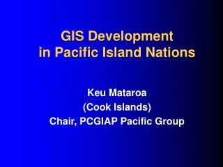
GIS Development in Pacific Island Nations Keu Mataroa (Cook Islands) Chair, PCGIAP Pacific Group
Pacific Islands Profile CharacteristicRangesCook Is Population: 2,000 - 800,000 20,000 Land area: 26km2 - 28k km2 237km2 EEZ area: 120k km2 - 3.5m km2 1.8m km2 GNP (US$): $12m - $2b $80m GNP/person: $800 - $5,000 $4,200 Aid % GDP: 2% - 67% 13% Countries profiled: Cook Islands, Micronesia, Fiji, Kiribati, Marshall Islands, Nauru, Niue, Palau, Samoa, Soloman Islands, Tonga, Tuvalu, Vanuatu.Source: ADB, 1988; AusAid, 1998; most data 1994 – 1997. 15th UNRCC-AP, Kuala Lumpur, April 2000
GIS Development Issues • Funding • Technology • Power supply • Skilled labour • Communications • Logistics • Natural disasters 15th UNRCC-AP, Kuala Lumpur, April 2000
PCGIAP Pacific Workshop • Suva, 22-25 March 1999 • Hosted by Fiji • Sponsored by Australia • 15 countries (from 19 invitations) • Presentations on PCGIAP, GIS, geodesy • Technical visits to Fiji & regional agencies • Discussions on development needs 15th UNRCC-AP, Kuala Lumpur, April 2000
PCGIAP Pacific Group • Formed to represent interests of 19 members • Recognised at 5th PCGIAP (Beijing) • Chair and Vice-Chair by annual rotation • SOPAC to provide secretariat • Communications • Work plan • Coordination and logistics • Obtain funding for projects 15th UNRCC-AP, Kuala Lumpur, April 2000
South Pacific Applied Geoscience Commission • Independent, intergovernmental, regional • Based in Suva • 54 staff • $10 million p.a. (members & supporters) • Managed by representative Council • Projects include environmental science, disaster management, energy, water supply 15th UNRCC-AP, Kuala Lumpur, April 2000
Pacific Group Priorities • Institutional Strengthening • Regional Geodesy • Remote Sensing Data Library 15th UNRCC-AP, Kuala Lumpur, April 2000
Institutional Strengthening • Undertake a comprehensive survey of GIS development needs • Design a major regional capacity building program • Seek funding to implement the program ! 15th UNRCC-AP, Kuala Lumpur, April 2000
Regional Geodesy • Extend APRGP to include all Pacific members (multiple islands per country) • Sea level (vertical datum) a special interest 15th UNRCC-AP, Kuala Lumpur, April 2000
Remote Sensing Data Library • Identify existing imagery • Develop a Pacific data library • Negotiate update arrangements 15th UNRCC-AP, Kuala Lumpur, April 2000