Download
1 / 35
350 likes | 426 Views
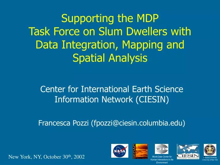
World Data Center for Human Interactions in the Environment. Columbia University in the City of New York. Supporting the MDP Task Force on Slum Dwellers with Data Integration, Mapping and Spatial Analysis. Center for International Earth Science Information Network (CIESIN)

E N D
World Data Center for Human Interactions in the Environment Columbia Universityin the City of New York Supporting the MDP Task Force on Slum Dwellers with Data Integration, Mapping and Spatial Analysis Center for International Earth Science Information Network (CIESIN) Francesca Pozzi (fpozzi@ciesin.columbia.edu) 1 1 New York, NY, October 30th, 2002
Center for International Earth Science Information Network (CIESIN) • Established in 1989 in Michigan as a Consortium; became a Center in the Columbia Earth Institute in July 1998 • Based at Lamont-Doherty Earth Observatory, Palisades NY • World Data Center for Human Interactions in the Environment • Registered UN nongovernmental organization • Interdisciplinary staff from social, natural, and computer sciences Home page athttp://www.ciesin.columbia.edu
CIESIN MD Task Force Role • Support all 10 task forces with “mapping” needs: • Subnational data on MD indicators, related parameters • Spatial data on topics of common concern, e.g., population, urban/rural distinctions, environmental context, access to roads/coasts… • Countries/areas of specific concern: develop integrated, cross-TF data bases • Help address the question of where the poor, the hungry, the vulnerable, etc. are, and what are the conditions that they face that may need to be addressed in any set of strategies • Coordinated effort with UN Human Development Report Office • Catalog and digitize available subnational data from national Human Development Reports • Assist with 3 specific case studies on landlocked countries, India, China
Functions of spatial analysis and mapping • Portraying empirical patterns, e.g.: • Documenting where the poor are • Showing which regions are behind in many development indicators, which in a few • Showing which countries have development outcomes that are evenly spread geographically, and which have them concentrated • Identifying anomalies within broad patterns • Testing causal hypotheses, e.g.: • Access to basic infrastructure facilitates development • Soil fertility is a fundamental determinant of food security for the rural poor
Types of data to be acquired and analyzed • Global data sets with subnational data • Multi-country collections with subnational development indicator data • Single-country data collections with subnational data • Investigator data tailored to specific research questions
Subnational data can be used in different ways • Mapping • Alone or in combination with other variables • Spatial Analysis • Asking questions that depend on geography (e.g., does the probability of a district having a high poverty rate depend on the distance from major urban centers?) • Exporting spatial data to tabular format, for use in regression and other statistical analysis “Mapping” is shorthand for subnational data integration
Benefits of collecting subnational data • 225 countries, with c. 3,400 first-order subnational administrative units (states/provinces) • GPW used data from 127,105 subnational units. • Generates greater variance • Permits more powerful statistical tests (where data are available at comparable levels) • Spans greater range of policy experiments and interventions • Permits more precise search for best practices, promising innovations
Spatial data collections can be aggregated to administrative units • CIESIN’s “National Aggregates of Geospatial Data” collection will be augmented with a “Subnational Aggregates” collection. • http://sedac.ciesin.columbia.edu/plue/nagd/place/
Intersects GPW population & national boundary datasets with environmental data to create tabular dataset of spatial data by country • Estimates of national-level aggregations of biome, climate, proximity to coast, elevation, slope and population density Purple: population density Red dots: 5 elevation classifications http://sedac.ciesin.columbia.edu/plue/nagd/place.html
Cross-cutting data, global coverage • Global Population • Global Land Cover • Global Road Data • Administrative Boundaries • Climate Zones • Ecological Zones • Slope • Elevation
Gridded Population of the World – global view Available at http://sedac.ciesin.columbia.edu/plue/gpw
Urban-Rural Population distribution with Urban extents • Human settlements database (points) • Populated places of 5,000 or more • Population estimates for 1995 and 2000 (UN growth rates) • Sources: census (where available) or Gazzeteer and other internet sources • Urban extents (polygons) • Derived from satellite imagery (nightlights) and ancillary GIS data • Population assigned from points database (where both available) • Urban-rural surface (grid) • Reallocation of urban population into urban areas • Total population of admin units (at lowest level avail.) used as control
Nigeria Human Settlements database
Night-time Lights over Africa (Oct.1994-March 1995)
Close-up View of Southern Nigeria Gridded Population of the World Version 2 Urban Rural Surface
Urban extents and point data superimposed to Landsat imagery
Potential uses and application of satellite imagery • Urban delineation • Night-time lights (global coverage vs. medium-low resolution and threshold/blooming issues) • Landsat/IKONOS/Aerial photography (resolution vs. temporal coverage and costs) • Change in urban extents • Urban characterization • high resolution preferred/recommended • Overlays with geographic data sources • Infrastructure, physical parameters, socio-economic, surveys data, etc • Spatial analysis and cross-tabulation
Night-lights change detection (1992/93- 2000) • Issues: • Non necessarily indicative of change in urban extents • Methodology still being developed • Available only from 1992 onward (pre-1992 data currently being processed) Legend: ¨Black = Bright lights (saturated) in both time periods ¨Red = Lights much brighter in 2000 ¨Yellow = New lights in 2000 ¨Blue = Lights missing or substantially dimmer in 2000 ¨Grays = Dim light detected in both time periods with little change
1999 Example of change detection in Westchester County, New York using Landsat data 1989 Band 1 (blue) displayed. Bright areas are built-up, darker areas represent vegetation and water
Demographic Classification New York City 3 classes of Population density(US-wide) Urban/suburban/rural Overlay with Vegetation Fractions Legend Red: Urban Green: Suburban Blue: Rural (Industrial)
Household Surveys • Demographic and Health Surveys (DHS) • Multiple Indicator Cluster Surveys (UNICEF) • Many (but not all) have sufficient geographic information and spatial coverage to permit aggregation to subnational units
Points correspond to georeferenced DHS survey clusters. • Hatched countries have georeferenced clusters but are not mapped here.
Country-specific databases • South Africa 1996 Census • Data available: dwellings, household services, education, mortality, fertility, welfare, etc • Boundaries data down to name places • Mapping possibilities and statistical capabilities (within the software) • Mali • Health study dataset (population and health data, i.e. clinics etc)
Type of dwelling by geographic region (magisterial districts and place names) Sample of the dataset
Some numbers… • 360 districts • About 9 M dwellings (all categories above) • About 11.5 % informal dwellings (not in backyard), 16% total • Cross-tabulation with income data • About 4 M Houses on separate stand of which • About 4.6 % with no income, about 10.1% with income between 6000-12000 rand • Next…calculate how many people live in informal dwellings, cross-tabulate with other variables…
Toilet facilities by geographic region (magisterial districts and place names) Sample of the dataset
TF Mapping Coordination Issues • Vast amount of spatial data available • Will take time and resources to access and integrate; need to be selective about what we get • TF help needed to define priorities: • research questions • countries/regions of common interest • TF help needed to identify relevant data, provide advice and feedback on analysis and mapping activities • Near-term objectives • Short-term: readily available data to illustrate specific issues, e.g., for HDR • Medium-term: more options for acquiring and integrating data from diverse sources and conducting innovative analyses