Download
1 / 16
160 likes | 188 Views
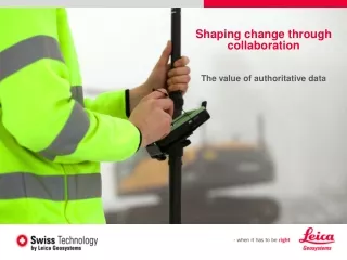
Explore the value of authoritative data and seamless collaboration between GIS and surveying communities to improve asset collection and management processes. Leica Zeno GIS series offers enterprise-oriented solutions for asset validation, optimization, and compliance, aiding in risk management and transparent decision-making. Contact Mike Cooper for further information.

E N D
Shaping change through collaboration The value of authoritative data
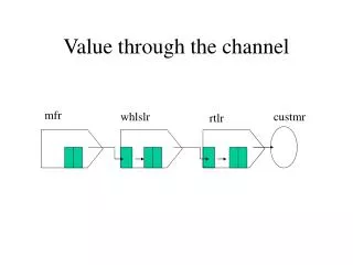
Connecting the GIS and surveying communities Survey Coding Geometry & CAD Attribute Rich GIS Data Features & Attributes Information Enterprise oriented Project oriented
Data rich and information poor I want a nice little app You outsourced the survey I haven't got the data How come?
Asset Collection and Management disconnected silo based model Higher costs and increased complexity associated with data integration Loss of data integrity impacts operational efficiency, reporting and analysis
Zeno Series GIS Asset Collection The measurement of positions & associated information of items of economic value that are owned by an individual, the public or an organisation
Asset life cycle Zeno GIS asset collection adds value at every stage Construction Commissioning & Maintenance Disposal Design Works Management Asset Validation Data transparency & compliance Asset Optimisation Enterprise wide process alignment Auditable Risk Management Reputational Risk BIM
Connecting the GIS and surveying communities Survey Coding Geometry + Rich GIS attribution Enterprise wide access to asset information
Leica Zeno GIS Series workflow Job done Easy in Easy out
Beneficial outcomes • Improved capital management and planning • Transparent and auditable compliance • Better alignment of processes and resources • Reliable, informed and consistent decisions • Efficiency savings of 50% in cost and time
Efficiency benefits • A simplified and fully integrated asset collection workflow reduces interactions and removes complexity • 30% to 50% savings in cost and time • 70% reduction in rework
Compliance benefits • Risk management including transparency of audit trails • Reliable, fast and consistent decisions carried out with confidence • Minimise errors, maintain data integrity
Leica Geosystems 200 years of experience, pioneering solutions to measure the world
Contact • For further information please contact: • Mike Cooper • Leica Geosystems Ltd • Market Manager • Asset Collection and Management EMEA • Mobile: +44 (0) 7770 929744 • Email: mike.cooper@leica-geosystems.com