CartoVis: A Web-Based Tool for Exploratory Spatial Data Analysis
CartoVis is a prototype web application designed for Exploratory Spatial Data Analysis (ESDA), enabling users to upload, visualize, and explore spatial data in both 2D and 3D formats. The application offers a suite of graphing and geovisualization tools, including choropleth mapping, histograms, scatterplots, and more, fostering innovative data exploration. With a user-friendly interface and capabilities for brushing, linking, and various mapping techniques, CartoVis aims to enhance the analysis and visualization of spatial relationships in data.

CartoVis: A Web-Based Tool for Exploratory Spatial Data Analysis
E N D
Presentation Transcript
CartoVis: A Web-based Exploratory Spatial Data Analysis Application Ryan Stanley West Virginia University
Introduction • Project Objective • Create a prototype web-based Exploratory Spatial Data Analysis (ESDA) application that allows users to upload, visualize, and explore spatial data in 2D and 3D • Implement a select suite of graphing and geovisualization tools that illustrate the possibility of ESDA in a web environment
Application Layout Menu Bar Graph View Map View Table View
Application Features • Mapping • Choropleth • equal intervals • standard deviation • quantile • box plot • natural breaks (Jenks) • Continuous Area Cartogram • 3D choropleth • Graphing • Histogram • Scatterplot • Box Plot • Parallel Coordinate Plot • Other Features • Attribute table • Brushing and linking • Map labels • Basemaps
Video http://cartovis.com
EDA and ESDA • Exploratory Data Analysis (EDA) • John W. Tukey, 1977, Exploratory Data Analysis • Emphasis on graphical analysis of data • Hypothesis generation rather than hypothesis testing • A philosophical approach to data analysis • ESDA • The merging of spatial data analysisand EDA • A collection of techniques used to describe and visualize spatial data distributions
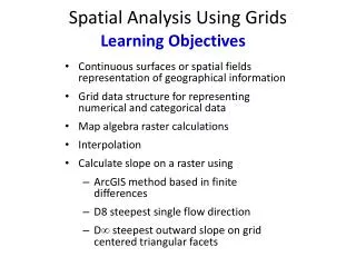
Geovisualization • The application of graphics to understand relationships and patterns in spatial data • International Cartographic Association definition: • visualization in scientific computing (ViSC) • cartography • image analysis • information visualization • exploratory data analysis (EDA) • tools for visual exploration, analysis, synthesis, and presentation of geospatial data
Languages and Libraries • HTML5 • CSS3 • Python (Django) • JavaScript • GDAL • PostgreSQL • TopoJSON • Linux Server • JavaScript Libraries • D3.js • TopoJSON.js • Colorbrewer.js • jQuery and jQuery UI • jQuery Datatables • Leaflet • Cartogram.js • JavaScript Topology Suite • simple-statistics.js • Three.js
Future Considerations • More statistical functions/tools • Include spatial statistics functions (e.g. Moran’s I) using PySal • Additional graph types • Print to PDF/ Reports • Additional options for symbolizing 3D features
Conclusion • CartoVis.com • Aprototype web-based Exploratory Spatial Data Analysis (ESDA) application that allows users to upload, visualize, and explore spatial data in 2D and 3D • Lays the groundwork for creating a fully featured web-based ESDA application