Download
1 / 51
510 likes | 539 Views
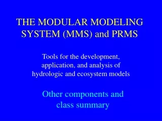
THE MODULAR MODELING SYSTEM (MMS). Tools for the development, application, and analysis of hydrologic and ecosystem models. MODELING ISSUES. Increasing complexity of problems Increasing need for multidisciplinary approaches Continued advances in science and computer technology

E N D
THE MODULAR MODELING SYSTEM (MMS) Tools for the development, application, and analysis of hydrologic and ecosystem models
MODELING ISSUES • Increasing complexity of problems • Increasing need for multidisciplinary approaches • Continued advances in science and computer technology • New data resources • No universal models
STARTING POINTS • There are no universal models • Models for different purposes require different levels of detail and comprehensiveness • Appropriate model process conceptualizations are a function of problem objectives, data constraints, and spatial and temporal scales of application
Modeling Conundrum • Experimental science builds on hypothesis testing and interpretation based on earlier published hypotheses and results • Modelers tend to build from the ground up because existing models are not well designed for incremental improvement by others
TOOL BOX MODELING VIEWS • Research Model Developer Complex Detail • Application Model Developer • Model User • Resource Manager • Policy Maker Condensed Analysis
LEVELS OF MODULAR DESIGN • PROCESS • MODEL • FULLY COUPLED MODELS • LOOSELY COUPLED MODELS • RESOURCE MANAGEMENT DECISION SUPPORT SYSTEMS • ANALYSIS AND SUPPORT TOOLS Single Purpose Multi-objective, Complex
LEVELS OF MODULAR DESIGN • PROCESS • MODEL • FULLY COUPLED MODELS • LOOSELY COUPLED MODELS • RESOURCE MANAGEMENT DECISION SUPPORT SYSTEMS • ANALYSIS AND SUPPORT TOOLS
CRITERIA AND RULES FOR GOOD MODULE DESIGN • relate directly to real world components or processes • have input and output variables that are measurable values • communicate solely via these input and output variables Modules should Reynolds J.F., and Acock, B., 1997, Modularity and genericness in plant and ecosystem models: Ecological Modeling 94, p 7-16
USGS PRMS DAFLOW 1-D Sediment Transport (beta) MODFLOW WEBMOD WETMOD OTHER TOPMODEL Hydro-17 (NWS snowmelt) Snowmelt Runoff Model (SRM) (ARS) ENNS Model (modified HBV, Austria) SELECTED MODELS AND MODULES IN MMS • IN DEVELOPMENT • PRMS-MODFLOW-DAFLOW-UnsatZone • Sacramento Model (NWS) • PHREEQC, OTIS, OTEQ, AHM (QW models) • RZWQM, RUSLE, SWAT, Generic Crop (ARS Ag models)
LEVELS OF MODULAR DESIGN • PROCESS • MODEL • FULLY COUPLED MODELS • LOOSELY COUPLED MODELS • RESOURCE MANAGEMENT DECISION SUPPORT SYSTEMS • ANALYSIS AND SUPPORT TOOLS
PRMS, MODFLOW, DAFLOW Unsaturated Zone Unsaturated Zone Model (Niswonger and Prudic, 2003, WRR) Streamflow
LEVELS OF MODULAR DESIGN • PROCESS • MODEL • FULLY COUPLED MODELS • LOOSELY COUPLED MODELS • RESOURCE MANAGEMENT DECISION SUPPORT SYSTEMS • ANALYSIS AND SUPPORT TOOLS
Watershed Model Hydraulics Model Data Management Interface (DMI) Fish Model LOOSELEY COUPLED MODELS MMS Model Off-the-shelf Model Database
Watershed Model Hydraulics Model Data Management Interface (DMI) Fish Model LOOSELEY COUPLED MODELS MMS Model Off-the-shelf Model Database Model Management Interface (MMI) [XML]
LEVELS OF MODULAR DESIGN • PROCESS • MODEL • FULLY COUPLED MODELS • LOOSELY COUPLED MODELS • RESOURCE MANAGEMENT DECISION SUPPORT SYSTEMS • ANALYSIS AND SUPPORT TOOLS
Recreation Watershed and River Systems Management Program Municipal & Industrial Irrigation Hydropower Research and development of decision support systems and their application to achieve an equitable balance among water resource issues. Riparian Habitat Endangered Species
Upper Gunnison DSS Hydromet Real-time climate data feed Hydrologic Database DMI DMI RiverWare Reservoir and River System Operations Model DMI MMI Object User Interface Interface for data visualization and modeling Modular Modeling System Physical Process Models
WARSMP BASINS CURRENTLY OPERATIONAL CURRENTLY OPERATIONAL IN DEVELOPMENT WARSMP RELATED IN DEVELOPMENT,MMS PLUS YAKIMA SACRAMENTO TRUCKEE GUNNISON SAN JOAQUIN SAN JUAN RIO GRANDE
LEVELS OF MODULAR DESIGN • PROCESS • MODEL • FULLY COUPLED MODELS • LOOSELY COUPLED MODELS • RESOURCE MANAGEMENT DECISION SUPPORT SYSTEMS • ANALYSIS AND SUPPORT TOOLS
ANALYSIS and SUPPORT TOOLS Currently Available Statistical and Graphical Analyses Parameter Optimization Parameter Sensitivity Analysis Beta Testing Shuffle Complex Evolution Optimization Multi-Objective COMplex Evolution Algorithm (MOCOM) Generalized Likelihood Uncertainty Estimation (GLUE) Visualization
DIGITAL DATABASES (1 km2 resolution) Vegetation Type (USFS) Vegetation Density (USFS) Land Use-Land Cover (USGS)
Forecast Methodologies - Historic data as analog for the future Point measures (ESP) Radar data (NEXRAD) - Synthetic time-series using regional info - Atmospheric model output Statistical Downscaling Dynamical Downscaling
CURRENT FOCUS ISSUES IN MMS DEVELOPMENT AND APPLICATION • Coupling of SW and GW Models • A Priori Parameter Estimation • Incorporation of Remotely Sensed Data • Coupling of Atmospheric and Hydrologic Models • Improved Hydrologic and Ecosystem Process Simulation • Integrated Analysis and Support Tools
PRMS, MODFLOW, DAFLOW Unsaturated Zone Unsaturated Zone Model (Niswonger and Prudic, 2003, WRR) Streamflow
A Priori Parameter Estimation Hydrologic Landscape Units Selected Basins
Sleepers River, Vermont Trout Lake, Wisconsin Panola Mountain, Georgia Loch Vale, Colorado Luquillo, Puerto Rico USGS WATER, ENERGY, AND BIOGEOCHEMICAL BUDGETS (WEBB) PROGRAM
FOCUS ISSUES ARE ADDRESSED THROUGH COLLABORATIVE MULTI-DISCIPLINARY EFFORTS
UNIVERSITY COLLABORATION University of Arizona NSF funded -- Sustainability of semi-Arid Hydrology and Riparian Areas (SAHRA) NASA funded -- Southwest Regional Earth Science Applications Center -- Integration of remotely sensed data University of Colorado NOAA funded -- Coupling of hydrologic and atmospheric models to provide short- to long-term forecasts
INTEGRATED SYSTEM DEVELOPMENT Collaborative effort to integrate the Object Modeling System (OMS) and the Modular Modeling System (MMS) • US Geological Survey • Friedrich Schiller University, Jena, Germany • US Agricultural Research Service (ARS) • US Natural Resources Conservation Service (NRCS)
Nuclear Regulatory Commission (NRC) Army Corp of Engineers (COE) US Geological Survey (USGS) National Oceanic and Atmospheric Admin (NOAA) U.S. MULTI-AGENCY MEMORANDUM OF UNDERSTANDING (http://www.iscmem.org) Facilitates cooperation in R&D of multi-media environmental models, frameworks, and databases for use in human and environmental health risk assessment • Environmental Protection Agency (EPA) • Department of Energy (DOE) • US Agricultural Research Service (ARS) • Natural Resources Conservation Service (NRCS)
MMS International Collaboration • Public Works Research Institute, Japan • Korean Water Resources Corp., South Korea • Chinese Academy of Sciences, Geography and Natural Resources Institute, Beijing • Friedrich Schiller University, Jena, Germany • University of Bodenkultur, Vienna, Austria • International Atomic Energy Agency, Vienna
SUMMARY • Toolbox approach to model and system development • Supports multi-disciplinary model integration for decision support systems • Open source software design allows many to share resources, expertise, knowledge, and costs • Flexible framework approach enables the incorporation of continuing advances in science, databases, and computer technology
POINT Chicken Soup for the Modeling Soul “A fool with a tool is still a fool.” System Development magazine
PRECIPITATION - RUNOFF MODELING PROJECT OPEN SHOP CONSULTATION COLLABORATION