Download
1 / 26
290 likes | 850 Views
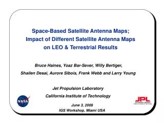
Space-Based Satellite Antenna Maps; Impact of Different Satellite Antenna Maps on LEO & Terrestrial Results . Bruce Haines, Yoaz Bar-Sever, Willy Bertiger, Shailen Desai, Aurore Sibois, Frank Webb and Larry Young Jet Propulsion Laboratory California Institute of Technology. June 3, 2008

E N D
Space-Based Satellite Antenna Maps; Impact of Different Satellite Antenna Maps on LEO & Terrestrial Results Bruce Haines, Yoaz Bar-Sever, Willy Bertiger, Shailen Desai, Aurore Sibois, Frank Webb and Larry Young Jet Propulsion Laboratory California Institute of Technology June 3, 2008 IGS Workshop, Miami USA
Problem: Uncertainties in GPS antenna phase variations (APV) among the limiting sources of error in global, GPS-based geodesy. Solution: Use GRACE tandem mission (2002– ) as orbiting geodetic lab for recovering GPS transmitter APV maps. GRACE advantages: Scale (mean height) can be determined at cm level from dynamical POD constraint (GM). Clean spacecraft and simple attitude laws produce low multipath, and facilitate modeling of surface forces. Advanced “BlackJack” GPS receivers on two spacecraft separated by ~200 km. Long-duration measurements (2002–) with dense global coverage (89.5° inclination). 500 km altitude implies no troposphere to confound APV interpretation. 500 km altitude enables sampling of GPS antenna beam pattern away from Earth’s limb. GRACE-Based Estimates of GPS Antenna Phase Variations GPS Block IIA Satellite Gravity Recovery and Climate Experiment (GRACE)
Daily precise orbit solutions for 2004–2006 One GRACE s/c at a time Phase (LC) only (High rate 30-s) Minimum arc length of 30 min Dynamical POD to preserve link between scale and GM CD and 1 cpr acc. reset every rev. per UT/CSR approach. GPS ephemeris and clock offsets fixed to precise, fiducial-free values (JPL/IGSAC) A priori offset of GPS s/c phase-center with respect to CG assumed to be zero. GRACE a priori antenna phase variation model from anechoic chamber: GRACE Processing • Postfit residuals binned according to az/el of transmitters. • High rate (30-s) ionosphere-free phase (LC) • Least-squares fit to antenna map • Iterate until converged –15 0 15 mm
GRACE-Based Antenna Phase Variations:Results for 3 GPS Satellite Blocks Block II/IIA (1989–1997) Block IIR-A (1997–2003) Block IIR-B/M (2003–pr.) RMS 3.7 mm RMS 4.1 mm RMS 15.9 mm
Anechoic chamber measurements provide a-priori APV for GRACE choke-ring antennas. After recovery of GPS transmitter APVs, GRACE carrier-phase (LC) residuals depict multipath predicted by simulation: Recovery of Grace Multipath: A Closure Test 0 10 –10 0 10 –10 0 10 –10 mm mm mm GRACE Multipath Simulator1 (X 0.5) GRACE-A GRACE-B 1 Byun, S., G. Hajj and L. Young, Radio Science 37(6), 2002
GPS Nadir (+Z) Phase Center OffsetsGRACE- Vs. Ground-based (IGS) Solutions
TOPEX/POSEIDON and Jason-1 Tests:Antenna Offset Estimates as Proxy for Scale TOPEX/Poseidon (1992–2005) • First demo of precise GPS in space • ~2 cm radial orbit accuracy from GPS • Low multipath (GPS antenna on 4-m boom) • Apparent 5-cm bias in radial position of antenna • Reported early in mission (e.g., Bertiger et al., 1994) • Eluded explanation for over a decade Jason-1 (2001–) • Successor altimeter mission to T/P • 1-cm radial orbit accuracy from GPS • Apparent 4–5 cm bias in radial antenna position • Due to errors in modeling of GPS transmit antenna PCO. Specialized Dynamic POD Tests • Enable estimation of mean (daily) antenna phase center offset wrt vehicle CM • Serves as proxy for errors in the TRF (scale) realized by GPS • Exposes errors in the transmitter phase-center locations • Use ionosphere-free phase (LC) alone in dynamic POD soln.
GPS Transmitter APV Maps Explain Anomalous Estimated Radial Antenna Offsets for T/P and Jason-1
GPS Transmitter APV Maps Explain Anomalous Estimated Radial Antenna Offsets for Jason-1
Sampling of GPS Transmitter Beam Pattern:Effect of Ground vs LEO Data Distribution on IIR-B/M Phase Center Estimate Block IIR-B/M
Reprocess 6-yrs of data from 2002–2007 (inclusive) 60 stations Reprocess 25-d of data in 1995 (AS-free period from April–May) Support selected TOPEX/Poseidon POD tests Obtain snapshot of TRF scale realized from older GPS data set (fewer stations) Use 3-day solution arcs, shifted by 1 day. Use fiducial-free strategy TRF realized by GPS alone (large rotations possible, but scale well determined). Use GRACE-based APV maps Block averages of GRACE maps for GPS transmit antennas Robot/anechoic maps for ground antennas (igs05_1455, Schmid et al., 2007). Employ POD strategy that capitalizes on dynamical constraints. 1-cpr empirical accelerations in along, cross track (random walk w/ 12 hr update) Y bias and solar radiation pressure coefficient (bias parameters) Extra stochastics on eclipsing satellites (2-hr update) Model planetary radiation pressure (albedo) Apply second-order ionosphere correction (Kedar et al., 2003) Use GMF troposphere mapping function (Boehm et al., 2006) Use bias fixing Internal (GPS) TRF compared to ITRF via 7-parameter transformation GPS Global Network Data ReanalysisHighlights of Long-arc POD Strategy
TRF Scale from GPS Alone (2002–2007):Agreement with ITRF2005 See also Ge et al. (GRL, 2005) Annual Cycle Removed
TRF Scale from GPS Alone (2002–2007):Agreement with ITRF2005 See also Ge et al. (GRL, 2005) Annual Cycle Removed
Alternative Choke Ring APV ModelReduces Scale Difference to 1 ppb
Ensemble Ground Multipath?1 Month of Stacked LC residuals (60 stations) from Global Net. Soln. Elosegui et al., 1995
GPS antenna phase variation (APV) maps developed from GRACE data Describe complete phase correction with respect to s/c center-of-mass No constraint to ITRF (use fiducial-free GPS orbit and clock products; derive scale from GRACE dynamics) Individual maps for all GPS s/c flying in 2003–2006 time frame. Using block averaged maps is viable option Basic validation of APV maps yields promising results Inferred Block IIA nadir (Z+) offset (+1.8 m for LC) yields good agreement with recent robot test (+1.7 m; Wubenna et al, 2007) and rooftop test (+1.7 m; Mader and Czopek, 2002) Residual systematic errors (GRACE LC residuals) agree with multipath predicts. APV maps significantly reduce scale errors in kinematic LEO orbit solns (Jason-1, T/P) Reduce Jason-1 scale rate (2002–06) from +0.48 to +0.01 ppb/yr (+3.7 to +0.1 mm/yr) Reduce Jason-1 scale bias from +5.6 ppb to –2.4 ppb ( +43 to –19 mm) Reduce T/P scale bias in 1995 test data from +7.3 to 0.0 ppb (+56 to 0.0 mm) IGS transmitter maps also reduce LEO errors, but seem to be less effective, due in part to abundance of LEO data outside 14o zenith angle represented by ground data (no map default to phase center offset.) APV maps significantly stabilize TRF scale realized in global network soln. +0.01 ppb/yr wrt to ITRF2005 (2002-2007) using GRACE maps & IGS ground maps together. Testifies to ability of GPS alone to determine TRF scale rate over 6-yr span. 6 ppb bias in TRF scale using GRACE maps & IGS ground maps together. Consistent with smaller transmit PCO offsets (Z+) from GRACE-based technique. Use of Choke ring APV from JPL antenna test range decreases bias to +1 ppb (< 1 cm). Ground error sources (e.g., multipath, troposphere) should not be ruled out as potential cause of bias discrepancy between GRACE- and ground-based APV estimates for GPS transmitters. Highlights
GPS S/C Orbit Solution Differences: (Long Arc vs. IGS Combined) Bias 6.78 Drift 0.21 Pfit 0.56 Bias 0.20 Drift -0.01 Pfit 0.20 Bias 0.07 Drift 0.00 Pfit 0.19 Bias –0.28 Drift 0.20 Pfit 0.90 Median = 3.9 cm
High Elevation SLR Passes Reveal Significant Reduction in Range Bias to GPS High Elevation Passes from Graz, McDonald Observatory and Monument Peak
Antenna Phase Variation (APV) Maps Reveal GPS Antenna Elements GPS Block IIA Antenna Array GPS Block IIA Carrier (LC) APV (Mean Offsets Removed) –10 0 10 Mader and Czopek (2002) mm Also Haines et al. (2004); Schmid et al. (2005)
GPS Transmitter PCV Maps Explain Anomalous Estimated Radial Antenna Offsets for Jason-1
TRF Centering from GPS Alone (2002–2007): Agreement with ITRF2005