Download
1 / 26
260 likes | 280 Views
Learn about the advancements in geodetic leveling post-2022, including the transition from NAVD 88 to NAPGD 2022 and the integration of GNSS technology. Discover the advantages, challenges, and estimated accuracy of this approach, along with case studies and ongoing research developments.

E N D
geodesy.noaa.gov Leveling After 2022 Dan Gillins, Ph.D., P.L.S. April 25, 2017 Geospatial Summit 2017
Differential Leveling Rod 1 Setup of Leveling, Δn = B – F Rod 2 Foresight Backsight F B Δn SB SF S
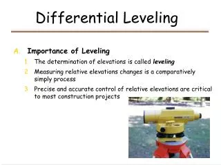
Differential Leveling Advantages: • Leveling is used to determine differences in heights between marks • Highly accurate (i.e., mm to sub-mm) height differences can be obtained in less than one km Challenges: • A tedious process • Line-of-sight technology, restricted to 50-100 m sight lengths; prone to blunders • Requires starting from a mark with a “known” height (i.e., vertical control point or bench mark)
Heights on Bench Marks • NGS publishes orthometric heights on bench marks referenced to NAVD 88 • NAVD 88: • Realized by over 700,000 km of leveling lines • Over 500,000 monumented bench marks • Minimally Constrained adjustment, holding fixed the Father Point/Rimouski tide station in Canada
NAVD 88 Courtesy Brian Shaw
Challenges with NAVD 88 • Bench marks may not be in convenient locations or near a project area • Must assume the bench marks have not moved, and their published heights are without error • Bench marks are often destroyed and rarely replaced • Sparse number of bench marks outside of CONUS • Heights for the bench marks were derived from a single point, allowing error to build up across the country
NAPGD2022 • The North American-Pacific Geopotential Datum of 2022 (NAPGD2022) will replace NAVD 88 • Will not be realized by leveling between passive marks • Accessed by GNSS observations (referenced to NATRF2022) and a high-accuracy gravimetric geoid model (GEOID2022)
GNSS-Derived Orthometric Heights H ≈ h - N HNAPGD2022 = hNATRF2022 – NGEOID2022 h H Ellipsoid N Geoid Ocean
Advantages of NAPGD2022 • Easily accessed by making GNSS observations • Establish vertical control in convenient locations • Level from this control to other stations in your survey • Possible to derive orthometric heights on marks at the time of your survey • Enables monitoring orthometric heights on marks
Estimated Accuracy of GNSS-Derived Height Differences h2 h1 N2 Ellipsoid N1 Geoid Ocean
Principles of Least Squares Two Components of a least squares adjustment: • Mathematical Model • Stochastic Model • How to weight your observations and constraints • Weights inversely proportional to variances
Case Study: GSVS11 Austin • 325 km line from Austin to Rockport, TX • Static GPS collected on 218 stations (48-h sessions) • First-order Class 2 geodetic leveling • Surface gravimetry Rockport
Preliminary Adjustments of GSVS11 Austin • Free adjustment of leveling observations: • ΔH = 158.454 m • σH,end = ±0.014 m • Simply differencing GNSS-derived orthometric heights at each end of line: • ΔH = 158.398 m • σH,ends ≈ ±0.04 m Rockport
GNSS+Leveling Adjustments ΔH H2 ΔH H1 Geoid
GNSS+Leveling Adjustments ΔH H2 ΔH H1 Geoid
GNSS+Leveling Adjustments ΔHadj H2,adj ΔHadj Hf He Hd Hc H1,adj Hb Ha Geoid
Conclusions • GNSS and a high-accuracy geoid model connects network to NAPGD2022 • (network accuracy) • Leveling improves accuracy of height differences between marks • (local accuracy) • Addition of leveling with GNSS increases overall redundancy in a survey network
Ongoing Research and Development • Develop models to combine and adjust GNSS-derived heights and/or observations with leveling • More tests with other GNSS+leveling projects • Add a new section to the NOS NGS Manual 3 on “Geodetic Leveling” • Provide guidance for the necessary spacing of vertical control from GNSS • Update FGCS specifications for leveling • Develop software applications and tools
Questions? Dan Gillins Daniel.Gillins@noaa.gov