Leveling
Leveling. Introduction. The term level is defined as "being perpendicular to a vertical line.” . If an object is parallel to the horizon, it also said to be "level". This concept is not limited to surveying.


Leveling
E N D
Presentation Transcript
Introduction • The term level is defined as "being perpendicular to a vertical line.”. • If an object is parallel to the horizon, it also said to be "level". • This concept is not limited to surveying. • When a picture is hung on the wall, care is taken to insure that it hangs straight--level. • Kitchen appliances are “leveled” when they are installed. • As a carpenter builds forms for placing concrete, they are leveled, or checked to see if the top of the forms is the same elevation at all points.
Level • The application of the term level is dependent on a tube of liquid with an air bubble called a spirit level. • When air bubble is centered it is level. • If the air bubble is not centered--it is out of level • Spirit levels are attached to or built into surveying instruments so the instrument can be set level.
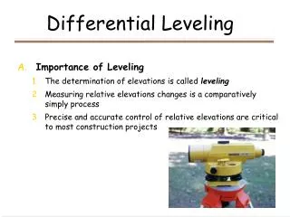
Leveling is the process of determining if an object is parallel to the horizon, perpendicular to a vertical line, or if two or more objects are at the same elevation. One person can attach pictures to the wall and be satisfied that they are level (at the same height), but there is a good chance that another person will not agree. Leveling
It is very difficult to tell if two or more objects are level without the use of a tool or instrument. One alternative is to measure down from the ceiling and set both pictures the same distance. Objects may be parallel to the ceiling, but they will only be level if the ceiling is level. Leveling-cont.
The principles of leveling can be illustrated with a simple type of level--a garden hose. Clear, vented, graduated tubes are attached to each end of a garden hose. When the hose and tubes are filled with water and the tubes are held in a vertical position, the water will be at the same elevation at both ends of the hose. Level Example
A straight line between the top of the water at each end of the hose is level. This is a very primitive tool for leveling and should be used with care, but the distance over which the hose level can be used is only limited by the length of hose the operators are willing to manipulate. Water Level-cont.
A hose level can also be used to determine the difference in elevation between two points. In this example it is being used to determine the difference in the height at two ends of a wall. In this case, the difference in height is 1.9 feet. Water Level Example
Try to visualize an instrument set up so that the centerline of the instrument is at the same elevation as the top of the water at one end of the hose. When the horizontal cross hair of the instrument telescope is at the same elevation as the water in the first tube, then the line of sight through the instrument will strike the second tube at the height of the water. Line of Sight
The line of sight through the telescope establishes a level reference line. Line of Sight-cont.
Because the instrument line of sight is horizontal, when the instrument is set up correctly, it can be used to compare the relative elevation of two or more objects. The rod is placed on one object, or station, and the center cross hair is read on the rod. Instrument Reference Line
Instrument Reference Line-cont. • The rod is then placed on the second object, or station, and the center cross hair is read for the second time. • Subtracting the two rod readings results in the difference in elevation between the two stations. • Is this equation correct if the instrument is not level?
The rod measures the vertical distance from the line of sight, the reference line, to the top of the object the rod is resting on. If the same reference line is used---the rod readings can be compared. This is the principle of leveling used for differential and other types of surveys. Assuming the instrument is set up correctly, the line of sight through the telescope establishes a horizontal reference line that can be used to compare the elevations of two or more objects/stations. Instrument Reference Line-cont.
A plane was defined as a flat surface. The line of sight through an instrument forms a reference line that can be part of a vertical or horizontal plane. A reference plane is established whenever a surveying level is rotated in a horizontal or vertical circle Reference Plane
Reference Plane-cont. • Study the illustration. • Is it correct to say that the distance between ball A and ball C is: (8.3 ft + 6.9 ft ) or 15.2 feet apart? • No • Is it correct to say that ball A is 15.2 feet higher than ball C? • Yes • Is it correct to say that Ball A is (8.3 ft - 5.2 ft ) or 3.1 feet higher that ball B? • Yes Why is question one not true, but two and three are?
The reason is the important difference between distance and a difference in elevation. Distance is the amount of straight line separation between two points. A difference in elevation is measured as a vertical distance from a reference line or reference plane. The surveying rod is used to measure vertical distance from a reference plane. Reference Plane-cont.