Download
1 / 29
290 likes | 1.02k Views
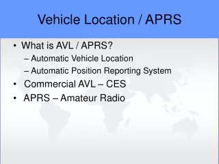
Presentation to TETRA Business Solutions Group Automatic Vehicle Location Nick Smye 29th September 1999 Concepts to Reality e-mail: masoncom@masoncom.com http://www.masoncom.com FORMAT 1. Introduction 2. A Brief History of AVL

E N D
Presentation toTETRA Business Solutions GroupAutomatic Vehicle Location Nick Smye 29th September 1999 Concepts to Reality e-mail: masoncom@masoncom.com http://www.masoncom.com
FORMAT 1. Introduction 2. A Brief History of AVL 3. Overview of Positioning Technologies 4. Business Benefits 5. Global Market Opportunity 6. Summary
INTRODUCTION Positioning System Bearer Network • Central • Application Vehicle Mounted Positioning Unit Typical AVL System
BRIEF HISTORY OF ELECTRONIC NAVIGATION AND LOCATION • Radio Navigation and Location • Air Navigation • Radio Navigation Beacons • Aeronautical • Maritime (Decca/LoranC) • Terrestrial
HISTORY OF SATELLITE (1) • Sputnik launched in 1957 • US Navy Transit Satellite Network • Operational on Polaris Submarines in 1964 • Commercially available in 1967 • Accuracy to 160 metres - measures Doppler Shift • Must be nearly Stationary and update only every 40 mins • Atomic Clocks
HISTORY OF SATELLITE (2) • 1973 US Navy & USAF combined programs • 1978 First two Navstar Satellites launched • Constellation operational in June 95 • At least 24 satellites operational at a time • Further enhancements to GPS Planned
SATELLITE DEVELOPMENTS • EC recommendation to develop Galileo • an independent but GPS compatible £2bn Satellite system • May 98 US Naval Academy discontinued courses on stellar navigation
OVERVIEW OF POSITIONING TECHNOLOGIES • Terrestrial Radio Beacons • GPS • GSM • Satellite • Transponder
TERRESTRIAL RADIO • Network of fixed basestations • LF propagation • Number bases • Vehicle Unit calculates position and passes data back to control point • Requires communications e.g. UHF radio • Coverage Issues (Beacon / Bearer)
SECURICOR DATATRACK • In 1985 Securicor Datatrack looked to increase protection and management of its “Cash in Transit” fleet • Location to within 50 metres • Protection from Interception and Corruption • By 1990 over £19M invested in UK Network • 14 LF “Beacons” • Dedicated UHF Band Network
GPS • Global Positioning System • Primarily Military System • Run by US DOD • Selective Availability • Civilian accuracy typically 100m • Requires view of several satellites • Problem in cities
DIFFERENTIAL GPS • Measures offset at fixed reference location • Broadcast to Vehicle to Give Accurate Remote Location • corrections broadcast by various carriers • use bearer network to send corrections • Post-processed at Host • Accuracy of about 5 metres
GPS RESILENCE ------------------------------------------------------------------- APRIL 17, 1998 …13:58 EDT ------------------------------------------------------------------ Russians selling navigational jamming device BY BOB BREWIN ALEXANDRIA, Va. -- A recently developed Russian jamming device that can knock out satellite navigation system signals has been sold to numerous countries, opening the possibility that terrorists could seriously disrupt the system that ships and aircraft use to navigate, according to government officials. ------------------------------------------------------------------- APRIL 13, 1998 ------------------------------------------------------------------ AIR FORCE Rogue transmitter knocks out GPS signals BY BOB BREWIN An errant Air Force transmitter in upstate New York jammed Global Positioning System …...
GPS RESILENCE (2) 21st August 1999 Global Positioning Systems Fail Todayby Dave Murphy Ninety-Five Thousand Japanese drivers may have to leave their cars at home, starting today. Pioneer Electronic Corp., a vendor of Global Positioning System (GPS) devices, had started to receive hundreds of calls for assistance from owners of its products when the GPS display screens started to go blank or the units froze up.
GSM • Cell Location • Identification of Basestation • Accuracy dependent upon Cell Size • Cursor • Series of fixed GSM receivers • Handset software u/g • Compares two signals and calculates position • Accuracy within 125m
LEO SATELLITES • Commercial LEO Services • Still building network • Low Cost Messaging • Containers • Remote Metering • Subscriber Unit offer location to approx 1Km by measuring Doppler shift
REQUIREMENTS FOR BEARER NETWORK • Capacity depends upon the number of vehicles and the position refresh rate • On board unit must have intelligence to filter out and reduce transmissions • Report by exception • Stationary • Can also be used for other services e.g. operator status update Coverage, Capacity and Cost
EXAMPLES OF BEARER Coverage, Cost and Capacity • RAM Mobile Data • Vodafone Value Added and Data Services (PAKNET) • GSM SMS • Securicor Datatrak • PAMR • Dolphin • Private
BUSINESS BENEFITS • Little Business Benefit in Location Alone • Vehicle location display needs map overlay • Can allow GSM Operators to offer Value Added Services • Key is the Application • At most basic visual tracking - map display overlaid with vehicle locations • Advanced systems perform workflow management Real Benefits come from the application
EMERGENCY SERVICES • Police Force • Blue light/panic button • Fire Service • Dynamic route assignment • Ambulance • RBA to cut Emergency response times by 2 mins • Response to new Goverment standards • Confirmation of message delivery
TRANSPORT • £1M contract for 500 installations • maximise trailer and load efficiencies • reduced fuel consumption • internet tracking
BUS SERVICES • Belgian Bus • dynamic timetable • download location • upload pick-up and drop-off points • Birmingham Centro • real time information display • roadside beacons • initial results 27% increase in passenger journeys • Multi-operator routes
UK ELECTRICITY COMPANYFOCUS ON BUSINESS DRIVERS • Drive for profit • Improved workforce management • Competition in energy supply • Pressure from Industry Regulator • Improvement in customer services • Core network reliability
UK UTILITY COMPANYFOCUS ON BUSINESS DRIVERS • Customer Service: • Fault restoration times • Business Efficiency: • Asset management • Work management • Cost monitoring
TELEMATICS GLOBAL MARKET • “Integration of Vehicle Control and Monitoring Systems with Location Tracking Devices and Wireless Telecommunications” • Strategis Group estimates that more that 1.2 million vehicles will be fitted Telematics (currently estimated 56,000) • Estimate 430,000 commercial vehicles fitted with AVL • Growth on consumer market will drive down hardware costs. Market worth $8.4bn by 2011?
OTHER BUSINESS DRIVERS • E911 Directive in US • development of new positioning systems • Will drive down costs of GSM based location
SUMMARY Positioning Application Bearer ££ Benefits Business Drivers Telematics Solution Match the Application to the Business Needs