Download
1 / 15
180 likes | 660 Views
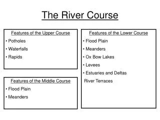
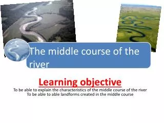
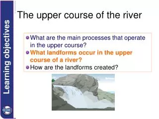
The lower course of the river. LO: I can describe and explain he formation of ox bow lakes . I can describe and explain he formation of flood plains . I can describe and explain he formation of levees. The lower course of the river. What are the characteristics?

E N D
The lower course of the river LO: I can describe and explain he formation of ox bow lakes. I can describe and explain he formation of flood plains. I can describe and explain he formation of levees.
The lower course of the river • What are the characteristics? • What landforms may be found here? • What is the land use? • http://www.youtube.com/watch?v=bsc2_NwyD-A
Explain the formation of an oxbow lake When the river floods it breaks through the thin meander neck and the river takes the easier, straight course. This leaves the meander loop ‘cut off’ as an oxbow lake. Over time, the oxbow lake will become colonised by vegetation. new course of the river Meander neck becomes smaller oxbow lake
Floodplain formation Floodplains and leveés are formed by deposition in times of river flood. The river’s load is composed of different sized particles. When a river floods it deposits the heaviest of these particles first. The larger particles, often pebble-sized, form the leveés. The sands, silts and clays are similarly sorted with the sands being deposited next, then the silts and finally the lightest clays. Every time the river floods deposition builds up the floodplain.
leveés clays and silts sands Floodplain formation This is a cross section of a floodplain. Draw a simple sketch of the diagram and annotate with the following labels:
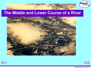
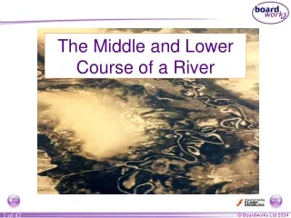
Techniques – interpreting aerial photographs Name the river landform shown in this aerial photograph. What else can you identify? How can you tell that this is not the upper course of a river?
The landforms of a river Which landforms are missing? Why?