Download
1 / 13
130 likes | 284 Views
Sediment Delivery to the Lower Neches River and the Effects of Impoundments (Town Bluff Dam-Sam Rayburn Dam).

E N D
Sediment Delivery to the Lower Neches River and the Effects of Impoundments (Town Bluff Dam-Sam Rayburn Dam)
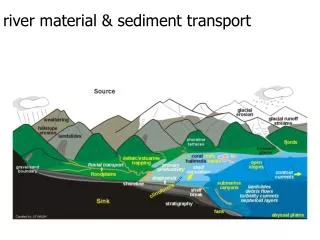
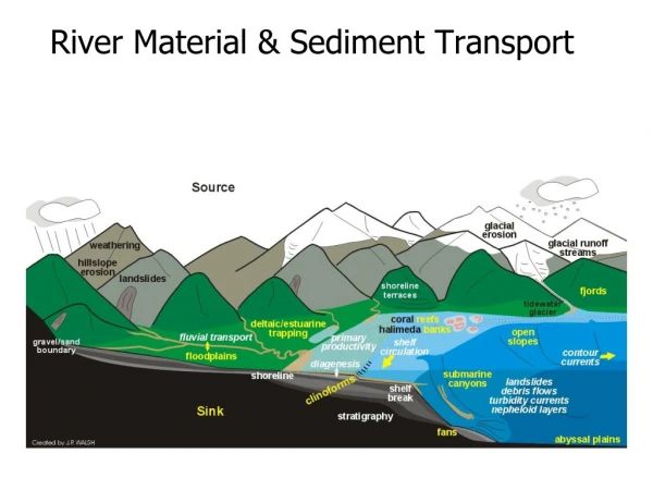
It is well known that reservoirs serve as sediment traps, which deprive downstream river reaches of their sediment supply.Under most circumstances, stream reaches and floodplains on the upstream side of newly constructed reservoirs aggrade in response to the new hydrologic gradient. Stream reaches below dam outfalls are scoured and their channels deepened. Water is sediment-free, except for scour.
Dams designed for flood control, such as Town Bluff, tend to lessen peak flows. River geomorphology tends to be a function of peak flows, so the Neches River might be expected to adjust over time to dam-induced, lower-than-historic peak flows.These lower peak flows are possibly accompanied by lower current velocities and lower sediment transport potentials.
In some cases, a deficiency of ‘floods’ leads to aggradation downstream.This effect has been documented. See:(http://www.usace.army.mil/inet/usace-docs/eng-manuals/em1110-2-1418/c-2.pdf)and(http://www.usbr.gov/lc/region/g2000/assess/appc.htm)Aggradation seems to follow a two-step process, 1) initial degradation of the stream bed, followed by 2) activation of local sediment sources as tributaries respond to the increased localized hydrologic gradient.
One requirement seems to be a ready source of easily erodable material from either the floodplain or surrounding uplands. A second requirement is that this local source be available in equal or greater quantities than the material captured by thereservoir.
These conditions have not been adequately documented for the Neches River, but evidence from the adjoining Trinity River Watershed suggests that conditions conducive to river aggradation might occur within the Gulf coastal plains.See: http://64.233.187.104/search?q=cache:HYw0RgV337wJ:www.twdb.state.tx.us/RWPG/rpgm_rpts/2002483442.pdf+neches+sandbar+development&hl=en
“Preliminary results suggest that [since the construction of the Lake Livingston Dam] there has been no detectable reduction in sediment delivery to the lowermost reaches of the Trinity River, and to Trinity Bay. Flow regimes downstream of Livingston Dam have not been greatly modified, and there is no flow-related decline in sediment transport capacity. There is also no shortage of available sediment in the lower Trinity. Sand is abundant, and there is no evidence of depletion of sandy bars since the dam was constructed. Floodplain accretion is occurring, also indicating that the river is not sediment supply-limited….
There is evidence of channel incision associated with reduced sediment loads immediately downstream of the lake, and as far downstream as Romayor, and evidence of reduced post-dam sediment yields at Romayor. However, there is no evidence of a post-dam reduction in sediment yield further downstream at Liberty. Sediment yield data also show that sediment storage in the lower Trinity valley--which is independent of, and occurred both before and after impoundment of Lake Livingston--is a more important control over sediment transport to the estuary than sediment trapping in Lake Livingston.”
This provides evidence that the area of the river between Romayor and Liberty serves as a depocenter for the Trinity
The source of sediment is apparently reworked material from the adjoining floodplain.Geomorphic effects downstream from dams are a complex interaction of river size, hydrologic regime, environmental setting, the history and morphology of the stream reach, as well as operation of the impoundment. Depositional loci are largely a function of sea level in such regimes.
There are several means of documenting floodplain aggradation:1) Physical structures within the channel2) Historic photography3) Dendrogeomorphology (examination of root crowns, flaring, and growth rings)4) In-stream sediment analysis
Ramifications of aggradation include:1) Reduced volumetric capacity a the river channel2) Flooding at lower flow volumes