Download
1 / 37
370 likes | 781 Views
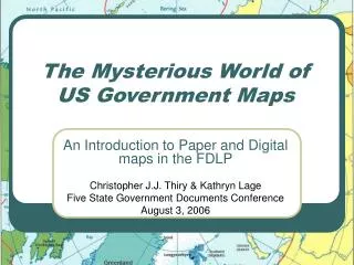
The Mysterious World of US Government Maps An Introduction to Paper and Digital maps in the FDLP Christopher J.J. Thiry & Kathryn Lage Five State Government Documents Conference August 3, 2006 National Atlas of the United States of America 1970 Every library should own.

E N D
The Mysterious World of US Government Maps An Introduction to Paper and Digital maps in the FDLP Christopher J.J. Thiry & Kathryn Lage Five State Government Documents Conference August 3, 2006
National Atlas of the United States of America • 1970 • Every library should own.
National Atlas Sheets (I 19.111) • Some plates from 1970 Atlas. • Most new sheets available on web, but some printed. • Libraries should get if they have cabinets.
US Geological Survey (USGS) State Maps (I 19.102/) • Excellent base maps. • Can be plain, with topography, or with shaded relief.
USGS Topos (I 19.81, I 19.110) • Excellent for historical research. • Some sheets up-to-date, others over 50 years old. • Different scales. • Complete coverage of the US. • Good to own maps of your library’s city and county--$6 each.
Castle Rock Topos • 1:500,000 1980 • 1:250,000 1978 • 1:125,000 1898 • 1:125,000 1913
Castle Rock Topos • 1:100,000 1983 • 1:62,500 1945 • 1:50,000 1976
Castle Rock Topos • 1:24,000 1965 • 1:24,000 1971 • 1:24,000 1980 • 1:24,000 1994
USGS Topo Indexes (I 19.41/6-3) • Free. • Need for topos.
USGS National Parks Maps (I 19.106) • Most out-of-date. • Show topography and often shaded relief.
National Park Service Maps (NPS) (I 29.6/, I 29.8, I 29.21, I 29.39) • Black boarder. • Given away at park entrances.
National Forest Service (NFS) (A 13.13, A 13.28, A 13.36) • Up-to-date. • Shows roads, camping, trails.
Bureau of Land Management (BLM) (I 53.7/2, I 53.11) • Similar to Forest Service. • Surface and Mineral Management maps immediately obsolete.
AMS/DMA/NIMA/NGA • World coverage. • Most date from WWII and immediately after. • Good for finding old names of cities in Europe.
TPC (Tactical Pilot Chart) (D 5.354) • 1:500,000 world-wide, topographic coverage. • None have come through the FDLP in years.
Sectional Aeronautical (TD 4.79/11) • 1:500,000 USA. • Updated and distributed twice a year.
NOAA, DMA/NIMA Nautical Charts (C 55.440, TD 4.82) • USA and worldwide coverage. • Not all issued/released.
CIA (PrEx 3.10/4) • Excellent for displays or reports. • Very simple. • Some very current.
FIRM (Flood Insurance Rate Map) (HH 10.9/2) • Shows flood prone areas. • Most out-of-date. • Newer ones online.
Soil Surveys (A 57.38) • Not all of the US done—most of the mountainous regions skipped. • Soil types on top of aerial photographs.
USGS Thematic Maps—(I 19.85:C), (I 19.89:HA, (I 19.91:I), (I 19.87:GP), (I 19.88:GQ), (I 19.113:MF), (I 19.90:MR), (I 19.92:OC), (I 19.93:OM), (I 19.91/3:SIM) • All discontinued except SIM (paper), and MF (digital). • Usually show geology and usually show USA. • Not all of the US mapped geologically. • Some mapping of Pakistan (satellite), other planets and the moon.
USGS Geologic Atlas (I 19.5/) • Covers only parts of the country—mostly mining areas. • Most about 100 years old. • Collectors’ items.
Open-File Reports (OFR) (I 19.76) • Most have maps. • Most show geology. • Blueline copies—print-on-demand. • Most not distributed in paper form via the FDLP. • Some distributed from 1990-2000 in microfiche. • Some issued on cd-rom. • Most new ones available on the web—some old ones too.
Census (C 56.242, C 56.242/2, C 56.242/3) • Variety of themes including elections and congressional districts • Census boundary maps are no longer printed in paper form.
CD-ROMS • Almost all out-of-date and some useless • DOQ (Digital Orthophoto Quadrangle) • DRG (Digital Raster Graphic Data) • DLG (Digital Line Graph) • TIGER/Census tract street index
Reference Materials • A Cartobibliography of Separately Published U.S. Geological Survey Special Maps and River Surveys • Map Index to Topographic Quadrangles of the United States, 1882-1940 • World Mapping Today • Guide to U.S. Map Resources • Where Once We Walked: A Guide to the Jewish Communities Destroyed in the Holocaust • A Guide to the Cartographic Products of the Federal Depository Library Program (FDLP)http://magert.whoi.edu/pubs.html
Static (PDF/JPG) Dynamic Interactive Customizable Maps (WebGIS) Sites shown today: Government hosted Government data hosted by other organizations Digital reproductions of paper maps New methods of publishing cartographic information “Hi, I need a map…”How to begin thinking about online U.S. government maps
Geographic Names Information System (GNIS) & GeoNET • http://geonames.usgs.gov/ • Searchable database from the U.S. Board on Geographic Names: foreign & domestic • Mapping Services • Google maps • TopoZone/Terraserver-USA • Census Maps • EPA Find Your Watershed
The National Atlas • http://nationalatlas.gov • Printable maps • Interactive maps (Dynamic Maps) • Customizable maps (Map Maker) • Download raw data • New: Atlas of North America data
Perry-Castañeda Library Map Collection • http://www.lib.utexas.edu/maps/index.html • CIA maps • Many other maps: news agencies, other government agencies, historical maps
The National Map: The Nation’s Topographic Map for the 21st Century • http://nationalmap.gov/ • “The National Map is a consistent framework for geographic knowledge needed by the Nation. It provides public access to high-quality, geospatial data and information from multiple partners to help support decision-making by resource managers and the public.”
Library of Congress American Memory Project • http://memory.loc.gov/ammem/index.html • Civil War Maps • Liberia ~ Maps ~ 1830-1870 • Maps and Cartographic Items ~ 1500-Present • National Parks ~ Maps • Panoramic Maps ~ 1847-1929 • Railroads ~ Maps ~ 1828-1900 • Revolutionary Era Maps ~ 1750-1789 • World War II Military Situation Maps
American Memory Map Collections • MrSID & JPEG2000 files • Need special software to download/print
U.S. Census Bureau Mapping • http://www.census.gov/geo/www/maps/ • Map Products: Links to PDF maps • http://www.census.gov/geo/www/maps/CP_MapProducts.htm • Congressional District Maps • Online Mapping • American Fact Finder • TIGER Map Server
Searching for U.S. Government Maps • Narrowest geographic area → broader geographic area • What agency might create this map or collect this data? • Electronic and paper: start with library catalog • Online • Geospatial One Stop: www.geodata.gov • Perry-Castañeda Library • CU-Boulder Map Library’s links (http://ucblibraries.colorado.edu/map/links/links.htm) • Google Image Search • Odden’s Bookmarks (http://oddens.geog.uu.nl/index.php)
The Mysterious World of US Government Maps Christopher J.J. Thiry Map Librarian Arthur Lakes Library Colorado School of Mines Office: (303) 273-3697 Fax: (303) 273-3199 cthiry@mines.edu Presentation and handout can be found at: http://ucblibraries.colorado.edu/map/class/past.htm Katie Lage Map Librarian Jerry Crail Johnson Earth Sciences & Map Library University of Colorado at Boulder Office: (303) 735-4917 Fax: (303) 735-4879 katie.lage@colorado.edu