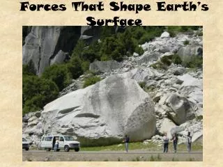
Exploring Earth’s Surface
Exploring Earth’s Surface. Chapter 1 Section 3. Standard. S.6.2 Topography is reshaped by the weathering of rock and soil and by the transportation and deposition of sediment. Anticipatory Set. Language of the Discipline. Topography Elevation Relief Plain Mountain Plateau Map Scale

Exploring Earth’s Surface
E N D
Presentation Transcript
Exploring Earth’s Surface Chapter 1 Section 3
Standard • S.6.2 • Topography is reshaped by the weathering of rock and soil and by the transportation and deposition of sediment.
Language of the Discipline • Topography • Elevation • Relief • Plain • Mountain • Plateau • Map • Scale • Degree • Latitude • Longitude
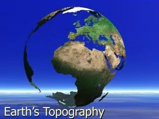
Topography (Input) • Definition- is the shape of the land. • It may be flat, sloping, hilly or mountainous • Topography includes the area’s elevation, relief and landforms. • Elevation- the height above sea level of a point on Earth’s surface • Relief- the difference in elevation between the highest and lowest parts of an area • Look at diagram on page 21
Types of Landforms (Input) • They vary in size and shape • Plains- a landform made up of flat or gently rolling land • If it is by the coast it is called a costal plain • If it is not by the coast it is called an interior plain
Mountains (Input) 2. Mountains- a landform with high elevation and high relief. They are normally in a mountain range • Mountain Range- mountains that are closely related in shape, structure and age • Mountain ranges in a long, connected chain form a larger called unit called a mountain belt (Rocky Mnts)
Plateaus (Input) 3. Plateaus- a landform that has high elevation and a more or less level surface • Streams and rivers cut into the surface (hardly smooth) • Columbia Plateau- rocks are stacked 1,500 meters thick
What is a Map? (Input) • Map- a flat model of all or part of Earth’s surfaces as seen from above. • Maps are drawn to scale and use symbols to represent topography and other features on Earth’s surface. • Scale- relates distance on a map to a distance on Earth’s surface. It is given as a ratio. • Mapmakers use shapes and pictures called symbols for features of Earth’s surface.
Map’s Continued (Input) • A symbol can represent a river, lake, mountain, or play • A symbol can also stand for a man made feature- a highway, city or airport • Map Key/Legend- is a list of all of the symbols used on the map and their meanings • Maps also include a compass rose or north arrow • North is usually located at the top of the map
Earth’s Grid (Input) • You need a grid to help you keep track of where you are • To locate positions on Earth’s surface, scientists use units called degrees. • Each degree is a measure of an angle formed by lines drawn from the center of Earth to points on the surface.
Equator (Input) • Halfway between the North and South poles is an imaginary line that circles the Earth • This equator divides the Earth into a Northern Hemisphere and a Southern Hemisphere. • Hemisphere- one half of the sphere that makes up Earth’s surface • Look at wall map. Locate equator, Northern and Southern Hemispheres
Prime Meridian (Input) • Another imaginary line • Makes a half circle from the North Pole to the South Pole. • If they are East of the line, they are in the Eastern Hemisphere. • If they are West of the line, they are in the Western Hemisphere. • Look at wall map, locate prime meridian, and East and West Hemispheres
Locating Points (Input) • The lines of latitude and longitude on a map form a grid that can be used to find locations anywhere on Earth. • The equator is the starting line to meausre latitude • North to South • The Prime meridian is the starting line to meausre longitude • East to West
Using Latitude and Longitude (Input) • Any location on Earth can be expressed in terms of the latitude and longitude lines. • Look at page 27 and picture of globe • Explain how they found London • What would be the latitude and longitude for Los Angeles? • What would be the latitude and longitude for Sydney?
Checking for Understanding • True or False • Elevation and relief are part of an area’s elevation?
Checking for Understanding • What is the landform that has high elevation but a level surface (relief)?
Checking For Understanding • Draw a world map and label the equator and the prime meridian
GP and IP • Guided Practice • #1-3 • Stop!!! You must have a stamp to keep going! • Independent Practice • #4-6 • Homework • #7-end