Download
1 / 146
1.46k likes | 1.82k Views
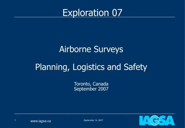
Exploration 07. Airborne Surveys Planning, Logistics and Safety Toronto, Canada September 2007. Presenters. John Issenman, IAGSA Chief Operating Officer Stan Medved, Manager Aviation Safety - BHP Billiton, IAGSA Technical Committee Chair and Executive Committee Member.

E N D
Exploration 07 Airborne SurveysPlanning, Logistics and SafetyToronto, CanadaSeptember 2007
Presenters • John Issenman, IAGSA Chief Operating Officer • Stan Medved, Manager Aviation Safety - BHP Billiton, IAGSA Technical Committee Chair and Executive Committee Member
Airborne Surveys – Planning Logistics & Safety • Introduction and Accident Rate Review 09:00-09:10 • Review of Typical Business Process & Logistics 09:10-09:30 • Geophysical Goals Versus Aviation Constraints • Fixed Wing Safety Considerations 09:30-10:20 • Break • Helicopter Safety Considerations 10:40-11:30 • Introduction to IAGSA Standards 11:30-12:00 • Lunch • Sample Survey Flight Specifications & 13:00-14:00 • Risk Analysis • Accident Case Studies 14:00-14:30 • Break • Accident Case Studies (cont) 14:50-15:30 • Conclusions 15:30-16:00
Why form IAGSA? • After a particularly bad year in 1995 (5 aircraft lost; 10 fatalities) several survey companies decided to form the International Airborne Geophysics Safety Association (IAGSA) • Mandate: • To develop promote and enhance safety in the industry • Develop standards and recommended safety practices for survey operations • To serve as a repository of safety information relevant to the industry • To educate clients on the relevant safety topics to assist in writing appropriate contract specifications
What has IAGSA done so far? • Developed “Standards” and “Recommended Practices” for the industry; published in a Safety Policy Manual • Developed a “Recommended Contract Annex” based on the Safety Policy Manual for clients to add to their requirements (more on this later) • Gathered accident and activity data • Gathered safety advisories for sharing among members
What has IAGSA done so far? • Implemented an accreditation program to review Active Member compliance with IAGSA policies • Funded a special project to develop risk analysis tools for high elevation helicopter autorotations • Established website where much of the above information may be obtained www.iagsa.ca
How are we doing? • IAGSA gathers accident and activity data to develop meaningful accident rates • Each Active Member provides annual activity data (i.e. flying hours) for each category of aircraft • In addition, the number of fatal and non-fatal accidents is compiled • These data are used to calculation accident rates normalized to 100,000 flying hours – (convention aviation accident statistics throughout the world)
Accident Rate Review • Airborne Geophysics Survey Industry overall accident rate (fixed and rotary wing) has come down from 11 in 1998 to 2 in 2005 • Fatal rate over same time has come down from 6 to 1 per 100,000 hours • North American/European/Australian non-scheduled commercial air services (fixed and rotary) rates are approximately 10 (total) and 1 (fatal) per 100K hours, respectively
Accident Rate Observations • Since IAGSA inception, the accident rates have trended in the right direction • One in two survey accidents result in a fatality compared with one in ten for non airline commercial aviation • Analysis of survey accidents has shown: • the inability to clear high terrain while flying lines is a factor • high proportion of piston engine fixed wing aircraft
End of Part 1: Introduction and Accident Rate Review QUESTIONS?
A request for proposals or a tender document is issued to eligible bidders The RFP specifies, among other things, how the client expects the survey to be flown It is important that the client know what is “reasonable” to expect from various aircraft over differing terrain with the desired survey equipment Step 1 – Tender Issue
A bid is prepared during which the bidder considers: Suitable types of aircraft for the requested survey data and equipment Terrain over which the survey it to be done Specs for flying height, speed and data resolution Costs A risk assessment is completed to determine whether the survey can be completed safely as requested or with mitigations applied If the answer is NO, it will be difficult to submit a conforming bid! (so will someone else bid on it?) Step 2 – Bid Preparation & Acceptance
Step 3 – Crew Assembly Field crew is assembled and mobilized: • One or two geophysicists or logisticians • One or two pilots • Possibly one onboard technician • Probably one Aircraft Maintenance Engineer (AME) • Risk analysis updated based on any amendments to contract and subject to crew input upon arrival on site
Step 4 – Logistics Support • Aircraft availability – Foreign registration of aircraft, aircraft modifications • Air Operator Certificate • Permits • Flight crew licensing • Fuel availability – pre-positioning may be required • Spare parts (aircraft and survey equipment) • Hangar access • Office and personnel accommodation • Security
Step 4 – Data Acquisition • First flights to assess validity of assumptions used in risk analysis (e.g.. determine suitability of digital terrain elevation model used and drape surface generated) • Geophysicists process data gathered daily for quality control. • Pilots fly grid lines and may monitor onboard survey equipment. • Technician or operator may monitor onboard survey equipment. • AME ensures aircraft can fly. • Geophysicist performs quality assurance and preliminary field processing
Step 5 – Data Processing Most final data processing, cartography, and production of other final products are done at the operator’s main offices; some done in field for QC and to provide preliminary data to client.
End of Part 2: Review of Typical Business Process QUESTIONS?
Part 3 a: Fixed-wing Safety Considerations In Airborne Geophysics Stan Medved
Fixed Wing Safety Considerations • General factors – What are the goals? What Types of aircraft? • Speed – What does it mean for the geophysicist & the pilot? • Climbing and Descending – which is more demanding? • Multi-engine is always safer – isn’t it?
Fixed Wing Safety Considerations - General • Geophysicist’s goal: • To obtain the best possible data with available resources • How? • Fly low and slow • Increase number / size of sensors • Increase sampling rate • Improve sensor resolution
Fixed Wing Safety Considerations - General • Pilot’s goal: • To safely fly the task within survey specifications • How? • Operate the aircraft within manufacturers’ and regulatory limits • Use a risk management based approach • Regulatory requirements relating to survey flying are minimal compared with other commercial operations
Fixed Wing Safety Considerations - General • Aircraft types: • Typical aircraft are smaller single and twin engine piston and turboprop • A few larger aircraft such as the Fugro Dash 7 and CASA 212 • With a few exceptions aircraft have not been designed for continuous low level operations • Performance implications • Affect on structural integrity • Inappropriate limitations • Aircraft need to be modified
Fixed Wing Aircraft Types • Smaller aircraft designed to FAR Part 23 standards or equivalent • Airline type aircraft designed to the more rigorous FAR Part 25 • This has a significant impact on required and achievable climb performance and system redundancy • Larger aircraft essentially used to provide big EM loop; they are generally too big for other applications
Unmanned Aerial Vehicles • Will become more common • Potential of better performance and safety • Currently payload limited • Large UAVs are more complex than existing manned survey aircraft • Introduces new safety issues
Fixed Wing Safety Considerations - Speed • The speed of an aircraft does not have the same meaning or implications for different people • Geophysicists are concerned with ground speed (GS) • Pilots are primarily concerned with Indicated Airspeed (IAS) followed by True Airspeed (TAS) • What’s the difference?
Fixed Wing Safety Considerations - Speed • Indicated Airspeed (IAS) is what the pilot sees on the airspeed indicator. • Calculated by subtracting static air pressure from the total pressure of the airflow (pitot pressure) and dividing by air density • All aircraft reference speeds are quoted in Indicated Air Speed • Stall (Vs) • Take-off • Landing approach (typically 1.3 Vs) • Best rate of climb (Vy, Vyse), etc • IAS reference speeds remain unchanged regardless of altitude and temperature
Fixed Wing Safety Considerations - Speed • IAS is easy to measure and display to pilot. • IAS only equals true air speed under standard atmospheric conditions i.e. sea level (1013 hPa) & 15C. • As altitude and temperature increase, so does true airspeed for a given IAS. • For example 120 Knots IAS equals a TAS of: Air Temperature 15C 35C Sea Level 120 125 5000 ft 129 134 10,000 ft 139 144 15,000 ft 152 156
Fixed Wing Safety Considerations - Speed • Ground Speed is simply True Airspeed plus the wind effect. • A practical IAS – TAS – GS example: • Cessna 404 minimum safe/practical airspeed is 130 KIAS • New Mexico survey elevation 6000 ft, air temperature 20C • 130 KIAS = 147 KTAS • 15 knot tailwind will give a ground speed of 162 knots • Either accept the higher ground speed or choose a different aircraft which can fly safely at a lower IAS.
Fixed Wing Safety Considerations - Speed • Some definitions: • Stall speed (Vs) – is the minimum Indicated Airspeed at which the aircraft can generate sufficient lift to continue flying; not related to the function of the engine(s)! • Minimum single engine control speed (Vmc) – is the minimum Indicated Airspeed at which a multi-engine aircraft can be controlled with one engine failed and the other producing maximum thrust
Fixed Wing Safety Considerations - Speed • Best single-engine rate of climb speed (Vyse) – is the Indicated Airspeed at which the aircraft will achieve the maximum climb rate with one engine operating at maximum thrust
Fixed Wing Safety Considerations - Speed • For higher data resolution, it is often desirable to fly at low speed • Turbulence, high nose up attitude, and turns make consistent flying at minimum flight manual speeds impractical and unsafe • IAGSA has developed a minimum speed standard for fixed wing aircraft which is the greater of: • 130% of the clean stall speed (Vs) • 110% of the recommended single engine climb speed (Vyse - multi-engine aircraft only)
Fixed Wing Safety Considerations - Speed • IAGSA minimum safe speed examples: • C404 120 knots (KIAS) • C208B 82 knots (KIAS) • These are not intended to be used as target survey speeds but are the lowest Indicated Airspeeds that a pilot should ever see while surveying and manoeuvring.
Fixed Wing Safety Considerations - Speed • Reasons for not flying slower: • You can fly right down to stall speed, but safety margins are eroded to the point where turbulence or a turn will cause the aircraft to stall. At survey heights recovery is unlikely. • You can fly below single engine control speed as long as both engines are operating – lose one and the aircraft will rapidly depart controlled flight. • You can fly below best single engine climb speed – but in the event of an engine failure, the only way to accelerate to this speed is to descend – in most cases not an option at survey heights. • Aircraft are more difficult to control at low speeds.
Fixed Wing Safety - Climbing and Descending • Pilots generally think in terms of climb and descent rates (metres per minute) whilst geophysicists refer to climb or descent gradients (metres per km). • Aircraft performance charts provide climb rates which vary with density altitude. • Typical survey aircraft can achieve a maximum cruise climb rate of 1000 fpm at 120 KIAS. • As survey elevation increases TAS increases and achievable rate of climb decreases.
Fixed Wing Safety - Climbing and Descending • An Example: • At sea level 120 KIAS and rate of climb (ROC) of 1000 feet per minute (fpm) results in a climb gradient of 8.3% (i.e. 83 metres per km) • At 5000 feet 120 KIAS equals 129 KTAS and ROC will typically decrease to 900 fpm. Climb gradient reduces to 7.0% • Add a 15 knot tailwind and climb gradient decreases to 6.25%
Fixed Wing Safety - Climbing and Descending • Desirable to have the aircraft maintain constant height over the ground • In practice the maximum sustainable climb gradients are between 5 and 10% (slower airplane; steeper gradient) • Landing approach gradients are typically 3 - 3.5% • Anything above 4% is considered steep for a landing approach – and the aircraft is configured to achieve a good descent rate gradient (slow, flaps out, landing gear down, low power setting)
Fixed Wing Safety - Climbing and Descending • Survey flying, depending on terrain, necessitates frequent climbs and descents. • We don’t reconfigure the aircraft (landing gear and flaps down) to increase drag to optimise descent gradients on survey • Reluctant to reduce power too aggressively only to reapply for the subsequent climb; speed builds up when descending and limits descent gradient • Achievable descent gradients tend to be shallower than climb gradients!!! • Difficult to calculate accurate descent gradients due to lack of performance chart data – obtained by experience and testing
Fixed Wing Safety - Climbing and Descending Want to climb and descend at same gradient in order to achieve consistent heights at intersections; Generate a “drape” surface
Fixed Wing Safety - Climbing and Descending • Over such steep terrain we “drape” the surface to match the aircraft’s performance; descent performance is usually the limiting factor • The quality of the “drape” depends on the accuracy of the digital elevation data used – much of it is still insufficient for this purpose • Pilots need to be ready for errors in drape and have some performance margin available as shown in the following example: