Download
1 / 39
400 likes | 696 Views
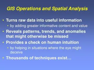
Spatial Decision Support and GIS. NCGIA Core Curriculum Unit 127 - Spatial Decision Support Systems by Jacek Malczewski, Department of Geography, University of Western Ontario, Canada. Using GIS. GIS and computers can synthesize data and perform analysis and modeling

E N D
Spatial Decision Support and GIS NCGIA Core Curriculum Unit 127 - Spatial Decision Support Systems by Jacek Malczewski, Department of Geography, University of Western Ontario, Canada
Using GIS • GIS and computers can synthesize data and perform analysis and modeling • But PEOPLE make decisions! • How can GIS be used as part of the decision-making process? • Decisions can be top down (managers) or bottom-up (public participation)
Spatial Decision Problems The main characteristics of spatial decision problems include: • Many alternatives, • Consequences of the decision alternatives are spatially variable • Each alternative is evaluated on the basis of multiple criteria, • Some of the criteria are qualitative others quantitative • More then one decision maker (or interest group) involved in the decision-making process • Decision makers have different preferences on evaluation criteria and decision consequences • Decisions are often surrounded by uncertainty • NIMBYism etc.
Emergency Management Decision Support GIS For the Tampa Bay Region
Emergency Management • Domestic preparedness • Vulnerability Assesments • Mitigation planning • Training • Incident management • Recovery
Storm Categories
Cat 3Hurricane Storm Categories
RVAM Plot Storm Track Extreme Risk Property Owners Notify Now Input Wind Radii Identify Parcels Notify Owners Assess Damage Assess Future Growth Scenarios
RVAM Assessment Complete Risk Damage Assessment Assess Now Parcels Affected Plot Storm Track Extreme High Moderate 5299 Input Wind Radii 5343 Identify Parcels 7167 Notify Owners Assess Damage $ Building Loss Estimate Assess Future Growth Scenarios Extreme 100% Loss 1,964,336,700 High 75% Loss 1,830,798,900 Moderate 50% Loss 591,793,600 Save Results and Exit? Yes No Future Growth Losses Scenario 1 12,382,300 Yes No Scenario 2 7,564,900
Historical Background • Decision Support System (DSS) based on work by Herbert A. Simon in 1950s and 1960s (Simon 1960); • DSS evolved during the 1970s and 80s • SDSS concept has evolved in parallel • IBM's Geodata Analysis and Display System 1970s earliest large DSS • SDSS has been associated with the need to expand the GIS capabilities for complex, ill-defined, spatial decision problems • Major growth in research, development, and applications of SDSS in the last 10 years • Many threads with different, but related names, such as collaborative SDSS, group SDSS, environmental DSS, spatial knowledge based and expert systems, PPGIS
The Decision-making Process • Simon divides any decision-making process into the phases of decision-making • intelligence- is there a problem or an opportunity for change? • design - what are the decision alternatives? • choice - which alternative is best?
Planning Stages • Problems • Goals • Objectives • Alternatives • Evaluations • Choice • Implementation • Monitoring
Planning Methods • SWOT • Bargaining • Brainstorming • DELPHI • Scenario writing • Consensus building • Public meeting support • Charrette • Consultants • Stakeholder involvement • Outreach
GIS and Decision Support • GISystems have limited capabilities to support the design and choice phases of the decision-making process • GIS provides a static modeling environment , reducing their scope as decision support tools • Especially so in the context of problems involving collaborative decision-making
What is SDSS? • SDSS is an interactive, computer-based system designed tosupporta user or group of users in achieving a higher effectiveness of decision making while solving a semi-structured spatial decision problem; • The three terms (semi-structured spatial problems, effectiveness, and decision support) capture the essence of the SDSS concept
Components of SDSS • Data Base Management System contains the functions to manage the geographic data base • Model Base Management System contains the functions to manage the model base; • Dialog Generation and Management System manages the interface between the user and the rest of the system.
DSS Tools • Procedural programming languages and code libraries (e.g., VB, AML, Avenue, TransCAD - Caliper Script macro language, MapInfo - MapBasic); • Visual progamming language (e.g. STELLA, Cantata and Khoros); • Inter-application communication software (e.g. dynamic data exchange (DDE), object linking (OLE), open database connectivity (ODBC)); • Simulation languages and software (e.g. SIMULINK, SIMULA); • Application programming interfaces (API) (e.g. the IBM's geoManager API, Java Advanced Imaging API, TransCAD's API); • Applets (e.g. GISApplet, Microsoft Visual J++), • Visual interfaces, graphics and color subroutines (e.g. graphical user interfaces – GUI, OpenGL, SVG, etc.)
DSS Generator • Package of related hardware and software which provides a set of capabilities to quickly and easily build a specific SDSS • GISystems (e.g. ARC/INFO, ArcView, ARCNetwork, Spatial Analyst, MapObjects LT, GRASS, IDRISI, MapInfo, TransCAD) • Database packages (e.g. dBase, Access, Paradox); • Decision analysis and optimization software (e.g. LINDO, EXPERT CHOICE, LOGICAL DECISION); • Statistical and geostatistical software (e.g. S-PLUS, SPSS, SAS); • Simulation (e.g. Spatial Modeling Environment)
Specific DSS • Systems devoted to the analysis of a particular set of decision problems • Support decision makers in tackling semi-structured problems • Active Response Geographic Information System • IDRISI Decision Support • GeoMed • Spatial Group Choice • winR+GIS Spatial Decision Support • CommunityVis
Since December, 1942: 130 sites Source: www.prop1.org/ 2000/noflymap.htm
77,000 tons of highly toxic wastethat will be radioactive for hundreds of thousands of years
Where is it now? Wet and dry Source: www.aecl.ca
50 years of decision-making • 1957 NRC report recommended burying the waste in a permanent repository • Need a “safe” site for 77,000 tons of highly radioactive waste • Safe means stable for at least 10,000 years as measured by radionuclides in surface and ground water downstream • Need a stable place, free from hazards • Storage-movement-disposal issues • No solution in spite of 1982 act (DOE by 1998). • Single site eventually chosen
Yucca Mountain Waste Repository What is the radionuclide travel time from the repository to the water table? Question addressed through modeling • Conceptual model selection • Calibration • Predictions
Dual Permeability Fractures can flow even when matrix is unsaturated Calibration could be attained with more reasonable perc. rates of 5 mm/y Travel times to water table of 10’s to 100’s of years possible! Data collection, revised conceptual model, computational model advances Early models Current models UZ Travel Time Predictions: 1995-2003 Effective Continuum • Fractures and matrix assumed to be in pressure equilibrium • Calibration yielded water perc. rates of 0.01 to 0.1 mm/y, dry fractures • Travel times to water table of about 350,000 years Conceptual model uncertainty is critical to assessment of overall system uncertainty
Cl-36 Observations Confirm Rapid Transport Pathways Atmospheric fallout from nuclear weapons testing (1950’s and 1960’s) is present in fluid 200-300 m below ground surface. Fault zones appear to be the pathway. Source: Fabryka-Martin et al., 1997, YMP Milestone SP2224M3
5 Climate Precipitation Waste Package Degradation 1 Unsaturated Zone Flow Seepage 4 Waste Form Degradation From Mountain Crest to Repository ~ 1,000 feet Infiltration 2 Drift Cross Section Unsaturated Zone Flow 3 Near-Field Geo-chemical Environment 6 Radionuclide Mobilization Through Engineered Barrier System Transport Thermal Hydrology Drift Scale Unsaturated Zone Flow and Transport Tpt From Repository to Water Table ~ 1,000 feet 7 GDF Saturated Zone Flow and Transport 8 Tcp Tcp Tcp Biosphere Water 9 Water Well Pathway Plants Key Attributes of Repository Safety Strategy Tcp ~ 20 km Tcp Animals Limited Water Contacting Waste Package Slow Release From Waste Package Amargosa Valley People WATER TABLE Saturated Zone Low Concentration of Radionuclides in Groundwater Long Waste Package Lifetime The Yucca Mountain Decision Model Framework
Many unknowns • Will there be new faults and fractures in the next 100,000 years? • Will the local tectonics remain inactive? • Who will be there to notice in 12,005AD? • What language do you write the warning notice in? • [etc]
Current YMP Total System Model “Overview” Can such a model be “understood” by anyone besides the developer?
Problem N: Controversy DOE Admits Yucca Mt. Safety Information May Have Been Lied AboutMarch 17, 2005, 04:25 PM It's being called a devastating blow to the Yucca Mountain Project -- some of the government's scientific data may have been faked. Workers on the proposed nuclear waste dump are under investigation for lying about their research -- meaning the "sound science" President Bush said he was following might be wrong
New Initiative • SDS Knowledge Portal V1.1 • Support from ESRI-U. Redlands • www.institute.redlands.edu/sds
Summary • SDSS has been defined as an interactive, computer-based system designed to support a user or group of users in achieving a higher effectiveness of decision making while solving a semi-structured spatial decision problem • The SDSS concept is based on the DDM (dialog, data, model) paradigm; a well-design SDSS should have balance among the three capabilities. • There are three sets of technologies for building an SDSS: the DSS development tools, the DSS generators, and specific SDSS • The DSS tools facilite the development of specific SDSS or they can be configured into a DSS generator which in turn can be used to build a variety of specific SDSS.