Download
1 / 27
270 likes | 359 Views
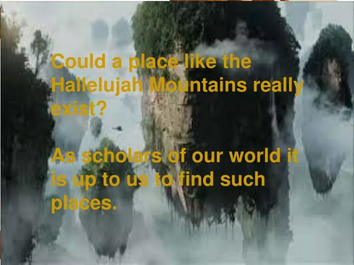
Where in the World????. Do you know where this is? What hemisphere is it in? Or is it in two? What is the climate like? Would you live here? Why? If you did live here what would your culture be like? Would you be well educated by the standards of the modern world?.

E N D
Where in the World???? Do you know where this is? What hemisphere is it in? Or is it in two? What is the climate like? Would you live here? Why? If you did live here what would your culture be like? Would you be well educated by the standards of the modern world? Could a place like the Hallelujah Mountains really exist? As scholars of our world it is up to us to find such places. http://whc.unesco.org/en/list/640/
Geography Chapter 1-Studying Geography
Section 1 Discussion Questions • What are the two main branches of geography? • How do we use Geography? • What are some ways we can organize our world and the study of geography?
Ch. 1 Section 1 • What is Geography? Answer: The study of everything on earth (physical, biological, and cultural features of the Earth) • Observe cities, cultures, plants and resources • Geographers look at perspective (the way a person looks at something) and landscapes (scenery of a place , including its physical, human, and cultural features).
Types of Perspective • Spatial perspective geographers use to study the patterns of location and how things are arranged on earth. • One thing used to study these patterns is landscape • Scenery of a place ( physical and cultural features)
2 Branches of Geography • Human-analyze distribution and characteristics of people (where they live, their jobs, way of life) • Physical-study of earth’s natural environments (landforms, water, atmosphere, animals, plants, soils and processes that affect them)
Who Uses Geography? • Everyone • Cartography-study and making of maps that are either drawn or produced via computers, they publish maps in magazines, atlases and so on Meteorologists-study weather and make predictions based on weather patterns
Other Jobs For Geographers • Work for U.S. Geological Survey • Businesses who want shipping and trucking routes • Tourism, travel, international sales • Teaching (awesome)
How do we study Geography? • Region-area with one or more common features that make it different from surrounding areas. • Defined by physical features - climate, river systems, soils, vegetation • And human features - languages, religions and trade networks • Sometimes regions are defined, sometimes vague (countries, deserts, mountain ranges, suburbs, neighborhoods) Regions of focus 1)Formal- Has one or more features in common 2) Functional- These places are linked together and work as a unit. 3) Perceptual- How we view the world around us
5 Themes of Geography 1. Location-the exact (absolute) or relative spot of something on Earth 2. Place-includes the physical and human features of a location 3. Human-Environment Interaction-ways people and environments interrelate with and affect each other 4. Movement-how people and things change locations and the effects of these changes 5. Region-geographic areas with one or more characteristics
1. Location-the exact (absolute) or relative spot of something on Earth
2. Place-includes the physical and human features of a location
3. Human-Environment Interaction-ways people and environments interrelate with and affect each other
4. Movement-how people and things change locations and the effects of these changes
Section 2 Discussion Questions • How do geographers and mapmakers organize our world? • What kinds of special maps do geographers use? • How do geographers use climate graphs and population pyramids?
Section 2-Skill Building • Organizing the Globe A. Globe vs. Map B. Latitude (parallels) and longitude (meridians) lines make up grid system.
C. Absolute Location -Distances measured in degrees, minutes and seconds D. Hemispheres (N,S,E,W) E. 7 Continents F. 5 Oceans ( Atlantic, Arctic, Indian, Pacific, and Southern)
Making Maps A. Atlas B. Map projections-how globes are transferred to a flat surface C. Most common are cylindrical, conic and flat-plane.
Most Common: Mercator map • Image a piece of paper wrapped around the equator. • Land near equator accurate • land near poles are inaccurate. • Navigators use it because it shows correct direction and shape of landforms Cylindrical
Imagine a paper has been wrapped around a globe like a cone hat. • Where the paper touches the globe are the most accurate depictions shapes and sizes of landmasses: United States and Russia • Useful when studying a location that is far spanning in terms of east to west. • Inaccurate direction Conic
Flat-Plane • Imagine a paper only touching the globe at one point. • True size, but distorts shapes • True directions for airplane pilots and ship navigators.
Review of Map Projections D. Cylindrical-landmasses larger toward poles…Mercator…true direction and shape E. Conic-accurate where lines touch the cone…almost true shape and size F. Flat-plane- true size… poor shapes G. Great Circle Route-shortest distance between two places…confusing
III. Map Components-Scales, Legends, Keys, Compass Rose, Inset Map
Special-Purpose Maps- Beginning of Units A. Political v. Physical B. Climate and Precipitation C. Population and Economic Maps D. Elevation Profiles and Topographic Maps (ex. Contour Maps)
V. Climate Graphs and Population Pyramids-Page 19 Climate Graphs Population pyramid Pop of males and females Left side male Right side female Percentage of pop on the bottom Age of pop along the side Bottom is the youth Top is elderly • Average temp & precipitation • One side temp • One side rainfall • Bottom months