Download
1 / 23
230 likes | 391 Views
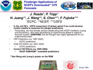
Firedanger Applications of NCEP's Downscaled** CFS Forecasts. J. Roads*, P. Tripp* H. Juang**, J. Wang**, S. Chen***, F. Fujioka*** *ECPC, **NCEP, ***USFS. In the mid 90’s, USFS researchers (Fujioka) asked if we could develop routine weekly to seasonal fire danger predictions.

E N D
Firedanger Applications of NCEP's Downscaled** CFS Forecasts J. Roads*, P. Tripp* H. Juang**, J. Wang**, S. Chen***, F. Fujioka*** *ECPC, **NCEP, ***USFS • In the mid 90’s, USFS researchers (Fujioka) asked if we could develop routine weekly to seasonal fire danger predictions. • Fortunately, we had already started collaborating with NCEP modelers (Juang and Kanamitsu), who were developing an experimental global to regional forecast system (GSM/RSM) that we thought was highly appropriate for our experimental effort. • FWI Predictions (ca. 1997-2000) • ECPC predictions • Initial FDI Efforts (ca. 2001-2004) • ECPC predictions • Current FDI Efforts (ca. 2005-2008) • NCEP GSM/RSM** ensemble predictions **See Wang and Juang’s poster on the RSM
Firedanger predictions • The USFS NFDRS describes the potential for fire danger. • The NFDRS is based on historical USFS wind tunnel, fuel bed research (Rothermal). • The NFDRS uses input from weather stations. • Our long-term goal has been to show that NWP models can provide long-range forecasts of the NFDRS. • USFS and other land agencies could use accurate long-range forecasts for planning purposes. • In fact, there is 1 such meeting each year in early Mar. to make this assessment. • Model resolution is a continual problem. • Long range forecasts use coarse resolution models • Application communities want high resolution input and have started to use some of the regional analysis products • We have been using the NCEP GSM/RSM forecast system to connect to the fire danger application community • The RSM provides relatively high resolution input to FDI • As shown previously, the GSM & RSM have at least comparable forecast skill. • We are hopeful the RSM will eventually be shown to provide additional useful, skillful features
And updated fire statistics (Western States!) A higher resolution Fire Danger Code
Vegetation in 25km Fire Danger Code Model A Annually varying Western grasslands Model B Mature dense fields of brush Model C Open pine stands Model D Southeast coastal pine stands Model F California chaparral Model G Dense conifer with heavy litter Model H Short needled conifers Model L Perennial grasses Model N Florida sawgrass Model O Dense brushlike fuels of Southeast Model P Closted stands of long-needled southern pines Model Q Upland Alsaskan black spruce Model R Deciduous hardword Model S Alaskan tundra Model T Great Basin sagebrush grass Model U Closed stands of western long-needled pines
National Fire Danger Rating System Structure Site Description 1300 LST Observation 24-Hour Observations Carryover Fuel Moistures (FM) Fuel Model Slope Class Live Fuel Types Climate Class Input Relative Humidity Temperature Cloudiness Precipitation Amount Max/Min RH Min Temp Precipitation Duration 100-Hour 1000-Hour Maximum Temperature Periodic Measurements Latitude Wind Speed Live Woody FM Average Annual Precipitation Fuel Stick Moisture Season Code & Greenness Factor (88) KBDI (88) Calculated 1-hr FM 10-hr FM 100-hr FM 1000-hr FM Live FM (88) Drought Fuel Contribution of dead FM to SC Contribution of dead FM to ERC Output Ignition Component IC Spread Component SC Burning Index BI Energy Release Component ERC Optional pathway September 19,2000
USFS Fire Danger Indices Roads, J., F. Fujioka, S. Chen, R. Burgan, 2005: Seasonal Fire Danger predictions for the USA. International Journal of Wildland Fire, Special Issue: Fire and Forest Meteorology, 14, 1-18. • SC is an index of the forward rate of spread at the head of a fire and is sensitive to wind speed. • ER is a number related to the available energy per unit area within the flaming front at the head of a fire. ER is not affected a by wind speed. • IC is a rating of the probability that a firebrand will cause a fire requiring suppression action. SC is a component of IC. • BI is a number related to the contribution of fire behavior to the effort of containing a fire. SC and IC contribute to the BI. • KB is a stand-alone index that can be used to measure the affects of seasonal drought on fire potential. • FWI was derived by Fosberg (1978) who assumed constant fuel (vegetation=grass) characteristics as well as climatic initial conditions. The FWI is most easily applied in practice andprovides a first look at fire danger globally. It is a grassland approximation to BI.
Firedanger predictions • All fire danger indices (except FWI) depend upon the previous FDI history. We must therefore use the best available data to drive the validating and initializing fire code • We use 1 day RSM predictions, which are closely related to NCEP analyses, except we can easily access all the needed variables in near real time with the same model we use for longer-range predictions. • Analysis/Forecast precipitation has been a problem! Fortunately, • Daily CPC precipitation at .25 degrees is now available in near-real time and this precipitation is used in place of predicted precipitation to update the fire danger code every day. (poor man’s LDAS) • We validate the fire danger seasonal forecasts with the validating/initializing fire danger values and now also • Fire occurrence data (counts, ln area burned), which are available at coarse temporal (monthly) and spatial (1-deg.) resolution (cf. A. Westerling).
NCEP Global to Regional predictions • NCEP CFS T62L64 SST forces NCEP GSM T62L28 • NCEP GSM T62L28 forces NCEP L28 RSM (US 50 km) • A continuous series of 1-day runs have now been made from 1982-present, to provide (along with Higgins precipitation) the initialization/validation data for fire danger code • Ten 7-month predictions made monthly starting from 0000 and 1200 UTC of the first 5 days of current month and last 5 days of previous month. • Experimental predictions began Oct. 2004 and have been continued every month without fail since then. • 3 hindcasts (the first two days of month and the last day of the previous month) initialized from the NCEP/DOE reanalysis for the same month but each year 1982-2004, or 23*3 mon. hindcasts. • more hindcast members may be added later if model not upgraded. In fact, many sensitivity experiments are underway • a new land model, increased vertical resolution, etc.
FWI BI KB IC ERC SC CN AC US WestTime Series5 month running means. Validation (dark lines) and 2-month lead forecasts, (red lines)Note summer has largest values
FWI BI KB IC ERC SC CN AC US WestAnomaly Time Series5 month running means. Validation (dark lines) and 2-month lead forecasts, 2+5 (red lines) Note lower values in 80s and higher values in 90’s
RSM FDI fcst biases are fairly similar for all of the indices, note the positive biases along the CA coast and over the GP and the negative values over the US West.Bias errors on the order of 10% of mean values
Tmax, Tmin RHmax, RHmin Precip, Dur. WSP, CLDC RSM RH, T, and pcp have fairly similar biases. It is too cold and wet over the US West, and too hot and dry over the Great plains. The wsp is too high along the coast and over the southern GP and too low over the US West. CLDC not influential
Tmax, Tmin RHmax, RHmin Precip, Dur. WSP, CLDC GSM biases are somewhat similar.GSM fcsts are too warm and dry over most of US. The wsp is too high along the coast and over the GP and too low over the US West. The CLDC bias is the same. Precip, unfortunately, was missing from initial GSM archives. We are now trying to recover GSM precip. to compare GSM & RSM FDIs. Need to determine the sensitivity to input errors
Correlations of MMJJA validations with Mar. 1 forecastDifferent indices have slightly different preferred regions
FDI Correlations 3 month ave. 5 month ave.
Correlation of FDI and ln counts Correlation of FDI and ln acres burned
FDI MJJAS Correlations Mar. 1 Fcst
Summary • We are currently working with NCEP and USFS to develop routine US fire danger forecasts from the CFS • Daily RSM products and observed precipitation from 1982-present now provide a long term fire danger initialization/validation set for an upgraded fire danger model. • This initialization/validation RSM set is used as the initialization/validations for 7-month and historical fire danger prediction ensembles (10+23x3). • Preliminary results for Mar. 1 forecast of MJJAS are encouraging but analysis is continuing. • Need to include additional ensemble forecasts/hindcasts to increase skill and estimate significance! • Need to determine added value of RSM to CFS/GSM • Need to determine added value of GSM/RSM to persistence • Need to determine whether it makes a significant difference if we use 1-day GSM/RSM predictions and obs. Precip. instead of NARR for initialization and validation of FDI. • Need to determine if other skill measures may be better measures of firedanger skill.