Download
1 / 34
340 likes | 444 Views
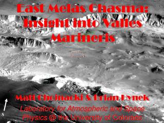
Destabilization of Valles Marineris wallslopes by retreat of ancient glaciers. Daniel MEGE Olivier BOURGEOIS Planetology and Geodynamics Laboratory CNRS Research Unit #6112 University of Nantes, France. 3. 2. 1. Peulvast and Masson, 1993. Valles Marineris wallslope morphogenesis.

E N D
Destabilization of Valles Marineris wallslopes by retreat of ancient glaciers Daniel MEGE Olivier BOURGEOIS Planetology and Geodynamics Laboratory CNRS Research Unit #6112 University of Nantes, France
3 2 1 Peulvast and Masson, 1993 Valles Marineris wallslope morphogenesis • Open air/fluvial? • Submarine/lacustrine? • Glacial/subglacial? • Liquid flows? • Viscous flows? • Dry flows?
Observations at intra-chasma and • inter-chasma ridges, and terrestrial analogs I U S C H A S M A I U S C H A S M A G E R Y O N M O N T E S Doppelgraten (Penck, 1894; Paschinger, 1928) double crest lines Ridge-top splitting
glacial valley glacial valley Ius Chasma ridge width 20 km Bodeneck, Austrian Alps ridge width 8 km
1 km C A N D O R C H A S M A antislope scarps M E L A S C H A S M A
Hoher Trog Oberes Törl Thanks to Jürgen Reitner (Geol. Survey Austria) for this photograph! Austroalpine nappes, Austrian Alps
C A N D O R C H A S M A M E L A S C H A S M A Austroalpine nappes, Austrian Alps Hoher Trog antislope scarps Thanks to Jürgen Reitner (Geol. Survey Austria) for this photograph!
Tatra Mountains (Slovakia and Poland) Nemčok, 1972; Kellog, 1984 Historic study areas Tatra Mountains Tyrol Observation sites: Carpathians, Alps of Europe, Japan, and New Zealand; Cascades, U.S. and Canadian Rockies, Alaska, Andes, Scotland and England Caledonides, Himalaya Western Tatras Jahn, Z. Geomorph., 1964 antislope scarps graben Reitner and Linner, 2009 Oberes Törl, Austrian Alps
old-fashioned wording Sackung (sagging) Zischinsky, 1966 modern talented scientist jargon Deep-seated Gravitational Slope Deformation (DGSD) Deep-seated Gravitational Spreading (DSGS)
inter-chasma ridge intra-chasma ridge chasma wall Valles Marineris ridge-top splitting and antislope scarp sites (more) IUS MELAS (more) base map: Peulvast et al., 2001
Deep-seated gravitational slope deformation Belledonne Range French Alps • antislope scarps • basal bulging post-glacial slope deformation Hippolyte et al., 2006, 2009
100 m SAGGING SLOPE (Geryon Montes) Basal slope bulging in Ius Chasma dipping 11°S slope displacement horizontal vertical exaggeration x1.5 no vertical exaggeration S A G G I N G S L O P E (Geryon Montes) F O L D E D F L O O R (LPSC 2005) H O R I Z O N T A L F L O O R
5 km Deep-seated gravitational spreading in Ius Chasma G E R Y O N M O N T E S antislope scarps basal bulge Mège et al., LPSC 2005
MELAS CHASMA CANDOR CHASMA 10 km CANDOR CHASMA IUS CHASMA 10 km MELAS CHASMA More examples MELAS CHASMA
2 landslide DGSD initial ridge top DSGS prior to ILD deposition! 10 km steep landslide failure plane (56°) Lucas et al., LPSC 2009 + subm. JGR 1 initial ridge top (split) 3 ILD 10 km OPHIR CHASMA CANDOR CHASMA More examples landslide COPRATES CHASMA sturzstrom
s t e e p e n i n g i n i t i a l f a u l t s c a r p d i p a n g l e Steep initial failure dip angle accounts for the shape of the Coprates sturzstrom deposits. Lucas et al., LPSC 2009 + subm. JGR COPRATES LANDSLIDE S1 S2 S3 Granular landslide modelling This is consistent with triggering from deep-seated gravitational slope deformation.
July 29, 1998, debris flow Mount Meager, British Columbia 1998 debris flow Sudden debris flow after decades of slow deep-seated gravitational slope deformation antislope scarps historical rock avalanches Again a post-glacial event! Bovis and Jakob, 2000
oblique view 500 m Beinn Fhada (Long Mountain) Scotland Caledonides 400 m eroded landslide deposits? vertical view • Post-glacial DSGS • Post-DSGS landsliding micro-Candor Chasma landslide analog? antislope scarps
spreading ridge cohesion loss Oberes Törl, Austrian Alps Courtesy by J. Reitner 2. Is DSGS always paraglacial? Possible origin from previous works
postglacial trigger (ridge debuttressing/glacial unloading): 29 32 DSGS trigger studies in international peer-reviewed publications Kobayashi, K. Periglacial morphology of Japan. Biuletyn Periglacjalny 4, 15-36 (1956). Beck, A. C. Gravity faulting as a mechanism of topographic adjustment. New Zealand J. Geol. Geophys. 11, 191–199 (1968). Tabor, R. W. Origin of ridge-top depressions by large-scale creep in the Olumpic Mountains, Washington. Geol. Soc. Am. Bull. 82, 1811-1822 (1971). Radbrush-Hall, D. H., Varnes, D. J. & Savage, W. Z. Gravitational spreading of steep-sided ridges ("sackungen") in western United States. Int. Assoc. Eng. Geol. Bull. 14, 28-35 (1976). Bovis, M.J. Uphilll-facing (antislope) scarps in the Coast Mountains, southwest British Columbia. Geol. Soc. Am. Bull. 93, 804-812 (1982). Beget, J. E. Tephrochronology of antislope scarps on an alpine ridge near Glacier Peak, Washington, U.S.A. Arctic Alpine Res. 17, 143-152 (1985). Holmes, G. & Jarvis, J.J. Large-scale toppling with a sackung type deformation at Ben Attow, Scotland. Q. J. Eng. Geol. London 18, 287-289 (1985). Thorsen, G. W. Splitting and sagging mountains. Washington Geologic Newsletter 17, 3-1 (1992). Reitner, J., Lang, M. & van Husen, D. Deformation of high slopes in different rocks after würmian deglaciation in the Gailtal (Austria). Quaternary Int. 18, 43-51 (1993). Ego, F., Sébrier, M., Carey-Gailhardis, E. & Beate, B. Do the Billecocha normal faults (Ecuador) reveal extension due to lithospheric body forces in the northern Andes? Tectonophysics 265, 255-273 (1996). Bovis, M.J. & Jakob, M. The July 29, 1998, debris flow and landslide dam at Capricorn Creek, Mont Meager Volcanic Complex, southern Coast Mountains, British Columbia. Can. J. Earth Sci. 37, 1321-1334. Agliardi, F., Crosta, G., & Zanchi., A. Structural constraints on deep-seated slope deformation kinematics. Eng. Geol. 59, 83-102 (2001). Smith, L.N. Columbia Mountain landslide: late-glacial emplacement and indications of future failure, Northwestern Montana, U.S.A. Geomorphology 41, 309-322 (2001). Jarman, D. & Ballantyne, C. K. Beinn Fhada, Kintal: An example of large-scale paraglacial rock slope deformation. Scottish Geog. J. 118, 159-168 (2002). Hermann, S. W. & Becker, L. P. Gravitational spreading ridges on the crystalline basement of the Eastern Alps (Niedere Tauern mountain range, Austria). Mitt.Österr. Geol. Ges. 94, 123-138 (2003). Holm, K., Bovis, M. & Jakob, M. The landslide response of alpine basins to post-Little Ice Age glacial thinning and retreat in southwestern British Columbia. Geomorphology 57, 201-216 (2004). Brückl, E. & Paroditis, M. Prediction of slope instabilities due to deep-seated gravitational creep. Natural Hazards Earth System Sci. 5, 155-172 (2005). Hetzel, R. & Hampel, A. Slip rate variations on normal faults during glacial-interglacial changes in surface loads. Nature 435, 81-84 (2005). Kinakin, D. & Stead, D. Analysis of the distributions of stress in natural ridge forms: implications for the deformation mechanisms of rock slopes and the formation of sackung. Geomorphology 65, 85-100 (2005) doi:10.1016/j.geomorph.2004.08.002. Korup, O. Geomorphic imprint of landslides on alpine river systems, southwest New Zealand. Earth Surf. Process. Landforms 30, 783-800 (2005). Ambrosi, C., & Crosta, G. B. Large sackung along major tectonic features in the Central Italian Alps. Eng. Geol. 83, 183-200 (2006). Hippolyte, J.-C., Brocard, G., Tardy, M., Nicoud, G., Bourlès, D., Braucher, R., Ménard, G. & Souffaché, B. The recent fault scarps of the western Alps (France): tectonic surface ruptures or gravitational sackung scarps? A combined mapping, geomorphic, levelling, and 10Be dating approach. Tectonophysics 418, 255-276 (2006), doi:10.1016/j.tecto.2006.02.009. Hippolyte, J.-C., Tardy, M. & Nicould G. Les failles récentes des Grands-Moulins (Savoie) : un sackung (tassement gravitaire) majeur dans les Alpes françaises. C. R. Geosci. 338, 734-741 (2006). Hürlimann, M., Ledesma, A., Corominas, J. & Prat, P. C. The deep-seated slope deformation at Encampadana, Andorra: representation of morphologic features by numerical modelling. Eng. Geol. 83, 343-357 (2006). Jarman, D. Large rock slope failures in the Highlands of Scotland: Characterization, causes and spatial distribution. Engineering Geol. 83, 161-182 (2006). Turnbull, J.M. & Davies, T.R.H. A mass movement origin for cirques. Earth Surf. Process. Landforms 31, 1129-1148 (2006). Wilson, P., & Smith, A. Gomorphological characteristics and significance of Lat Quaternary paraglacial rock-slope failures on Skiddaw Group terrain, Lake District, northwest England. Geografiska Annaler 88, 237-252 (2006). Ustaszewski, M., Hampel, A. & Pfiffner, O. A. Composite faults in the Swiss Alps formed by the interplay of tectonics, gravitation and postglacial rebound: an integrated field and modelling study. Swiss. J. Geosci. (Eclogae Geologicae Helvetiae) 101, 223-235 (2008). Hippolyte, J.-C., Bourlès, D., Braucher, R., Carcaillet, J., Léanni, L., Arnold, M., & Aumaitre, G. Cosmogenic 10Be dating of a sackung and its faulted rock glaciers, in the Alps of Savoy (France). Geomorphology108, 312-320 (2009). Reitner, J., & Linner, M. Formation and preservation of large scale toppling related to alpine tectonic structures – eastern Alps. Austrian J. Earth Sci. 102, 69-80 (2009).
postglacial trigger (ridge debuttressing/glacial unloading): 29 • possible in theory • never documented Rogers and Watkins, 2003 32 DSGS trigger studies in international peer-reviewed publications
postglacial trigger (ridge debuttressing/glacial unloading): 29 • possible in theory • never documented Rogers and Watkins, 2003 2 reported (controversial) cases Loma Prieta, 1989 (Ponti and Wells, 1991) Northridge, 1994 (Harp and Gibson, 1996) 32 DSGS trigger studies in international peer-reviewed publications
postglacial trigger (ridge debuttressing/glacial unloading): 29 • possible in theory • never documented Rogers and Watkins, 2003 ridge edification by river incision and evaporite flow Somali plateau (Mège et al., submitted) Canyonlands grabens-type spreading 2 reported (controversial) cases Loma Prieta, 1989 (Ponti and Wells, 1991) Northridge, 1994 (Harp and Gibson, 1996) 32 DSGS trigger studies in international peer-reviewed publications sandstone gypsum +
sandstone gypsum summit graben Gravitational spreading, Somali plateau Mège et al., submitted
postglacial trigger (ridge debuttressing/glacial unloading): 29 • possible in theory • never documented Rogers and Watkins, 2003 ridge edification by river incision and evaporite flow Somali plateau (Mège et al., submitted) Canyonlands grabens-type spreading 1 unelucidated case (seismic shaking dismissed) South Italy (Rizzo and Leggeri, 2004) 2 reported (controversial) cases Loma Prieta, 1989 (Ponti and Wells, 1991) Northridge, 1994 (Harp and Gibson, 1996) 32 DSGS trigger studies in international peer-reviewed publications +
-- Deglaciation seems by far to be the most likely DSGS trigger in Valles Marineris --
-- Deglaciation seems by far to be the most likely DSGS trigger in Valles Marineris -- 3. Are there other hints of ancient glaciers in Valles Marineris?
trimlines 600 m Ius Chasma formerly interpreted as normal fault scarps… Mège, 1994 Peulvast et al., 2001 … but no clear length/displacement scaling law and poor segmentation! trimline (highest extent of glacier) Tana glacier, Alaska Molnia, 2004
I U landslide deposits S G E R Y O N M T S E O N I U S C H A A M F S L O O R 10 km Possible trimlines I U S C H A S M A
trimline 5 km ?? Glacial receding since Little Ice Age trimline subglacial polished rocks 600 m 500 m chasma floor Thrilling Candor Chasma analog in Svalbard Evans, Quat. Sci. Rev., 2009 Candor Chasma Svalbard Longyearbreen glacier
2 km Is a glacier still present in Candor Chasma? +1200 m -4000 m ILDs -4200 m -4500 m -3000 m MASKED GLACIER? EXPOSED SUBGLACIAL ROCKS TRIMLINE ground moraine ILDs
2 km 200 m 100 m 1 km Receding glaciers northeastern Ius Chasma Valley glaciers in northern Nepal, Higher Himalaya Central Candor Chasma ice melting humocky topography depending on local melting conditions and relative ice/rock ratio
100 m 2 km Glacial valley in southern Tibet MELAS CHASMA Ius Chasma GERYON MONTES (DSGS)
Conclusions Morphology and structure of intra- and inter-chasma ridges in Valles Marineris point to the existence of ancient valley glaciers in all the major chasmata, hence equatorial glaciations(it can be shown that the glaciers producing DSGS were present before ILD deposition). From trimline height, preliminary measurements suggest that the thickness of some glaciers may have been ~ 0.5 - 2 km. Wallrock has been very weak since deglaciation, providing a mechanical framework for widespread mass wasting processes during the Amazonian (Peulvast et al., 2001).