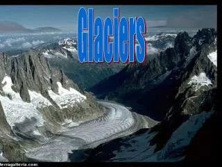
Glaciers
440 likes | 827 Views
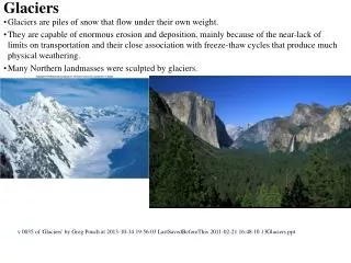
Glaciers. Pleistocene. HOW THE GREAT LAKES WERE FORMED BIBLIOGRAPHY www.great-lakes.net/ -- GLIN (Great Lakes Information Network) -- The Great Lakes Information Network (GLIN) is a partnership that provides a wealth of information on the Great Lakes region.

Glaciers
E N D
Presentation Transcript
HOW THE GREAT LAKES WERE FORMED • BIBLIOGRAPHY • www.great-lakes.net/ -- GLIN (Great Lakes InformationNetwork) -- The Great Lakes Information Network (GLIN) is a partnership that provides a wealth of information on the Great Lakes region. • www.great-lakes.net/teach/ -- a GLIN Partner: exploringthe History, Culture, Geography and commerce of the Great Lakes region. • www.on.ec.gc.ca/great-lakes-atlas/intro.html -- Produced byEnvironment Canada, an excellent resource on the Great Lakes, including physical characteristics, natural processes,people, concerns, joint management and new directions (mirrored on the U.S. - E.P.A. site). • www.geo.msu.edu/geo333/ -- Michigan State University,Geography Dept. - a site about the geography of Michigan and the Great Lakes Region.