Download
1 / 16
160 likes | 277 Views
2012 Land cover mapping of the Glacial Habitat Restoration Area (GHRA). Josephine (Jo) Horton Ron Gatti Wisconsin Dept. of Natural Resources Wildlife and Forestry Research Section. Overview. The Glacial Habitat Restoration Area Why was an updated map needed? Classification process

E N D
2012 Land cover mapping of the Glacial Habitat Restoration Area (GHRA) Josephine (Jo) Horton Ron Gatti Wisconsin Dept. of Natural Resources Wildlife and Forestry Research Section
Overview • The Glacial Habitat Restoration Area • Why was an updated map needed? • Classification process • General trends in land cover composition (1990 and 2012) • GHRA goals vs. results
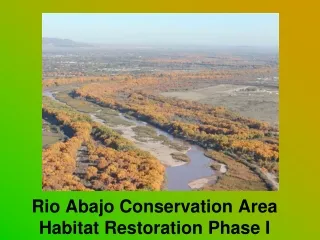
GHRA Goals2 Restore 11,000 acres of drained wetlands Establish grassland nest cover of 38,600 acres within the GHRA Restore 20,000 acres of grassland
Existing Land Cover Maps • WiscLand • Based on 1991-1993 statewide imagery • National Land Cover Database • Based on 2006 imagery • 2012 USDA National Ag. Statistic Service Survey • Does not evaluate non-crop land • Needed a map that was current AND evaluated non-crop land cover
Reference Data Collection -Reference data was collected in June and July of 2012 -Digitized into ArcGIS and imported into ENVI -Total of 2543 reference points used in ENVI for classification and cross-validation
Imagery Selection/Correction -6 images (April – Sept, 2012) with minimal cloud cover -Neighborhood Similar Pixel Interpolator3 -60-band multi-temporal ‘stacked’ image
Process -Linear Support Vector Machine (SVM) algorithm, 80/20 K-class cross-validation for accuracy assessment -Post-classification inclusion of soil data -Evaluate land cover change and possible associations with wildlife population changes
GHRA Grassland Change 1990-2012 (acres) -CRP lost 4,700 acres since peak
Results vs. Goals • Goal-restore 11,000 acres of Wetland • Water and Cattail areas +7,700 acres (70% of goal) • Including Shrubs +17,700 acres (161% of goal) • Goal-total of 38,600 acres of Grass • Total Grass based on Satellite was 82,000 acres in 2012 (75,000 acres in 1990) • Goal-restore 20,000 acres of Grass • Total Grass +7,100 acres (35% of goal) • Upland Grass -3,200 acres • If CRP had stayed at peak, 93% of goal
Summary • Creation of updated map allowed for GHRA land cover composition change to be evaluated • Loss of grassland on private land is a challenge for conservation • Wetland restoration in the GHRA close to meeting/exceeded goals for the project • Total initial grassland was greater than tabular data indicated, but restoration goals were not met
Acknowledgements • This project was supported through the WDNR Bureau of Science Services, with Federal Aid in Wildlife Restoration Project W-160-P funds. • Philip Polzer, Ross Jackson • Ron Gatti, Brian Woodbury, Aaron Wright, Karl Martin, Eric Erdmann, and Alan Crossley of the WI DNR • John Krapful, Jim Lutes, and Kurt Waterstradt of the US FWS • Gregg Kidd of the US NRCS • Annemarie Schneider and Carly Mertes of the UW-Madison
References • Polzer, P. 1992. Assessment of classification accuracy improvement using multi-temporal satellite Data: case study in the Glacial Habitat Restoration Area in east-central Wisconsin. Thesis, University of Wisconsin, Madison, USA. • Crossley, A., T. Peterson, S. Ugoretz, and G. Albright. 1990. Glacial Habitat Restoration Area environmental impact statement and feasibility study. Wisconsin Department of Natural Resources, Unpublished Report. Madison, WI, USA. • Chen, J., X. Zhu, J. Vogelmann, F. Gao, and S. Jin. 2011. A simple and effective method for filling gaps in Landsat ETM+ SLC-off images. Remote Sensing of Environment 115:1053-1064.