Geography Mapwork
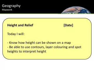
Geography Mapwork. Height and Relief [Date] Today I will: K now how height can be shown on a map Be able to use contours, layer colouring and spot heights to interpret height. Geography Mapwork. There are three different ways to show height on a map. These are:. 1. Layer Colouring.

Geography Mapwork
E N D
Presentation Transcript
Geography Mapwork • Height and Relief [Date] • Today I will: • Know how height can be shown on a map • Be able to use contours, layer colouring and spot heights to interpret height
Geography Mapwork There are three different ways to show height on a map. These are: 1. Layer Colouring 0-10m 11-20m 21-30m
Geography Mapwork Geography Mapwork 2. Spot heights
Geography Mapwork 3. Contours 30 20 10
Geography Mapwork 10 10 10 10 20 20 30 20 10 20 30 30 30 20 20 30 20 10 30 10 20 10 20 20 10 10 10 10
Geography Mapwork Relief is the shape of the land.
Geography Mapwork
Geography Mapwork Contours are lines which join up places of equal heights. Contours that are close together show steep slopes. Contours that are far apart show gentle slopes.
Geography Mapwork
80 70 60 30 50 50 10 40 30 20 30 150 20 100 50 10 50 100