Download
1 / 34
350 likes | 529 Views
Cyclone Hazard Risk Profile of Coastal Districts of India. M. MOHAPATRA , G.S. MANDAL*, B. K. BANDYOPADHYAY and AJIT TYAGI. India Meteorological Department Mausam Bhavan, Lodi Road, New Delhi-1100 03. Presentation Layout. Introduction Data and Methodology Results and discussion

E N D
Cyclone Hazard Risk Profile of Coastal Districts of India M. MOHAPATRA, G.S. MANDAL*, B. K. BANDYOPADHYAY and AJIT TYAGI India Meteorological Department Mausam Bhavan, Lodi Road, New Delhi-1100 03.
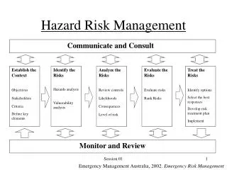
Presentation Layout • Introduction • Data and Methodology • Results and discussion • Conclusions
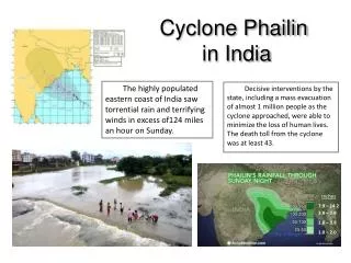
Tropical Cyclone Extreme Weather Events Causes major loss of lives and live stocks. In single event 2 to 3 lakh people lost lives. (Bangladesh Cyclone, November 1970.) Only weather system which bears name or identification because of long life. Eye-wall Eye Spiral cloud bands Convective cells
Special features • globe, five form over north Indian Ocean • Ratio of TCs between Bay of Bengal and Arabian Sea – 4:1 • Year to year variation - Quite large • 13 coastal States/UTs are vulnerable to cyclones North Indian Ocean • Bay of Bengal is a vast warm pool adjoining the warm pool of the western North Pacific. Several of the precursors of the Bay of Bengal cyclones emerge from the neighbouring Pacific basin as remnant of typhoons and re-intensify over the Bay after passing over rather narrow strip of SE Asian countries • Ocean currents in the Bay of Bengal are quite complex and in the post-monsoon season low salinity warm waters begin to cover eastern coastal waters from October to December through the East India Coastal Current
IMD is the nodal Govt. agency to provide cyclone warning services in India. There is no accepted definition to define cyclone prone district. For better cyclone disaster management in the country it is necessary to define cyclone proneness and identify cyclone prone coastal district. Necessary to decide degree of hazard proneness of a district to prioritize mitigation measures and for sustainable land use planning. Study made an attempt to prepare a list of Cyclone Prone Districts by adopting Hazard criteria. Objective
Frequency and intensity of cyclones crossing different coastal states and different latitudinal belpts Vulnerability Atlas of India (BMTPC-Ministry of Urban Development) Based on above study identification of cyclone prone district by a Committee headed by Prof. A.S.Arya. National Cyclone Guidelines prepared by NDMA also listed the same. Earlier Study
Probable Maximum Storm Surge in meters for each coastal District A shallower bathymetry piles up the surge more Source: IMD
Data and Methodology • For the purpose of study, the following districts has been taken into consideration : • Districts touching coast. • Coastal districts as per the Vulnerability Atlas of India published by BMTPC. • Districts considered as coastal districts for the issue of cyclone warning by India Meteorological Department (IMD).
Data and Methodology • To find out cyclone proneness of a district, a composite rating procedure has been adopted based on five parameters, viz • Total number of Tropical Cyclones, • Total number of severe Tropical cyclones, • Maximum wind, • Probable maximum storm surge and • Probable maximum precipitation for any station in the district. These parameters take into consideration the frequency and intensity of TCs along with associated adverse weather conditions. Based on different categories of ratings, the districts have been classified into moderately prone, highly prone and very highly prone districts.
Data and Methodology • Data on cyclone, severe cyclone and very severe cyclone frequencies affecting each district • India Meteorological Department has brought out an electronic version “Tracks of Storms and Depressions in the Bay of Bengal and the Arabian Sea”, which were published by IMD in the years 1964, 1979 and 1996. • IMD publication Mausam Journal • Data for Max Wind, Probable Max Storm Surge and Probable Max Precipitation • Vulnerability Atlas published by BMTPC, Ministry of Urban Affairs, Govt. of India, which again based on data of IMD. • IMD publication in Mausam Journal • PMP Atlas published by IMD • Storm Surge Monograph published by IMD
Categorisation of districts based on degree of proneness • Different districts have been rated in a 10 point scale as per the following four categories with the above parameter. • The intensity of proneness has been discussed accordingly. • Different ratings used for different cyclone parameters. • The same scale has been used as that in Vulnerability Atlas for the rating purpose to maintain conformity.
Rating based on cyclones and severe cyclones crossing the district • Total number of cyclones (b) Total no. of severe cyclones
Rating based on PMW and PMSS (c) Maximum wind (mps) over the district (d) Probable maximum storm surge over the district
District Rating (d) Probable daily maximum Precipitation (in cm) over the district • The rating scale is same for maximum wind as used in vulnerability atlas.
District Rating • A composite score/rating has been calculated taking the arithmetic mean of all ratings. • The composite score has been further been divided into four categories like • low (≤3), • moderate (>3 and ≤5), • high (>5 and ≤7) and • very high (>7) to find out the intensity of cyclone proneness of districts. For islands and some districts for which PMSS is not available, the composite rating has been found out using remaining parameter.
Methodology (i) Different Weights • Classification of Districts as Low, Medium, High and Very • High based on weight: • Total number of cyclones crossing districts (w1) = 1 • Total number of severe cyclones crossing districts (w2) = 2 • PMP for the district (w3) = 2 • Strong wind affecting the district (w4) = 3 • PMSS for the district (w5) = 5 • (Maximum weight is given to storm surge followed by wind, as the maximum hazard is associated with storm surge followed by wind.)
Methodology (ii) Equal Weights • Classification of Districts as Low, Medium, High and Very • High based on equal weight to all parameters: • Total number of cyclones crossing districts (w1) = 1 • Total number of severe cyclones crossing districts (w2) = 1 • PMP for the district (w3) = 1 • Strong wind affecting the district (w4) = 1 • PMSS for the district (w5) = 1
Methodology(iii)Cyclone Prone Districts based on BMTPC Wind Atlas The above classification has the limitation as, it does not distinguish between the maximum wind due to squall and that due to cyclone As a result it gives almost uniform weightage to all districts in east coast.
Methodology (iv)Cyclone Prone Districts based on actual wind Actual wind is collected from the reports published by IMD for the period 1971-2008 in MAUSAM Weightage to wind is given based on Damage Potential published by IMD According to damage potential, wind has been classified in this study into four categories. Overall damage as largr, extensive and catastrophic has been grouped together with highest rating System Wind speed Rating Cyclonic Storm: 34-47 Knots (62-87 Kmph) 03 Severe Cyclonic Storm 48-63 Knots (88-117 Kmph) 05 Very severe Cyclonic Storm 64-90 knots (118-167 kmph) 07 Very Severe Cyclonic Storm 91-119 knots (168-221 kmph) 10 Super Cyclonic Storm 120 knots and more 10 (222 kmph or more)
Category : Cyclonic storm T Number : T2.5 Wind speed : 34-47 Knots 62-87 Kmph Structures : Damage to thatched huts Communication and power: Minor damage to power and communication lines due to breaking of tree branches. Road/Rail : Major damage to Kutcha and minor damage to Pucca roads. Agriculture : Some damage to paddy crops, Banana, Papaya trees and orchards. Marine Interests : High to very high sea waves about 6-9 m high. Coastal Zone : Sea water inundation in low lying areas after erosion of Kutcha embankments Overall Damage Category : Minor to Moderate Impact of Cyclonic Storms
Category : Severe Cyclonic storm , T Number : T3.5 Wind speed : 48-63 Knots (88-117 Kmph) Structures : Major damage to thatched houses / huts. Roof tops may blow off. Unattached metal sheets may fly. Communication and power: Minor damage to power and communication lines. Road/Rail : Major damage to Kutcha and some damage to Pucca roads. Flooding of escape routes. Agriculture : Breaking of tree branches, uprooting of large avenue trees. Moderate damage to Banana and Papaya trees. Large dead limbs blown from trees. Marine Interests : Phenomenal seas with wave height 9-14 m. Movement in motor boats unsafe. Coastal Zone : Major damage to coastal crops. Storm surge upto 1.5m (area specific) causing damage to embankments/ salt pans. Inundation upto 5 Km in specific areas. Overall Damage Category : Moderate Impact of Cyclones
Category : Very Severe Cyclonic storm , T Number : T4.0 – 4.5 Wind speed : 64-90 Knots (118-167 Kmph) Structures : Total destruction of thatched houses/ extensive damage to Kutcha houses. Some damage to Pucca houses. Potential threat from flying objects. Communication and power: Bending/uprooting of power and commn poles. Road/Rail : Major damage to Kutcha and Pucca roads. Flooding of escape routes. Minor disruption of railways, overhead power lines and signaling systems. Agriculture :Widespread damage to standing crops plantations, orchards, falling of green coconuts and tearing of palm fronds Blowing down bushy trees like mango. Marine Interests : Phenomenal seas with wave heights more than 14m. Visibility severely affected. Movement in motor boats and small ships unsafe. Coastal Zone : Storm surge up to 2 m, Inundation up to 10 Km in specific areas. Small boats, country crafts may get detached from moorings. Overall Damage Category : Large Impact of Cyclones
Category : Very Severe Cyclonic storm , T Number : T5.0 – 6.0 Wind speed : 91-119 Knots (168-221 Kmph) Structures : Extensive damage to all types Kutcha houses, some damage to old badly managed Pucca structures. Potential threat from flying objects. Communication and power: Extensive uprooting of power and communication poles. Road/Rail : Disruption of rail / road link at several places. Agriculture :Extensive damage to standing crops plantations, orchards. Blowing down of Palm and Coconut trees. Uprooting of large bushy trees. Marine Interests : Phenomenal seas with wave heights more than 14m. Movement in motor boats and small ships not advisable. Coastal Zone : Storm surge up to 2 – 5 m, Inundation may extend up to 10-15 Km over specific areas. Large boats and ships may get torn from their moorings, country crafts may get detached from moorings Overall Damage Category :Extensive Impact of Cyclones
Category : Super Cyclonic storm , T Number : T 6.5 and above Wind speed : 120 Knots and above (222 Kmph and above) Structures :Extensive damage to non concrete residential &industrial building. Structural damage to concrete structures. Air full of large projectiles. Communication and power: Uprooting of power and communication poles. Total disruption of communication and power supply. Road/Rail : Extensive damage to Kutcha roads and some damage to poorly repaired pucca roads. Large scale submerging of coastal roads due to flooding and sea water inundation. Total disruption of railway and road traffic due to major damages to bridges, signals and railway tracks. Washing away of rail / road links at several places. Agriculture :Total destruction of standing crops/orchards, uprooting of large trees & blowing away of palm and coconut crowns, stripping of tree barks. Marine Interests : Phenomenal seas with wave heights more than 14m. All shipping activity unsafe. Coastal Zone : Extensive damage to port installations. Storm surge more than 5m, Inundation up to 40 Km in specific areas and extensive beach erosion. All ships torn from their moorings. Flooding of escape routes. Overall Damage Category :Catastrophic Impact of Cyclones
Classification of cyclone prone districts • All coastal districts are cyclone prone. • Therefore, it become imperative to decide degree of proneness. • In general, coastal districts in WB, Orissa, AP & TN are in high to very high category. • Some interior districts in NE India(earlier included in BMTPC atlas) excluded. • Cyclone proneness is very high for the districts of south 24 praganas & Midnapore (West Bengal), Balasore, Kendrapara, Bhadrak, Jagatsinghpur & Ganjam (Orissa), Nellore, Guntur, east Godabari (Andhra Pradesh)
Considering variable weightage of parametres pictures, become to some extent, unrealistic. Results with equal weight and hazard parameters give realistic picture of hazard proneness. Categorization of districts with degree of proneness tallies with observed pictures. Analysis does not include vulnerability aspects. As such, do not represent total risk. Separate studies need to be carried out in micro-scale to determine composite risk of an area/place. Apart from its utility in monitoring, prediction and early warning of TCs over small spatial scale, the studies can be utilized for district planning, especially for relief & rescue operation, cyclone shelter construction and socio economic development. Classification of cyclone prone districts