Download
1 / 2
20 likes | 134 Views
GEOVIQUA OBJECTIVES. CONTACT. GEO Label Questionnaire.

E N D
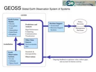
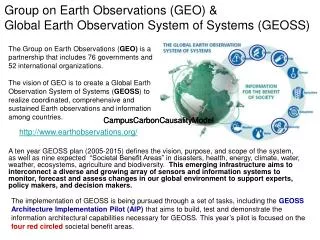
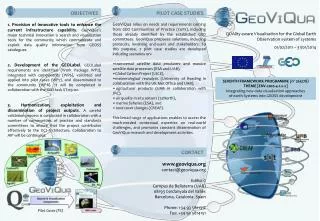
GEOVIQUA OBJECTIVES CONTACT GEO Label Questionnaire 1. Provision of innovative tools to enhance the current infrastructure capability. GeoViQua’s major technical innovation is search and visualization tools for the community which communicate and exploit data quality information from GEOSS catalogues. 2. Development of the GEOLabel. GEOLabel requirements are identified (Work Package WP2), integrated with components (WP6), validated and applied into pilot cases (WP7), and disseminated to the community (WP8). It will be completed in collaboration with the GEO task ST-09-02. 3. Harmonization, exploitation and dissemination of project outputs. A careful validation process is conducted in collaboration with a number of communities of practice and standards committees to ensure that the project contributes effectively to the GCI architecture. Collaboration to AIP will be continuous. www.geoviqua.org contact@geoviqua.org Edifici C Campus de Bellaterra (UAB) 08193 Cerdanyola del Vallès Barcelona, Catalonia. Spain Phone: +34 93 5811312 Fax: +34 93 5814151 For more information about the GEO Label Questionnaire please contact: Victoria Lush School of Engineering and Applied Science Aston University, Aston Triangle, Birmingham, B4 7ET, UK E-mail: lushv@aston.ac.uk SEVENTH FRAMEWORK PROGRAMME (nº 265178) THEME [ENV.2010.4.1.2-2] Integrating new data visualisation approaches of earth Systems into GEOSS development QUAlity aware VIsualisation for the Global Earth Observation system of systems 01/02/2011 – 31/01/2014 Pilot Cases (PC)
INTRODUCTION GEO LABEL DEVELOPMENT PHASES GEO LABEL QUESTIONNAIRE PARTICIPANTS NEEDED! As part of Phase I of the GEO Label development process, we produced an online questionnaire to collect the initial GEO Label requirements and to identify the role that a GEO Label should serve. The questionnaire consists of more generic questions not to bias the users in any direction. Initial questions attempt to identify whether users believe a GEO Label is relevant to geospatial data; whether users want a single “one-for-all” label or separate labels that will serve particular roles; the function that would be most relevant for a GEO Label to carry; the functionality that users would want to transfer to a GEO Label from common rating and review systems they use. • What is GEO Label: • At present the Science and Technology Committee (S&T) is actively discussing the topic of establishing a GEO Label to assist the user in assessing the quality of geospatial data. Thus far, however, this initiative has scarce research on which to base its agenda: hence, it remains open to proposals for establishing the GEO Label. • GeoViQua’s Role: • GeoViQua is expected to highly contribute to define the concept of the GEO Label so to allow for an increasing trustworthiness over GEOSS data and services delivery. GeoViQua will conduct online surveys, focus groups and controlled structured studies to define the role that a GEO Label should serve. We will apply the defined GEO Label protocol to the pilot case studies and identify major issues and possibility for improvements. • GEO Label Aim: • Encourage scientists, researchers, and others to contribute their data and systems to GEOSS by offering an accepted voluntary label that provides recognition that their contribution is valued by the GEO community. • Differentiate components, data and products delivered through GEOSS and provide a “trusted brand” to GEOSS users; member governments may base their decisions on data/products of such contributions. • (Extracted from: ST-09-02 Draft GEO Label Concept document) • Phase I : • We will conduct an online survey (GEO Label Questionnaire) that will be looking at : • background information about the survey participants, the data sources they use or produce in their work and their awareness of any certificates or seals that apply to geospatial data; • initial user and producer view on the role that a GEO Label should serve; • some examples of common review and rating systems to identify the participants’ opinion on such systems so that we can draw on the strengths of these when developing the GEO Label; • some examples of commonly used seals that use click-to-verify functionality and the relevance of such functionality to the GEO Label; • further comments and suggestions on a GEO Label or its potential role. • Phase II : • When Phase I results are analysed, we will conduct a further study presenting some GEO Label examples that will be based on our first study results. We will elicit feedback on these examples under controlled conditions and in a well-managed and structured way. • Phase III : • We will create physical prototypes which will be used in a human subject study. The most successful prototypes will then be used to define the GEO Label concept and the role that a GEO Label will serve. We would be very grateful if you could spare some time to complete our GEO Label questionnaire. Your responses will provide important information that will help us in defining what role a GEO Label should fulfil. For more information on how to complete our online questionnaire, please visit: http://www.geoviqua.org/Eng/GeoLabel.htm