Download
1 / 13
140 likes | 257 Views
The 2007 Workshop on Census Cartography and Management, hosted by the United Nations Statistics Division in Trinidad and Tobago, highlighted the importance of effective census data dissemination. It emphasized that a census is incomplete without making information available to users in suitable formats, whether through published reports, online databases, or tailored geographical units. The workshop showcased the power of maps in visualizing demographic data and explored how GIS can enhance these efforts, allowing users to conduct geographical selections and analyses for better decision-making.

E N D
Dissemination with GIS United Nations Statistics Division 2010 World Programme on Population and Housing Censuses: Subregional Workshop on Census Cartography and Management 22-26 October, 2007, Port-of-Spain, Trinidad and Tobago Workshop on Census Cartography and Management - October 2007
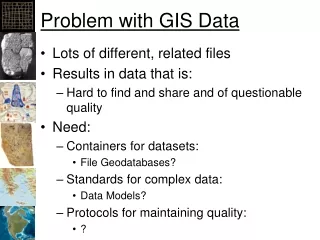
Census dissemination • A census is not complete until the data collected is made available to potential users in a form suited to their needs • The data may be: • included in published tables and reports for general distribution • produced as tables in unpublished form for limited distribution • stored in a database and supplied upon request, or disseminated online (in this case it will be available only to connected populations) Workshop on Census Cartography and Management - October 2007
Census geographical units • The census provides information at any geographical level, pre-defined or user-defined Workshop on Census Cartography and Management - October 2007
The power of maps • Maps visually communicate a concept or an idea • Maps summarize large amounts of information concisely • Maps are often meant to support textual information • Maps can be used for description, exploration, confirmation, tabulation • Maps encourage comparisons: • Between different areas on the same map: where are population densities highest? • Between different maps: is child mortality higher in the districts of province A than in province B? • Same area: where and by how much do literacy rates for males and females differ in the districts? • Between maps for different time periods: did fertility rates decline since the last census? Workshop on Census Cartography and Management - October 2007
GIS provide advanced functionalities for census dissemination • Combination of: • Census database: data at any geographical level • Geographical database: geographical structure of the country + cartographic representation Workshop on Census Cartography and Management - October 2007
Different Uses of Maps • Geographical selection • Direct selection of a user-defined area • Area delineation • Buffer zone • Areas of influence • Modelling: spatial smoothing Workshop on Census Cartography and Management - October 2007
Geographical selection Use this map to navigate to your area of interest by drilling down to the Geographic Areas that you require. Workshop on Census Cartography and Management - October 2007
Direct selection of a user-defined area... • The user describes the area on which he needs aggregated data by clicking on the components: for example, municipalities Workshop on Census Cartography and Management - October 2007
Area delineation • E.g. Interactive determination of school districts by looking at the number of children in each school and then aggregating census enumeration areas Workshop on Census Cartography and Management - October 2007
Buffer zone • How many people live within a five mile radius from the hospital ? Workshop on Census Cartography and Management - October 2007
Areas of influence • Commuting distances: daily commuters flow Workshop on Census Cartography and Management - October 2007
Modelling: spatial smoothing • Growth rate of the population between two censuses Workshop on Census Cartography and Management - October 2007
Uses of Graphs: Enriching the Understanding of GIS Data Sets • Exploratory Spatial Data Analysis • Linked Maps, Graphs & Tables • Dynamic Feature Selection • Visualization over Time • Animation Workshop on Census Cartography and Management - October 2007