Download
1 / 14
170 likes | 481 Views
Geographic Skills Year 8 Geography. What are they? Why do I need to know them? What can I use them for?. What do we use geographic skills for?. We use geographic skills to: collect, analyse and synthesis information. research and think about information.

E N D
Geographic SkillsYear 8 Geography What are they? Why do I need to know them? What can I use them for?
What do we use geographic skills for? We use geographic skills to: • collect, analyse and synthesis information. • research and think about information. • communicate information. • solve problems and make decisions. • compare, evaluate and apply information. • interpret the past • predict the future
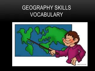
What are geographic skills? • Geographic skills is a very broad term that encompasses many skills. • Skills include (but are not limited to): • Graphs (line, bar, pie charts, histograms) • Maps (making and interpreting) • Direction (using compasses, maps and GPS)
What do we need them for? Graphs: When we create graphs we are organising data to represent trends, proportions and other statistics. When we interpret (read) we are analysing trends, proportions and other statistics. We can use this information to make predictions.
Line Graphs • We can use line graphs to interpret data • We can also use line graphs to compare data
Bar graphs • There are many kinds of bar graphs. • Simple • Compound • Histograms Bar charts are used to plot statistics, particularly amounts.
Pie charts • Pie charts show proportions.
Scatter graphs • Scatter graphs show relationships between two different sets of data.
Age/sex pyramids • Allow us to interpret populations.
Interpreting the landscape • Geographic skills allow us to interpret the landscape. We can: • find our way. • predict trends. • determine productive land use.
Interpreting the landscape • Skills we can use to interpret landscape are: • Map reading • Using a compass • Using a GPS • Creating different kinds of maps like: • Cross sections • Mapping rivers and tributaries • Working with co-ordinates..
Finding our way • There are several geographic skills to help us find our way: • Map reading • Using compasses • Using a GPS • Determining longtitude and latitude
Maps - skills • Reading keys • Interpreting scale • Calculating area • Reading contour lines and determining elevation • Cross sections • Weather maps
Summary. • This unit will arm you with skills that will assist you to interpret the world around you. • These skills are not used only in geography, you will find these skills help you in many subjects at school and in many walks of life once you have left school.