Enhancing GPS System Design to Meet User Needs: A Comprehensive Analysis
350 likes | 433 Views
Discover the critical aspects of GPS design and system decisions impacting user effectiveness measures. Learn about the Big 5 characteristics shaping GPS performance and potential advancements, with insights into military and civilian applications. Dive into mission simulations to understand the influence of GPS choices on operational outcomes.

Enhancing GPS System Design to Meet User Needs: A Comprehensive Analysis
E N D
Presentation Transcript
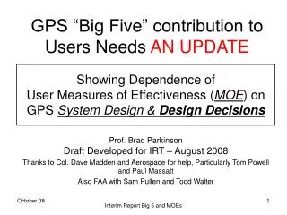
GPS “Big Five” contribution to Users Needs AN UPDATE Showing Dependence of User Measures of Effectiveness (MOE) on GPS System Design & Design Decisions Prof. Brad ParkinsonDraft Developed for IRT – August 2008 Thanks to Col. Dave Madden and Aerospace for help, Particularly Tom Powell and Paul Massatt Also FAA with Sam Pullen and Todd Walter Interim Report Big 5 and MOEs
The IRT “Big 5” – Essential GPS PNt CharacteristicsA Bridge between User’s MOE and GPS System Design • Assured(Geometric)Availability of GPS signals • Resistanceto(Deliberate or Unintentional)Interference • Accuracyof User’s GPS Position(After satisfying #1 and #2) • Boundedinaccuracy –Limiting potential for very large errors (Fratricide or Collateral Damage) • Integrity – Identifying and eliminating the non-normal GPS system or local errors (e.g. extreme user multipath or runaway clocks). Interim Report Big 5 and MOEs
Performance EnvelopeConceptual Examples “Envelope” Missions Current GPS Capabilities(30+ Sats) Needs for SDB (Target Designation in VisibilityImpaired Region) Potential GPS Enhancements Current GPS Specification(e.g. 21+3 Sats) Cat III Aircraft Landing(Integrity – Time to Alarmor Availability) Potential GPSAugmentations The “Envelope” FAA ATCModernizationADS-B Interim Report Big 5 and MOEs
Military Uses M1. Use of Small Diameter Bomb in region where ground target locator has impaired visibility (e.g. mountainous terrain or urban street) (In Mission A) M2. Delivering weapons close to friendly troops, or close to sensitive “don’t hit” locations (In Mission A) M3. Operating with impunity in the vicinity of high-power (or multiple, distributed) Enemy Jammers(In Mission A) M4. Operating in mined land or restrictive sea areas Civilian Uses C1.Precision Aircraft Approach and Landing (Up to Cat III) demanding 10-9 integrity (Mission B – includes a military mission) C2. First Responder PNT in Urban Area (Mission C) C3. Precision Survey using GPS carrier Phase C4. Use of GPS ADS-B mandated for future ATC System – improving separation distances (Mission D) C5. Resistance to inadvertent GPS interference or deliberate sabotage (see military #3) C6. Obscuration in Open Pit Mining Envelope Examples of Uses(Summarize A, B, and D) Interim Report Big 5 and MOEs
Mission Trade AnalysisMission A. Air Dropped Bomb against Ground located target UPDATE Want to show effect of GPS Decision Maker’s TradesonMeasures of Effectiveness Note: this is illustrative of the technique and approach It does not incorporate actual weapons system’s data Sensitive results are presented in Relative Terms Interim Report Big 5 and MOEs
Afghanistan in this Analysis • Observer is assumed to be part way up Mountain (Red Dot) • Slope assumed at 45 to 60 degrees (could be steeper) • Target Building is on other side of Valley Interim Report Big 5 and MOEs
Terrain – Valley in Afghanistan mountains, Observer on side of 45 (or 60) degree slope Obscuration ~40% Observer Laser Sight: Gyrocompass North- Azimuth - 3 mils, Elevation 3 Mils Range 3 Meters Observer GPS 2.6 meter multipath-limited receiver (1 meter multipath narrow tracking correlator) 0.75 meter receiver noise Target 1 km away GPS Constellation 18, 21, 24, 27, 30, 33, 36 considered with 1,2, or 3 satellites randomly out URE: Block II 0..57m, Block III 0.25m Bomb/Weapon Same Constellations considered 3.5m Guidance error Guidance Error 1.0m GPS 0.8m noise, negl. multipath URE as above Vertical at impact Jamming interference Assume a hostile 10W noise Jammer Constraints and AssumptionsWithin current Availability In Red, the next step possibilities – also analyzed Interim Report Big 5 and MOEs
Buildings on a Mountain RoadTarget is Largest Building Numbers in Boxes are the number of Hits Road Interim Report Big 5 and MOEs
Observer on Slope of 45 Degrees Interim Report Big 5 and MOEs
99.9% Circle -Only 1 in 1000 exceeds 50% Circle Half in, Half out. Usually called CEP – a poor measure of effectiveness 95 % Circle Should approximate Target size, (for first round effectiveness)Sometimes called “2d” bldgldg Interim Report Big 5 and MOEs
Observer on Slope of 60 Degrees Interim Report Big 5 and MOEs
Selected Civil “Envelope” Missions • Precision Approach and Landing (Mission “B”) • Representative US Airports • Desire Availability of >99.5% (99.9% ?) • Advanced Air Traffic Control System (Mission “D”) • GPS Based • Uses Automatic Dependent Surveillance Beacon (ADSB) • Integrity Guaranteed - Issue is Geographic Coverage for 99.5% availability Interim Report Big 5 and MOEs
Terrain – Civil Airports and Military Airfields Aircraft guided down to 200’ HAT CAT I Decision Height solely by GPS Local Area Augmentation System (LAAS) fielded at airport/airfield where landing takes place Vertical guidance is limiting factor From 200’ to 100’ HAT, aircraft guided by LAAS with airborne inertial system as backup Below 100’ HAT (above runway threshold), aircraft primarily guided by radar altimeter GPS Constellation 21, 24, 27, 30, 33, 36 considered with 1,2, or 3 satellites randomly out (cycle through all outage permutations) URE: dictated by LAAS ground and airborne error models RF interference When present, assume unintentional ground-based RF interference sufficient to make satellites below 10, 15 deg. elevation (TBC) unusable Constraints and Assumptions for Mission B – CAT III Precision Landing Interim Report Big 5 and MOEs
Four Measures of Effectiveness (MOEs) for Mission “B” – Cat III Landing • MOE 1: Long-term probability that CAT III operation is available (without RF interference) Trade I – No. of GPS Satellites in Constellation • MOE 2: Longest interval that CAT III operation is unavailable (without RF interference) Trade I – No. of GPS Satellites in Constellation • MOE 3 : Loss-of-continuity probability when RF interference is suddenly introducedTrade II - Techniques to reduce RF interference vulnerability • MOE 4: Availability probability when RF interference persistsTrades I and II Interim Report Big 5 and MOEs
Availability Results for IRT “Baseline” 24-SV Constellation – 1,2, or 3 GPS outages (Slide 1 of 2) 27 99.9 % Availability Threshold Results for 12 Airports 67 142 Max. Outage Duration (min) 284 Note Min. Avail. on Plot Interim Report Big 5 and MOEs
Availability Results for IRT “Baseline” 24-SV Constellation (Slide 2) Max. Outage Duration (min) 0 0 0 0 0 0 3 6 9 67 33 35 45 19 0 SV Out (15-sec updates) 19 49 46 51 51 27 50 43 43 86 65 82 102 1 SV Out (1-min updates) 94 98 110 96 88 80 106 116 248 2 SV Out (2-min updates) 142 244 272 272 276 268 264 228 164 284 284 3 SV Out (4-min updates) 236 Interim Report Big 5 and MOEs
Availability Results for IRT 30-SV Constellation 0 26 56 Max. Outage Duration (min) 136 Note Min. Avail. on Plot Interim Report Big 5 and MOEs
Comparison of CAT III Availability for All Six IRT Constellations (21 – 36 SV’s) 0 10 IRT 21-SV -1 10 IRT 24-SV IRT 27-SV Desired Availability 99.9% -2 10 IRT 30-SV Un-availability IRT 33-SV -3 10 IRT 36-SV -4 10 -5 10 -6 10 0 SVs Out 1 SV Out 2 SVs Out 3 SVs Out Number of SV’s Unhealthy Interim Report Big 5 and MOEs
Simulations with Current GPS Constellation • To compare to IRT constellations, a recent GPS constellation almanac (Week 465, 25 July 2008) was downloaded and simulated. • Results for two cases shown on the following slide: • Optimistic – use all 31 satellites listed in almanac (24 “primary” + 7 “spare” orbit slots) • Realistic: remove 5 satellites in “spare” orbit slots that are older than 15 years of age • Retain use of 2 satellites in “primary” orbit slots that exceed 15 years of age • 26 satellites are used (24 “primary” + 2 “spare” orbit slots) Interim Report Big 5 and MOEs
Comparison of CAT III Availability for IRT and Current Constellations 0 10 Current/Realistic (26-SV) Current/Optimistic (31-SV) IRT 21-SV -1 10 IRT 24-SV IRT 27-SV Desired Availability 99.9% -2 10 IRT 30-SV Current/Optimistic (31-SV) IRT 33-SV -3 10 Un-availability IRT 36-SV -4 10 -5 10 -6 10 0 SVs Out 1 SV Out 2 SVs Out 3 SVs Out Interim Report Big 5 and MOEs Number of SV's Unhealthy
Status of CAT III Analysis • More availability results to follow… • Results now available for all SV constellations for no-RFI case • Now experimenting with best ways to plot these results Interim Report Big 5 and MOEs
Mission D – GPS-Based ADS-B Support of Air Traffic Control • Many aircraft in flight • Each equipped with GPS/SPS and/or WAAS • Each equipped with ADS-B transponder to share GPS-based “PVT” information ADS-B PVT ADS-B PVT ADS-B PVT ADS-B PVT ATC Tower ATC Tower ATC Tower FAA ARTCC Airport B Airport A Airport C Interim Report Big 5 and MOEs
Perfect Constellation: Comparison of GIC (WAAS) and RAIM Integrity Techniques(Table with Numerical Values) Fraction of Airspace(inside ± 70 deg. Latitude) with ≥99.5% availability of support for Precision Approach to 200’ Height Above Terrain (Like CAT I) Interim Report Big 5 and MOEs
Realistic Constellation Comparison of GIC (WAAS) and Self-Integrity (RAIM) Techniques(Table with Numerical Values) Fraction of Airspace(inside ± 70 deg. Latitude) with ≥99.5% availability of support for Precision Approach to 200’ Height Above Terrain (Like CAT I) Interim Report Big 5 and MOEs
Summary and Path Forward • Evaluation of civil missions/uses B and D (CAT III precision landing and ADS-B support of ATC) will be conducted using common simulation approach • CAT III application is more clear-cut (based on use of already-defined single-frequency LAAS) • ADS-B application has more options and trades • The simulation needed to evaluate Mission B has been built and run for IRT constellations and for two variations of recent GPS Week 465 broadcast almanac Interim Report Big 5 and MOEs
Decision # I.The Number of GPS Satellites • Current “Requirement” – 24 (21 plus three active spares) • On orbit are 31but not optimal • Much improved geometric availability - Users now expect this performance • Paired Orbits – not optimal for 30 (ready for Failure) • Many studies have suggested the “knee in the curve” for user availability is 30 to 36 • Critical users – those with impaired sky visibility or extreme integrity req. • A key to increasing commitment to 30 + X is on-orbit cost of Satellites • Major driver Additional Payloads(reduce size, weight, power and complexity) • Cost savings opportunity - dual launch • Decision: A National commitment to increased number of SVs • Civil users could have significantly improved availability • Military Users more effective in impaired situations Interim Report Big 5 and MOEs
Conclusions • The concept of “Envelope” missions places focus on those missions that really drive GPS system design and illuminate trades for the decision makers • We have shown a Process : • relates GPS System Design Trades to Measures of Effectiveness (MOE) • Closely related to the “Big 5 GPS Characteristics” but adds the advantage of quantification • MOEs are very mission specific • relate to particular use and/or users • Additional “Envelope” missions are suggested as worthy of further MOE analysis Interim Report Big 5 and MOEs
PL Fundamental Issues – Operations • Most impaired users are in “harms way” • Placing PLs in the Afghan Mountains not plausible • One PL usually only benefits a narrow geographic area • Support for PL requires monitoring • GPS receivers must be specially configured to handle PL signal • Near-Far problem • Airborne PLs suffer degraded accuracy, and complex support architecture Interim Report Big 5 and MOEs
Comment on MOE 1:The Accuracy Payoff • Reducing error by 3 improves PK by up to 9 • CNN wars dictate reduced collateral damage – the stray bomb is important • Improve 1st round effectiveness = less US attrition. • Sorties to destroy = ~ 1/ PR Issue: Need both TLE and WLE accuracy Interim Report Big 5 and MOEs