Presentation Outline
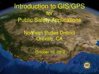
Introduction to GIS/GPS for Public Safety Applications Northern Buttes District Oroville, CA October 10, 2012. Presentation Outline. Enterprise GIS (eGIS) Highlights :10 GPS Demo/Exercise 1:00 Questions & Discussion :30. California State Parks Enterprise Geographic Information System.

Presentation Outline
E N D
Presentation Transcript
Introduction to GIS/GPSforPublic Safety ApplicationsNorthern Buttes District Oroville, CAOctober 10, 2012
Presentation Outline • Enterprise GIS (eGIS) Highlights :10 • GPS Demo/Exercise 1:00 • Questions & Discussion :30
California State ParksEnterprise Geographic Information System
Background Image : California -- Looking Northeast Spanning 1200 kilometers (750 miles) from the Humboldt Redwoods to Anza-Borrego, the state is outlined over earth imagery, undersea features, and points representing over 270 State Park Units and 1.5 million acres of land. Lake Tahoe Anza-Borrego Desert Humboldt Redwoods N Monterey
California State Parks GIS professionals synthesize visualizations like this one using diverse geospatial data in a service-oriented, information technology architecture. Building upon this infrastructure, an enterprise geographic information system (eGIS) team supports Parks and their partners in managing nearly one-third of California's coastline and the state's finest examples of natural and cultural resources. Each year, the state’s economy depends on the benefits from these recreational and educational opportunities, enjoyed by millions of Californians and visitors from around the world.
To address population and climate changes, California State Parks emphasize the common ground of geography and visualization to facilitate decisions in a complex network of government and private concerns. In such diversity of values, often the element of location is the most widely shared. Thus, in offering maps and imagery, State Parks leads by example and contributes to timely and effective solutions for the life-safety, resource protection, recreation, and educational needs of present and future generations.
Definition: An enterprise Geographic Information System (eGIS) consists of • Specially-trained teams of people • Mobile-, workstation-, & wide-area computing • Global Positioning Systems (GPS) • Data, and • Procedures to • Collect • Analyze, and • Report geospatial information with • Shared databases and • Web services
The California State Parks eGIS eGIS GIO
The California State Parks eGIS: • Serves multi-disciplinary, department-wide functions • Maps the location of department assets in all databases • Enhances visual learning by integrating maps & images with: • COM Center Geographic File – Public safety dispatch • Unit Data File – Parks’ internal, corporate knowledge base • CAMP – Computerized Asset Management Program • Supports Field-owned, HQ-managed, GPS data acquisition • Informs emergency management by Parks & partners in • Life Safety • Resource Protection (Cultural & Natural) • Public Education • Delivers interagency support through our Information Technology Office & Geographic Information Officer (GIO)
Example eGIS Applications • Planning • Land Acquisition • Facilities Management • Emergency Management
Introduction to GPS • Concepts • Latitude / Longitude – Various Formats • Universal Transverse Mercator (UTM)
Concepts • LENGTH – Trails fundamentals; position; map; location; proximity to hazards or sensitive sites • MASS – How “heavy” are your data: Trail type, use, complexity of networks, junctions, signage • TIME – Date of photos and positions; seasonal use; project schedules, and • SCALE – The closer you are, the more detail you “see” and the “less” of the whole is visible
Terminology Latitude / Longitude Formats (This is critical knowledge that could save a life) • H DDD° MM' SS.S“ Hemisphere, Degrees, Minutes, Seconds N 32° 18' 23.1" W122° 36' 52.5" (USGS quads) • H DDD° MM.MMM‘ Hemisphere, Degrees and Decimal Minutes N 32° 18.385' W122° 36.875' (GARMIN default) • H DDD.DDDDD° Hemisphere, Decimal Degrees (GIS Users) N 32.30642° , W 122.61458° For all of California - Think “10 by 10”
LAT / LON : Decimal Degrees : The California domain 124 120 114 For all of California - Think “10 by 10” “32 to 42 Degrees North by 114 to 124 Degrees West” 114 – 124.4 Degrees WestLongitude 32.5 – 42 Degrees North Latitude
Now go UTM statewide -- Zone 10 or 11 ; S or T ?? West 120 Degrees Longitude
UTM statewide -- Zone 10 or 11 ; S or T 10 T 11 T 11 S 10 S
X Anatomy of UTM Zone - MGRS Easting Northing 10 S 0559741 4282182 4281000m N Easting or “over” 560000m E Northing or “up”
GPS Demo Trimble GeoXH Ricoh 500SE GPS PhotoLink 4.3 Trimble Juno SC Ricoh 500SE Garmin Nuvi 255W Use with Confidence: Accuracy & Attributes Meet or Exceed Department Standards Garmin 76 S Cost & Complexity Use with Caution As Backup Only
Software: GPS PhotoLink v4.3 • “AutoMatic Lat/Lon” • via built-in GPS • or… • “Manual Lat/Lon” • Google Earth • Your GPS • Your ArcGIS • Your Map…
Outdoor Exercise • Four Groups • Four Baselines (Feature-to-Feature) • Mark A & B Waypoints for Each Baseline • GPS – Photo Link Demo
Instrument Cross-Check • Establish baseline with measuring Tape • Mark Waypoints at both ends, A & B • Compare Tape measure to difference in UTM Easting or Northing (A minus B) B A
Discussion: GPS “Quick Survey” • Likes (Strengths) • Concerns (Weaknesses) • Suggestions (Opportunities)
18,700 feet Planning Scale 1:24,000 (24k, 1” = 2000’, std. USGS quad)
Site Scale (1”=100’ )Example: Time AUSGS High-Res. Urban (6”) 2006 935 feet
Site Scale (1.2k; 1”=100’ )Example: Time BUSDA NAIP Med.Res., Statewide (1m) 2009 935 feet
Scales and Imagery Eye Alt Image / Map Scale for Wide-Area Views, Large Parks 24 miles 1 : 160,000 (125,000 ft) 1:10,000 1:3,000 Site Scale 1 : 600 In Google Earth, use “Eye Alt” (altitude, or height above ground) to control Image Scale: go higher to see more area
Eye Alt (feet) Scale Scale 125,000 1:160,000 1” = 13,000’
Eye Alt (feet) Scale Scale 30,000 1:50,000 1” = 4200’
Eye Alt (feet) Scale Scale 1,000 1:1,000 1” = 83’
Eye Alt (feet) Scale Scale 1,200 1:1,200 1” = 100’
Scale 1: 1,200 (1” = 100’) 93 meters (300 feet)
Scales and Imagery Eye Alt (feet) Image / Map Scale Mid-Size Parks 30,000 1 : 50,000 1:10,000 1:3,000 Site Scale 1 : 600 In Google Earth, use “Eye Alt” (altitude, or height above ground) to control Image Scale: go higher to see more area
Eye Alt (feet) Scale 30,000 1:50,000 Ahjumawi Lava Springs SP
Eye Alt (feet) Scale 10,000 1:14,000
Eye Alt (feet) Scale 4,000 1: 1,200
Identify Staffing & Funding Sources Standard Equipment Specs Park boundary survey data exchanges Facility Mapping and Information Public Safety Technology Modernization (PSTM) CAD Pilot Projects: Training, Research & Development GPS Opportunities
Learning Resources for Latitude / Longitude (Lat / Lon)and the Universal Transverse Mercator (UTM) Coordinate System • http://www.maptools.com/UsingUTM/metric.html • http://www.zdap.com/racereports/images/wnh_utm_tutorial.pdf • http://www.lakelandsd.com/tutorial/lesson1.html • http://www.maptools.com/UsingLatLon/Formats.html • http://www.geology.enr.state.nc.us/gis/latlon.html -- LAT/LON Format Converter Accessed 2008.10.16
The California State Parks Mission To provide for the health, inspiration and education of the people of California by helping to preserve the state's extraordinary biological diversity, protecting its most valued natural and cultural resources, and creating opportunities for high-quality outdoor recreation. Thank you ! Paul Veisze Geographic Information Officer California State Parks 916-949-3327 pveisze@parks.ca.gov