Download
1 / 20
200 likes | 406 Views
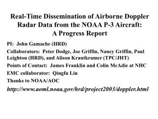
Real-Time Dissemination of Airborne Doppler Radar Data from the NOAA P-3 Aircraft: A Progress Report. PI: John Gamache (HRD) Collaborators: Peter Dodge, Joe Griffin, Nancy Griffin, Paul Leighton (HRD), and Alison Krautkramer (TPC/JHT) Points of Contact: James Franklin and Colin McAdie at NHC

E N D
Real-Time Dissemination of Airborne Doppler Radar Data from the NOAA P-3 Aircraft:A Progress Report PI: John Gamache (HRD) Collaborators: Peter Dodge, Joe Griffin, Nancy Griffin, Paul Leighton (HRD), and Alison Krautkramer (TPC/JHT) Points of Contact: James Franklin and Colin McAdie at NHC EMC collaborator: Qingfu Liu Thanks to NOAA/AOC http://www.aoml.noaa.gov/hrd/project2003/doppler.html
Project Goals • Develop a airborne-Doppler hurricane wind-field analysis in “real time” and make portions of it available to hurricane specialists at the Tropical Prediction Center • Send reliable observations to the Environmental Modeling Center at NCEP for data-assimilation testing in numerical hurricane simulations
Main Goals of this Presentation • List and describe briefly the tasks required for this project • Present the kinds of wind fields we have developed in “real time” on the P3 • Compare analysis briefly with GPS sondes for one case • Future work
Vertically scanning X-band Doppler radar aboard the NOAA P-3 Aircraft NOAA Antenna Jorgensen et al., JAM, 1983
HRD Software Prior to JHT • Three-dimensional variational analysis of winds from airborne Doppler radar data • Higher resolution radius height cross-section of wind along the inbound and outbound legs
Project Requirements • Automated Quality Control of Raw Doppler Data (completed) • Software to generate batch job files (completed) • Software to generate output files that can be transmitted off the aircraft by SATCOM to EMC (completed) • Software to generate tagged files to send analyses to TPC via SATCOM (in progress) • Network communication path to TPC and EMC (in progress)
Doppler Radial Velocity Hurricane Humberto 232855 UTC 23 Sep 2001 Raw (except for standard Bargen-Brown unfolding) HRD QC
“Real-Time” 2004 airborne-Doppler Accomplishments in Hurricane Ivan • Three-dimensional wind fields and vertical profiles produced in real time in Hurricane Ivan (2004)--1 per flight during N43RF flights on Sep 12, 13, and 15 • Files of trimmed quality-controlled radial velocities produced that could be sent to EMC by SATCOM
Wind speed in m/s at 1-km altitude Hurricane Ivan 12 September 1115-1145 UTC (digital camera picture of N43RF airborne workstation)
After flight cartesian airborne-Doppler analysis of winds from same flight leg at 1-km altitude in Hurricane Ivan 1115-1145 UTC on 12 September 2004 Available real time in 2005
Comparison of Doppler Vertical Cross Section with GPS Eyewall Sonde GPS sonde Doppler analysis Wind speed m/s
Manual QC (weeks) Automatic QC (minutes) Horizontal plots of total wind speed at 2 km altitude Hurricane Isabel 1710 UTC 12 Sep 2004
m/s 50 50 100 100 150 150 Radius from center (km) Radius from center (km) Automatic QC (minutes) Manual QC (weeks) Radius-height cross-sections of radial wind Hurricane Isabel 1710 UTC Sep 12 2004
NWS GEMPAK display of automatic Doppler analysis at 1600 ft altitude. Wind barbs at left and total earth-relative wind speed in knots on right Display developed at TPC by Alison Krautkramer Hurricane Ivan on 12 Sep 2004 at 1453 UTC Grand Cayman Possible further application: Modification of flight plan to find max wind.
Summary • We can produce real-time airborne Doppler wind analyses reliably • They are available in either a three-dimensional form, or as two-dimensional radial profiles of winds. Radial profiles have higher radial and vertical resolution than the three-dimensional fields since solution of mass continuity is not required
Future Work • Compute comparison statistics with dropsondes • Modify package to work on the G4-upgrade Doppler radar and linux system • Apply automatic QC and analysis to large archive of airborne Doppler data (this spring--2004) • Modify quality control software to allow manual QC after automatic QC (for research)
GEMPAK wind barbs at 3200 ft altitude Developed at TPC by Alison Krautkramer Hurricane Ivan on 12 Sep 2004 at 1453 UTC