Download
1 / 24
240 likes | 490 Views
CE S. Disaster Management Support Group (DMSG) Report to the 16 th Plenary 20-21 November 2002. Chair, Helen M. Wood (NOAA). DMSG History. Established in 1997 Terms of reference approved at 13 th CEOS Plenary, with USA/NOAA as Chair

E N D
CE S Disaster ManagementSupport Group (DMSG)Report to the 16th Plenary20-21 November 2002 Chair, Helen M. Wood (NOAA)
DMSG History • Established in 1997 • Terms of reference approved at 13th CEOS Plenary, with USA/NOAA as Chair • Focused on requirements vis-à-vis capacity of existing and planned earth observing (EO) satellite data • Provided forum to identify and interact with current and potential users
DMSG Mission To support natural and technological disaster management on a worldwide basis, by fostering improved utilization of existing and planned Earth observation satellite data.
DMSG Objectives • Work with emergency management users across all regions • Define user requirements • Recommend improvements to current and future systems, addressing gaps in observations, products and services • Provide support tools to ease access to data and derived information products • Foster use of lessons learned • Pursue cooperation with commercial sector
Project Participants* Council of Europe EC/DG11, DG12 SCOT CONSEIL Anite Systems Freiburg Univ. Reading Univ. EUMETSAT NPA Group ISMARC DERA ENEA BNSC CNES NPA MRC EOCI ESA DLR JRC ASI RAL EOS Utsunomiya Univ. JAMSTEC Tokai Univ. DIA/NIAES HD/MSA RESTEC NASDA PWRI NIED MSA MITI MSA JMA MSF NLA STA GSI HIT RPA PLANETA RSSIC FOMI Fisheries & Oceans RADARSAT Int. Manitoba Univ. MTRS CCRS CSA PCI SMC NRSC CAST Maryland Univ. FEMA NOAA OFCM NASA USDA NCAR SNDR USRA DOI SAC ISRO NRSA INEGI AGSO INIAS ESCAP MACRES Asia Air Survey Singapore Univ. Asia Inst.of Tech. INPE CONAE CSIR Zambia DOM ISDR OOSA FAO WMO WCRP UNEP/GRID GTOS World Bank FEWS *Partial listing
DMSG Achievements • Successful series of 15 productive meetings with over 400 experts participating • Close cooperation with key international organizations and partnerships • Outreach to and cooperation with the commercial sector • Creation of a disaster information server to support easy access to hazard information • Development of guidelines for specific hazard scenarios • Reports: 3 interim and 1 final
DMSG Meeting Schedule Place Time Host Brussels, Belgium May 97 EC Tokyo, Japan July 97 NASDA London, England September 97 BNSC Bangalore, India October 97 ISRO Silver Spring, USA March/April 98 NOAA Frascati, Italy September 98 ESA Montreal, Canada October 98 CSA Tsukuba, Japan October 98 NASDA Silver Spring, USA January 99 NOAA Paris, France June 99 CNES/ESA Hawaii, USA September 99 NOAA Tokyo, Japan February 00 NASDA Ottawa, Canada June 00 CCRS Paris, France January 01 CNES Brussels, Belgium* June 01 EC * (In cooperation with UN—ISDR and OOSA)
Cooperation with the United Nations • UN International Strategy for Disaster Reduction (ISDR) • UN Committee on the Peaceful Uses of Outer Space (COPUOS) • UN Office of Outer Space Affairs (OOSA) • Co-sponsor of regional OOSA workshops-Africa and Far East designed to: • Increase awareness of disaster managers and decision makers • Determine types of information and communication needed • Develop a plan of action leading to pilot projects • UNISPACE III action teams • UN ESCAP and UNEP • Other CEOS working groups
Support Development of IGOS Geohazards Team Data requirements, data gaps, integration of Earth observation data with in-situ measurements, models and GIS for establishing an integrated geohazards global observing system Landslide/ Land Subsidence Volcano Earthquake
International Charter: Space and Major Disasters Member/Partner Agencies • Active coordination to: • Promote participation in and with the Charter • Develop scenarios for the Charter 10
Cooperation with the Commercial Sector Convened commercial panel to provide perspectives on the use of satellite data for disaster management support that: • Identified barriers • Proposed remedies forreducing barriers
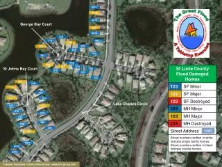
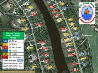
Prototype Disaster Information Server http://disaster.ceos.org
DMSG Hazard Scenarios and Team Coordinators Earthquake ESA, NPA/UK Fire USDA, UNEP, CFS/Canada Flood CCRS, NOAA Landslide CCRS, NIED Oil spill NRSC/UK Sea Ice NIC/USA, CIS/Canada Volcanoes NOAA,USGS, U. of Reading/UKDrought NRSA/India, Max Planck Institute/Germany
Example Scenario: Volcanic Eruption Trigger: Eruption reported Background: name/location; eruption history(frequency/type); responsible observatory (if any) nearby urban centers, air routes,roads, airports; proximity to water Current Situation: Vent location, eruption type, seismicity, surface changes (deformation cracks) steam or sulfur, weather, projected affected zoneSatellite Data Requirement: SPOT esp, IR,SAR, InSAR (data before and after eruption)Value-Added Processing Requirement:Feature labeling (if user not from observatory),DEM (if not current), temperature estimates from IR
Unmet Volcanic Hazard Requirements • Incorporate the 12.0, 3.9 and 8.5 mm IR wavelengths in planning future instruments NOAA response: All of these bands are included in plans for GOES-R+ procurement (2008 and beyond); Ash and SO2 requirements submitted for NPOESS (circa 2012) • Include both IR and UV (0.3-0.4 mm) on future geostationary satellites for a complementary monitoring system NOAA response: NOAA is supporting experimental Enhanced Special EventsImager (ESEI) with UV capability as an “Instrument of Opportunity” on future GOES (with NASA) • Minimum frequency of multi-spectral data should be 30 min for geostationary satellites; minimum spatial resolution should be 5 km for IR.NOAA Response: These requirements are met with current GOES, and will be exceeded for GOES-R+
Findings and Recommendations • Developed key findings and recommendations to promote understanding of challenges and partnerships with users. • Published as Annex II to Final Report • Solicited and received initial responses from space agencies on plans for acting on DMSGrecommendations.
Summary Findings Overview • Disaster management and response community willing to use space technology but reluctant to assimilate new technology and information quickly • Technology demonstrated conceptually but not operationally • Timeliness, cost, accessibility, ease of use, reliability, repeatability, and operational capability are critical factors • Need to integrate data (multiple agencies, mirroring, space and non-space data) • Need for a broad-based data policy
Summary Recommendations/ Responsiveness • Be proactive in responding to receptiveness of disaster management community to using space technologies • Create appropriate tools and perform compelling demonstrations • Assess needs and smooth transition from research to operations • Promote true value of remote sensing without understating or overselling • Address key factors of timeliness, cost, accessibility, ease of use, reliability, repeatability, and operational capability on merits, while avoiding trade-offs • Support rapid satellite tasking of EO missions • Support fast processing and delivery of data
Summary Recommendations/ Data Integration • Advance common data policy • Share technical information among agencies and develop user-friendly sharing tools • Develop mirroring • Facilitate seamless integrationof space and non-space data • Achieve broader geographic and disciplinary representation on hazard teams.
NOAA, EU, ESA Responses to DMSG Recommendations • IMPROVED SYSTEMS • Prototypes/demonstrations • Integration/data fusion with GIS • Automated products and models • Rapid response mechanisms • Improved algorithms • Expanded geographical coverage • Partnerships • NEW SENSOR IMPROVEMENTS • Spatial resolution • Temporal resolution • Radiometry—new channels, sensitivity, dynamic range Other Agencies Referenced: NASA, EUMETSAT, NASDA, CNES, DLR, CSA
Transition and CEOS Plenary Action • Accept the DMSG final report • Commend the work of DMSG participants • Endorse recommendations contained in the final report
The Way Forward • Integrate current DMSG activities into:- International Charter: Space and Major Disasters- UN COPUOS and OOSA Workshops- IGOS Geohazards • Continue opportunities to build technical capacity • Support DMSG website transition to CEOS website • Integrate specific hazards requirements into the CEOS/WMO requirements database • Facilitate opportunities to engage interactively with agencies to adopt and integrate DMSG recommendations.
CE S Disaster ManagementSupport Group (DMSG)Report to the 16th Plenary Chair, Helen M. Wood (NOAA)